
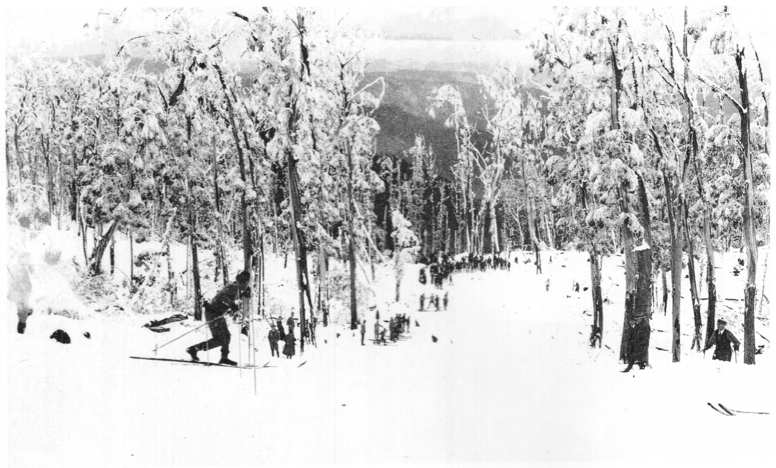
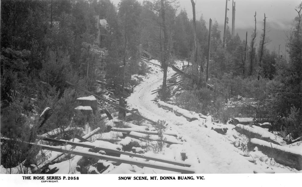
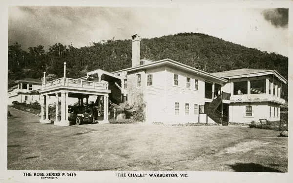
The Main Run circa 1930 before it was widened and lengthened. Photo: S. E. Douglas. Used with permission.
Donna Buang: the forgotten ski resort
© David Sisson. First published June 2015, expanded and updated to 2026.
Mt Donna Buang overlooks the town of Warburton in the Yarra Valley. Only 63 kilometres in a direct line from the centre of Melbourne, it was Australia’s busiest ski resort from the late 1920s until 1950. It had ski lodges, cafes, a ski hire, a ski jump and six runs cut through forests of myrtle beech and woollybutt. For over 20 years Donna had thousands of visitors every weekend there was snow.
However, the snow cover was erratic and after the Second World War better transport meant it lost out to resorts with more reliable snow further from Melbourne. Today Mt Donna Buang is a snow play destination with a lookout tower and a couple of nondescript buildings. But a few reminders of its heyday are hidden in the forest among the beech trees.
This is a book length article of over 30,000 words with more than 100 photos and maps. While it's designed to be as phone and tablet friendly as possible, some of the illustrations may not line up correctly in that format, so it's best read on a computer.

Contents.
Click on the main chapter headings to go to that section.

'Nancy' on the summit observation tower, 27 July 1929. Photo by Richard Courtney. Trove record.
1. Background
2. The beginnings of the resort
3. Skiing
- Ski runs
- Crowding
- Volunteer work parties
- Other activities: racing and military training
- A film of skiing on Donna Buang in the 1920s
- Administration and ski politics
- The ski jump
4. Access and transport
- Timber tramways
- The road
- The train
- Buses and service cars
5. Buildings and accommodation
- Accommodation in Warburton
- Club cabins
- Melbourne Walking Club
- University Ski Club
- Ski Club of Victoria
- Rover Scouts
- The summit hut
- Other buildings of the 1930s
- More recent infrastructure
6. Fire, war and the decline of skiing on Donna Buang
- Fire and war
- After the war
Appendices
7. Gazetteer: a directory of Donna Buang names and locations
8. Observation towers
9. The warning sign
10. Walks on Mt Donna Buang
- Ten Mile Turntable, summit circuit and Mt Victoria
- Donna Buang via Cement Creek, rainforest and Mt Victoria
- Warburton to Donna Buang via Mt Victoria
11. Historic articles on Donna Buang skiing
- Review of the 1929 ski season. Stan Flattely
- 1930s Donna Buang work party. Mick Hull
- A 1951 semi-obituary for Donna. Ski Horizon
12. Sources and thanks
- Periodicals
- Books
- Videos
- Web sites
- Other primary sources
- Thanks
1. Background
There was some recreational skiing at Kiandra in New South Wales in the 1860s and 70s and interest was revived by the construction of the Hotel Kosciusko near Perisher in 1909 and to a lesser extent by the Buffalo Chalet in 1911. However few people in Victoria used skis before the First World War; those who did mostly used them as a practical way of getting around the mountains in winter. Some were miners and from 1886 skiing mailmen traversed the Dargo High Plains between the St Bernard Hospice near Mt Hotham and Grant near the Crooked River goldfields. While a few tourists tried skiing as a novelty, it was never a popular recreation.
This changed in 1919 when the Norwegian born First World War nurse Hilda Samsing took over the lease of the Buffalo Chalet in north eastern Victoria. To boost winter business she imported skis from her homeland and encouraged guests to use them. At the same time, skiing was becoming popular in New South Wales and Tasmania; by the mid 1920s interest in the new sport had achieved critical mass, allowing it to take off. Shops began to stock ski clothing and equipment, ski clubs were founded and accommodation for skiers was built in a variety of locations in the Victorian high country. In 1925 alone, three new ski lodges opened on mountains in the north east of the state.
But these ski lodges in the north east were not convenient for Melbourne based weekend skiers at the time. Why?
Most people worked a 5½ day week with only Saturday afternoon and Sunday off.
Only a minority of families owned a car and many cars of the time were slow and unreliable.
Roads were fairly basic and even some major highways were still surfaced with gravel.
Longer distance travel was usually by train and the railheads nearest to the snowfields, such as Bright, Mansfield and Erica, were distant from Melbourne and on slow branch lines.
It took a lot of time to get to the snowfields at Mt Buffalo and the new 'chalets' at Mt Hotham, Mt Feathertop, Mt St Bernard, Flour Bag Plain and, from 1929, Mt Buller, so they were really only suitable for skiers planning extended trips of at least a week. With an increasing number of skiers living in Melbourne, there was a clear need for a ski destination close to the city, preferably with convenient rail access. Mt Donna Buang was the nearest mountain to Melbourne with reasonable snow cover. It overlooked the bustling timber harvesting and sawmilling town of Warburton, which was only 76 kilometres by rail from the city and 38 kilometres from the terminus of the electrified suburban rail network at Lilydale.
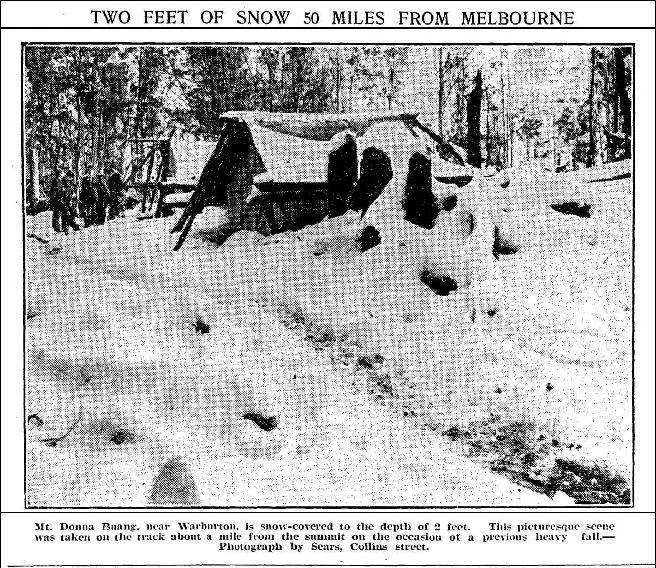
So, when city based skiers began searching for somewhere closer to Melbourne than ski destinations in north eastern Victoria or Gippsland, Donna Buang was exactly what they were looking for. The top car park on the mountain at the Ten Mile Turntable was only 96 kilometres from the city on the roads of the time and those without cars could catch a train to Warburton and either walk or hire a ‘service car’ to take them up the mountain. The only negative was that at 1250 metres, Donna was not high enough to guarantee reliable snow cover through the ski season, although in good years the snow was excellent; 15 consecutive weeks in 1929 and 17 consecutive ‘skiable weekends’ in 1943.
The six Victorian ski lodges in the 1920s.

Extract from the map Broadbent's Central Victoria, 1934.
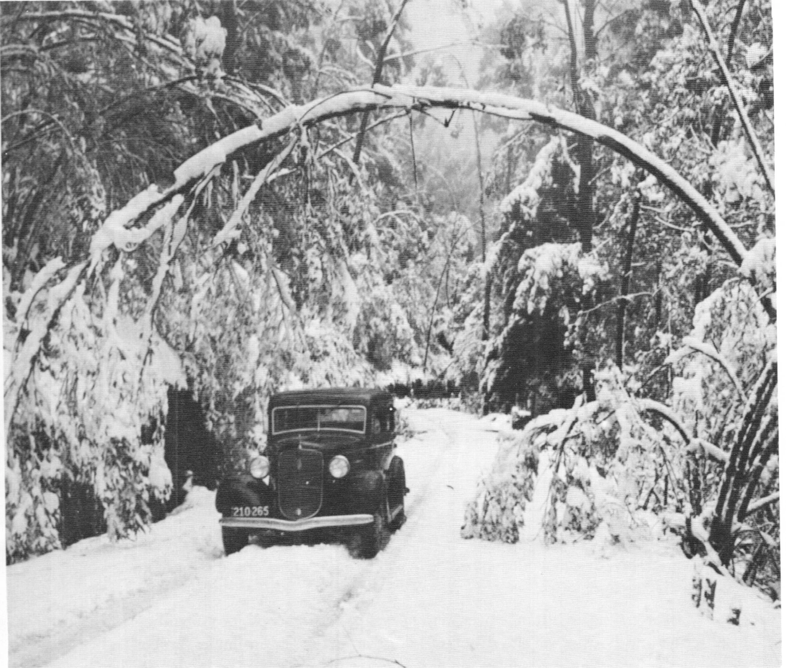
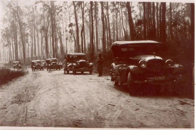
A 1930s Plymouth car on the road to Donna. Photo USC.
2. The beginnings of the resort
Interest in skiing on Donna Buang began when the president of the Warburton Progress Association took the initiative to invite some skiers to inspect the mountain on 29 June 1924. While their names are unrecorded, they thought the mountain had potential and the Progress Association agreed to clear a ski run, assisted by a £5 donation from the newly formed Ski Club of Victoria. The first people known to have skied on the mountain were a group organised by Stan Flattely on 11 July 1925. It was very much an exploratory trip with the group working out the best route up the mountain, the best method of carrying skis on a pack horse and assessing the best places to ski. They reported that the direct walking track was too steep and slippery to be used regularly, but that the road was quite usable in winter. They also reported that the newly built ski run was far too narrow to be safe.
Betty and Peg Nankivell of the University Ski Club at Donna Buang in 1929.
By 1927 skiers had a better idea of the nature of the mountain. A trip report by Jerry Donovan stated ‘...the snow was lightly packed, but after a few runs over the same tracks the pace was much accelerated. The evolutions performed in trying to control speed on a steep slide which owing to fallen timber and tree stumps narrowed to three feet in places, provided comedy for a number of pedestrians who appeared on the scene. Subsequently, when introduced to skis, greater comedy was supplied by the visitors. The germ, was implanted in them, and full information as to “where are skis obtainable?” and “can they be made easily?”... was demanded and supplied before departure. ...
It has been established... that suitable snow does lie on the mountain for many weeks during winter. On the other hand, to get to the snow means an ascent from Warburton of 3,000 feet along either a well graded road (12 miles) or a very steep bridle track (4 miles). Carrying skis up the Short Track is not recommended and the condition of the road is often such that it is impassable to cars beyond Cement Creek... The quantity of fallen timber which is met puts decided limits on the runs which may be had...’
In the next few years, ski runs were cleared and groomed by summer work parties, the road was improved and accommodation for skiers was built on the mountain, so by the 1930s the experience of visitors was much more comfortable.
Local interest in the mountain grew beyond promotion of tourism and the Warburton Ski Club was formed in late 1931, making it the eighth ski club in Victoria.* Warburton locals maintained first aid posts at the Ten Mile Turntable and the summit. Despite the popularity of skiing, there were only two ski lifts in Australia by the end of the 1930s, neither of them at Donna, so skiers on the mountain had to walk back up the side of a ski run and ‘earn their turns’, much like backcountry skiers today. However, the resort had all other facilities that a modern skier would expect to see at a small resort: on-mountain accommodation, day visitor facilities, kiosks selling snacks, first aid posts, a ski hire, shelter huts, a variety of ski runs and a large car park.
* The oldest known ski clubs in Victoria are:
Bright Alpine Club, 1888. (re-invigorated as a ski club circa 1927)
Ski Club of Victoria, 1924. #
Chamois Club of Australia, 1925. (Originally Victorian Alpine Ski Club.) #
Ski Club of East Gippsland, 1926. (Originally Omeo Ski Club). #
Mt Buffalo Alpine Club, 1927 or 1931. (Sources differ on the date, perhaps it began in 1927 and was formally organised in 1931?)
University Ski Club, 1929. #
Wangaratta Ski Club, 1930. #
Warburton Ski Club, late 1931.
# indicates clubs still in existence
Over a dozen more ski clubs were established in the thirties, there were 50 ski clubs in Victoria by the mid 1950s. Other groups such as walking clubs and Rover Scouts were also involved with skiing at the time and many casual skiers were not affiliated with any organisation.

Composite map showing early roads and tracks in bright purple superimposed on a modern map with roads in dull orange and modern walking tracks in grey. The probable locations of six ski runs in 1938 are shown in green. For scale, the grid lines are one kilometre apart.
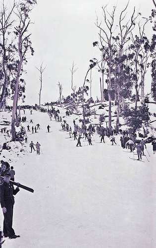
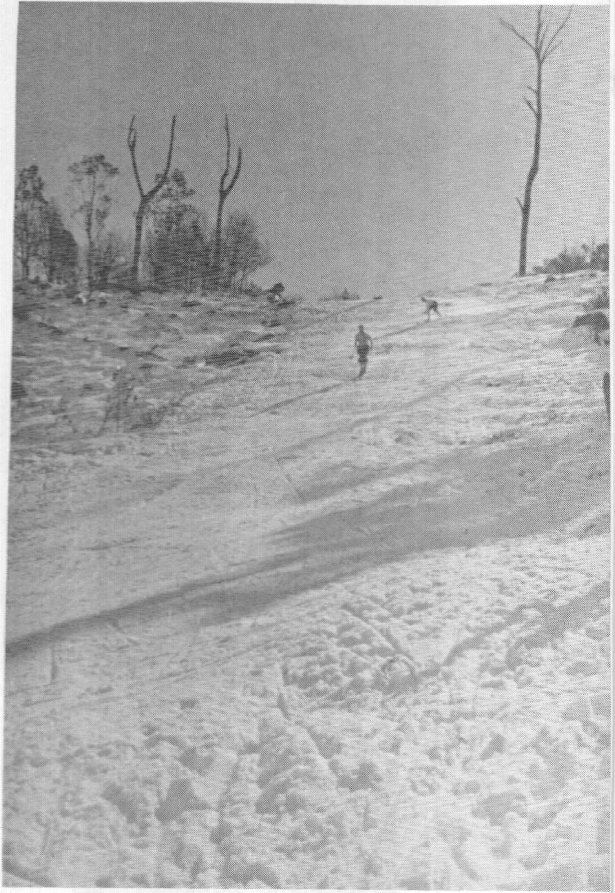
Looking down the Ski Slide (later widened, extended and renamed the Main Run) in 1929. Photo probably by Monty Kent Hughes.
3. Skiing
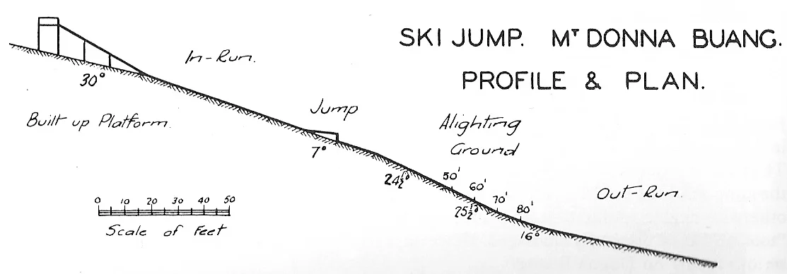
Ski runs
The first ski run was built over the summer of 1924 - 1925 by the Warburton Progress Association. Initially it was short and narrow, just 130 metres long and 2½ metres wide, but by 1926 the ‘Ski Slide’ had been widened to 20 metres by the local tourist committee and in February 1929 it was widened to 40 metres. In subsequent years the Slide was renamed the Main Run as more ski runs were cut through the forest. It was further extended and widened in March 1934 and April 1951.
By 1940 the Main Run was unrecognisable after 15 years of widening and lengthening. Photo Mick Hull.
In summer rocks and trees were laboriously dragged clear of the runs, mainly by volunteer work parties. Occasionally they used explosives to remove especially recalcitrant rocks and tree stumps.
The road beyond the car park at the 10 Mile Turntable was closed in winter and skiers accessed the slopes by a direct track from 10 Mile to the base of the Main Run (which is now overgrown). The snow-covered upper section of the road was used as a ski touring route, while a cleared fire break that ran parallel to the top part of the road seems to have been used as a gentle beginners run.
In the summer of 1932 - 1933, another short run was cut to the south of the Main Run. 20 metres wide and 41 long., it was funded by a government grant topped up with £16 from the Ski Club of Victoria, one of the clubs active on the mountain. So by 1934 there were at least two properly built runs, the main one about 130 metres long with a 21 degree slope and the other, shorter and steeper (25 degrees).
Increasing numbers of skiers and the crowding of existing ski runs by sightseers and tobogganists gave an impetus for existing runs to be widened and extended and for more runs to be be built. In April 1936 another new run measuring 270 x 60 metres was cleared to the north east of the summit. This ski run is still followed by the current walking track to Boobyalla Saddle. It appears to have been recommended by the Committee of Management and in part it was a widening of an existing fire break. The work was paid for with a £200 grant from the Public Works Department. In 1937 another £100 was provided to remove remaining rocks and stumps and for slope levelling, what is called 'summer grooming' today.
It is recorded that by 1937, there were six runs on the mountain, but it is not possible to identify them with absolute certainty and their names appear to have been lost. Reconstructing the routes from contemporary writing, a 1944 aerial photo and exploration of the mountain from 2011 to 2014, the most likely locations for the six runs are (clockwise from the north, see the map at the start of this chapter):
A slope heading north east from the summit tower, it was a widened & groomed fire break. The walking track to Boobyalla Saddle still follows it
Probably where the present day walking track descends from the summit area towards 10 Mile. It appears there was a fire break there too.
A slope just to the north of the Main Run.
The Main Run. Starts behind the present day toilet block with a staircase insensitively placed down the middle. (Known as the Ski Slide in the 1920s.)
A slope just to the south of the Main Run. This may have been known as the Jump Run.
The fire break to the south west that ran north east and roughly parallel to the top 800 metres of the original winding summit road.
The old summit road down to the main car park at the 10 Mile Turntable had sharp bends and the gradient was too gentle to be a proper downhill ski run, although it apparently made an excellent cross-country ski touring route. The road was closed in winter and in reasonable snow conditions it could be skied for 3 km, all the way down to the 10 Mile Turntable car park.

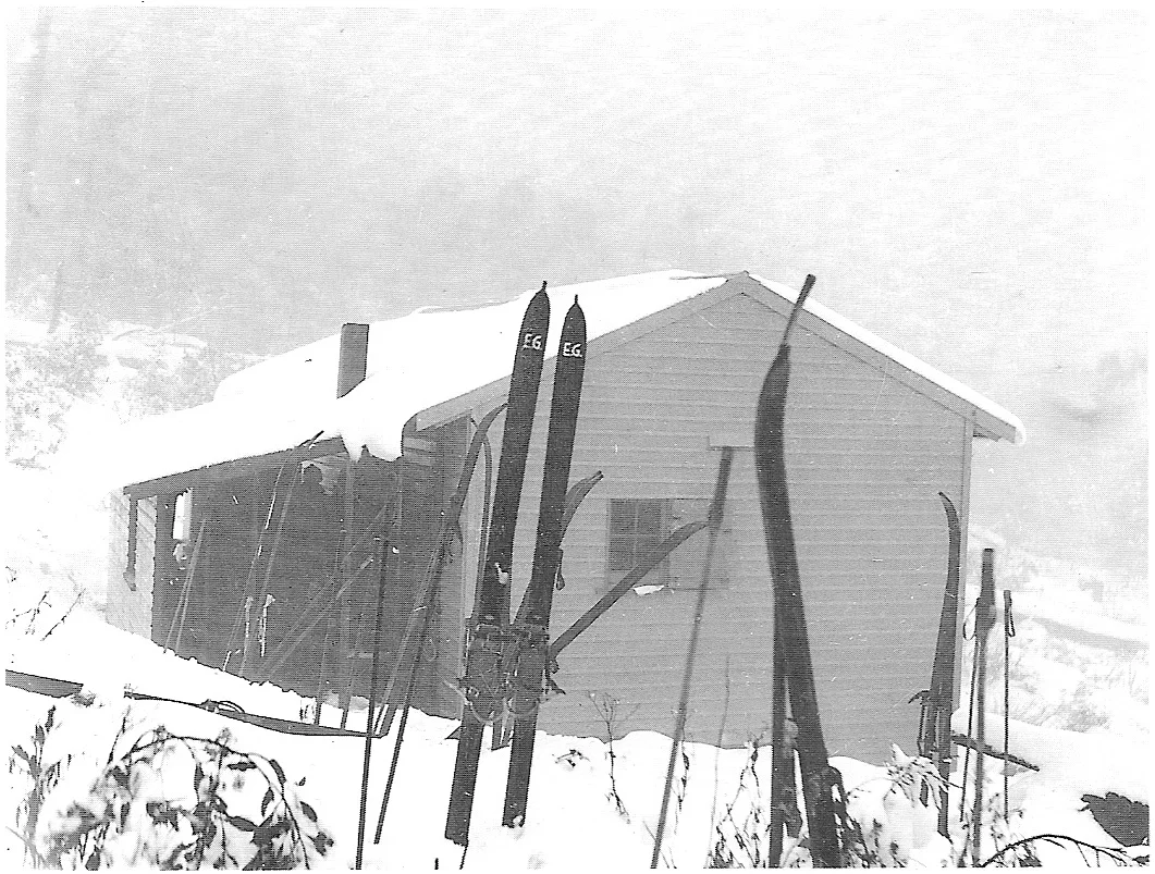
Eric Douglas and family taking a break July 1935. The photo gives an idea of ski fashions of the time. The structure in the background is yet to be identified, it may have been a kiosk, a shelter hut, toilets, ski hire or a first aid post. Please send a message if you have any idea.
Except for the moderately graded run along the fire break parallel to the summit road, all these runs were relatively short. Snow cover on the mountain was often marginal and it made little sense to invest energy and money extending ski slopes much below the 1150 metre contour, which is why no cut runs extended down to the main car park at the 10 Mile Turntable which has an altitude of 1050 metres.
Donna is a fair way south of most of today's ski resorts, meaning snow coverage extends to a slightly lower altitude, but while snow regularly falls at 700 metres, at that altitude it generally melts in less than a week or is washed away by rain. So, to maximise the time runs were skiable, work on them was largely confined to the highest parts of the mountain.
The only exception came in the dying days of skiing on Donna Buang when, in early 1951, a work party substantially extended the Main Run utilising £25 funding from the Tourist Resorts fund. The volunteers appear to have been largely locals associated with the semi-defunct Warburton Ski Club and members of the Ski Club of Victoria, one of the clubs with a cabin on the mountain.
To modern eyes, apart from the relatively short length of the ski slopes, the other unusual thing about five of the runs identified is that they are relatively steep. Except for the fire break to the south west of the summit, all would probably be classified as at least 'Blue' (intermediate) at a modern ski resort.
Of course, not all visitors had their own skis or were able to borrow them, so by the 1930s a ski hire service was available. It was run by Erik Johnson Gravbrot who went on to run a horse sled service providing winter access to Mt Hotham in the 1940s before the road to that resort was cleared of snow.
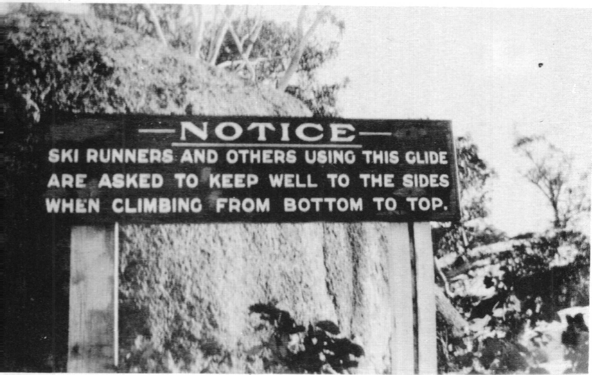
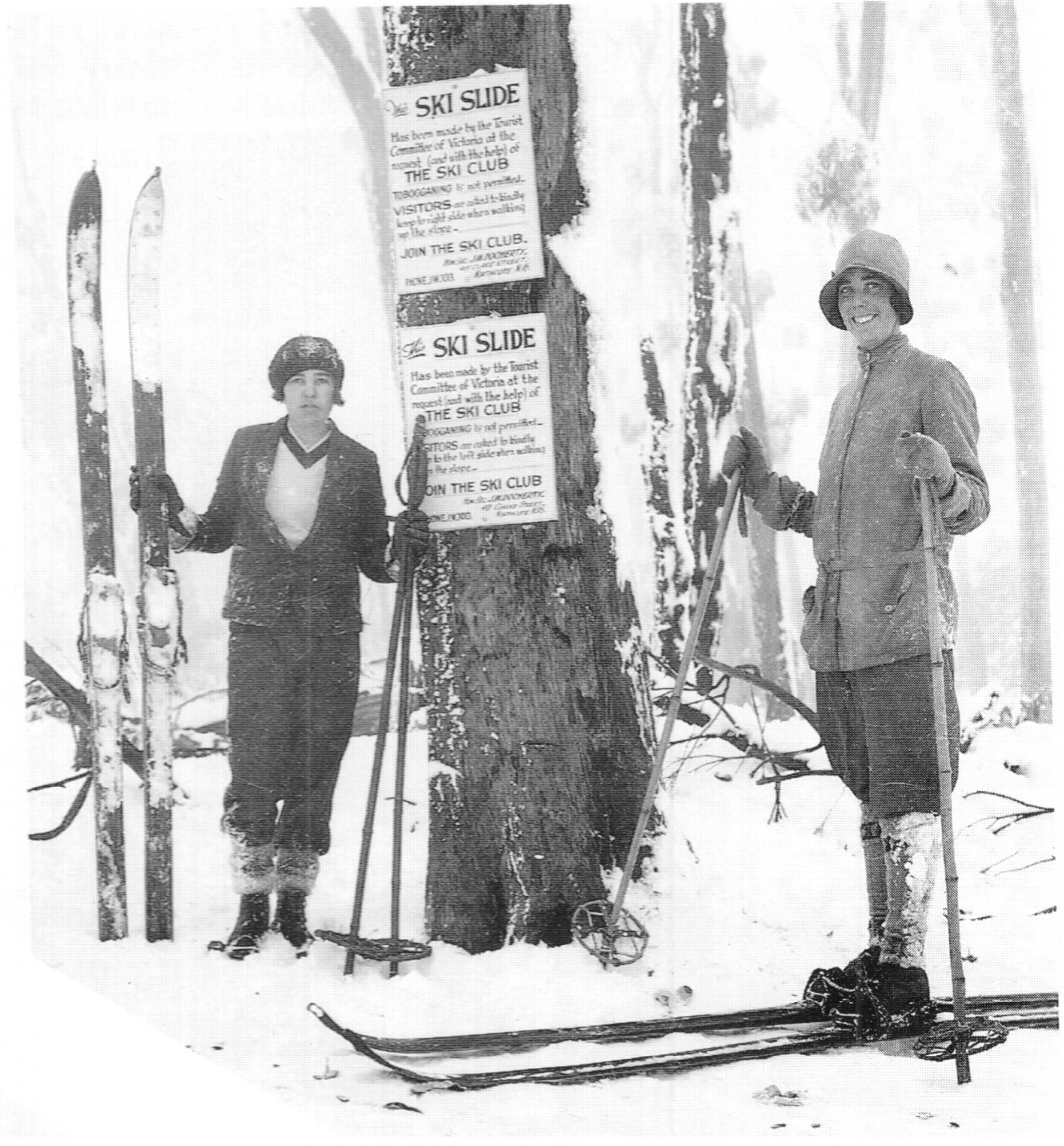
A sign in 1929 urging pedestrians to keep the ski slopes clear.
Crowding
The busiest day at Donna appears to have been Sunday 7 July 1935 when The Argus reported that more than 2,000 vehicles carried 12,000 visitors to the mountain, while another daily newspaper The Herald reported a less precise figure of 'over 10,000'. This is still more than any ski resort in Victoria gets today. How all those people crammed into the relatively small area between 10 Mile and the summit is hard to imagine. Somehow, one of the ski clubs managed to run races on Donna Buang that day.

Skiers at the base of the Main Run at Donna Buang. The Argus, 20 June 1932.
While crowds on other days were less extreme, good snow on a weekend always brought thousands of people to Donna Buang. A more typical day was probably Sunday 21 August 1932, when 620 cars visited and there were 2,000 people in the summit area. There don't appear to be formal records of visitor numbers and those quoted are drawn from newspapers and ski magazines. How accurate they are is open to question; on one day in August 1934 there must have been an awful lot of vehicles shuttling up and down the road for 'over 100 cars and vans' to deliver 'over 5,000 people' to the mountain. But whatever the precise figures really were, there is no doubt that Mt Donna Buang was a very crowded place whenever there was decent snow in the 1930s.
Fortunately for the skiers, most people simply came to visit the snow rather than to ski. However on busy weekends, crowds spilled onto the ski runs making skiing difficult and conditions dangerous for both sightseers and skiers. In 1933 a fence was built to keep non skiers off the slopes, but even after the fence was extended in the summer of 1935 - 1936, it was still not effective as the penned in non skiers simply climbed over the fences. Another attempt to deal with the problem was to build a toboggan run to give the snow players somewhere away from the ski runs to try out their mostly rented equipment.
But crowding of these areas often made it impossible to keep snow players and tobogganists off the ski slopes. There just wasn't the space for thousands of people to enjoy themselves in the treeless and cleared areas of this relatively small mountain and the crowding was hardly conducive to an enjoyable ski trip with a group of friends.
As the popularity of Donna Buang grew, so did the level of frustration by skiers. As early as 1928 Eric Stewart of the Melbourne Walking Club reported that ‘several parties of visitors arrived to see the snow, and in the nature of their kind, engaged in snow-balling (which we did not mind) and selected... our narrow ironed [ski] track to wallow through (which we did mind). Some of my remarks were, I fear, more pointed than polite.’

Non skiing 'visitors' walking on a ski run. Source: NLA
The crowding caused increasing concern amongst some skiers and irritation amongst others. In 1933 The Sun newspaper sensationally reported that 'war' had erupted between skiers and tobogganists and that a skier used an axe to destroy a toboggan that had been used on a designated ski run. The problem was slightly eased when the Main Run was widened in March 1934 and a new track for pedestrians was cut parallel to it.
One of the more intense written responses from skiers was a mid 1930's letter to the monthly ski magazine Schuss by Sandy McNabb. “... the congestion which has followed from wide publicity and the lack of facilities for casual visitors have caused misgivings to [skiers] who naturally wish to make the most of the limited ski runs... the suggestion of opening the road right to the summit must call a strong protest from skiers, Imagine the results with only 500 cars parked near the top and several thousand people dumped there. With all the cleared space occupied by cars there would be only one place for them to overflow and that would be on the ski runs... and the road would be completely lost to skiing... a snow plough would be necessary to keep it open and heavy maintenance charges would be involved. ... [Instead] let all the money available be spent on developing runs, trails and other accommodation... Cars are only required to get to the snow and not through it.”
Clearly McNabb believed in segregating skiers and those he described as merely ‘visitors’ as much as possible, presumably by encouraging them to stay down at the 10 Mile Turntable, away from the ski slopes and the observation tower on the summit. But his sentiments were shared by less blunt skiers and their lobbying ensured the road to the summit beyond 10 Mile remained closed in winter.
The Herald newspaper reported that 'over 10,000 persons' visited the mountain on the first Sunday in July 1935 and 'their transport presented a traffic problem of such magnitude that conferences are being held to determine how best such a concentration of vehicles can be handled in the future'. Arthur Shands, the president of the Ski Club of Victoria responded by proposing that a resort entry fee should be charged. This would reduce visitor numbers as well as funding further improvements to the mountain for skiers. The idea was strongly opposed by A. D. Mackenzie, chief engineer of the Public Works Department who had supervised the rebuilding of the road two years earlier. He argued that access to the mountain should be free and open to all.
This overcrowding by sightseers and tobogganists as well as skiers was the prime impetus for more ski runs to be built. As well relieving the crush, they also provided a greater variety of slopes for skiers, who in the early 1930s had been restricted to only a couple of properly built runs. However even with expanded skiing and snow play areas, the problem was not resolved and as late as 1947 a ski club newsletter reported 'Unfortunately snowballers and traffic jams were as bad as in the bad old days, mostly due to lack of suitable control'.

A volunteer 'working bee' on Donna Buang. Schuss, June 1945. p. 115.
Volunteer work parties
With skiing on the mountain becoming increasingly popular, it was only a matter of time before locals became interested and the Warburton Ski Club was founded in 1931.
Post logging debris and regrowing woollybutt below the lookout tower. This photo gives an idea of the work involved in clearing the ski runs.
Much of the hard work of improving the ski runs and fencing them off from areas frequented by Sandy McNabb's dreaded 'visitors' was undertaken by locals from the Warburton Ski Club, as well as members of the four clubs with accommodation on the mountain, although it is likely that other skiers and clubs assisted as well. The workers were volunteers and most of the funds needed were donated by the clubs and local tourist businesses, although occasionally grants were obtained from government agencies to cover the cost of materials and specialist labour.
Donna had its heyday in the late 1930s. The mountain was popular, clubs had built accommodation on the mountain and new ski runs were cut through the forest of woollybutt and myrtle beech. But the January 1939 wildfires, followed seven months later by the outbreak of the Second World War slowed things down. Wartime petrol rationing and many of the most active skiers enlisting in the armed forces reduced both the number of skiers and the ability to do summer maintenance work. When the war finished, after a brief revival, skier's attention rapidly moved to other resorts, initially Hotham and Buller but a few years later Falls Creek and Baw Baw as well.
By 1950 ski visitor numbers were in steep decline, the University Ski Club had transported their lodge to Mt Buller and the end looked near. But at least one club remained optimistic about Donna Buang's future. The Ski Club of Victoria organised volunteer work parties in March and May 1951. Ski runs were cleared of fallen timber, the old wooden jump was rebuilt in stone and the Main Run was extended. The Public Works Department contributed £25 to cover costs. Walk magazine reported 'visitors to the mountain during April and May were interested in the explosive efforts of Ski Club members improving the ski jump and run-out in preparation for the coming winter. Much gelignite was expended in removing large boulders from the track'.
It appears the final work parties on the ski runs were comprised of locals from the upper Yarra area and were organised by Mick Smith. Over summer Sundays in 1951 - 1952 they extended the Jump Run and linked it to the base of the Main Run by a curved route through the trees. But by the 1952 ski season there were very few skiers left to enjoy these improvements.

A modern staircase has been insensitively built down the middle of The Main Run, thwarting any potential skiers who may wish to recreate the experience of 90 years ago. © David Sisson.
Other activities
In the 1932 season there was skiable snow on 56 days including 12 Sundays. On Sunday 21 August, 620 cars visited and there were 2000 people in the summit area. That appears to be a fairly typical number for Sundays of that year.
Racing
In the 1930s skiing had not quite split into separate downhill and cross country disciplines, so while the main focus on the mountain was downhill skiing, cross country was also popular in the less steep areas. The Herald reported that a 'Langlauf' race held on 11 July 1935 in 'slow conditions' along the snow covered road from the summit to the 10 Mile Turntable was won by T. Fisher in 14 minutes 15 seconds. (The route was along the original summit road and not the shorter and steeper road built in the 1970s.)
The University Ski Club has records of downhill racing on the mountain and the Ski Club of Victoria held downhill and cross country races on Sunday afternoons from the late 1930s until at least 1951. It is possible that other clubs raced on Donna Buang as well.
Australian ski troops on patrol in Lebanon, 1941. Australian War Memorial.
Military training
In 1935 the Brighton Rifles, a unit of what is now called the Army Reserve, conducted 'snow manoeuvres' on Donna Buang. This may not have been as frivolous as it sounds as a few years later the Australian Army found a use for experienced skiers in two rather different theatres of war.
In 1941 the 1st Australian Corps, Ski School was established at The Cedars near Bsharri in the Taurus Mountains of Lebanon. Initially it was planned for Australia’s first ski troops to fight the Vichy French in the Syrian Campaign of the Second World War. This was part of a larger project with the intention of training mountain troops to operate on skis in winter and in difficult terrain in summer. It was planned to have two companies of about 200 of these specialist mountain troops in each of the three Australian divisions deployed to the Middle East at the time, but only the 9th Australian Division Ski Company was formally established..
However the French were defeated before the courses began, but it was decided to go ahead with the training anyway as trained mountain troops had the potential to be useful throughout Europe. However with the entry of Japan into the war, the 6th, 7th and 9th divisions were gradually reassigned to tropical areas, so their ski training was never utilised. The unit trained over 200 soldiers in ski warfare before it was disbanded in late February 1942. The work in establishing the ski school and developing courses was not wasted as the facilities at The Cedars and nearby areas were taken over by the British. In 1942 it became the (British) IX Army Ski School, then the Middle East Ski School in 1942-1943 when it was expanded to cover all aspects of mountain warfare, including both skiing and rock climbing before its closure in 1944.
In 1943 prisoners of war on the equator in Singapore established the Changi AIF Ski Club as a way to occupy themselves. The club’s weekly lectures and discussions proved to be quite a morale booster in the difficult conditions of the Changi prisoner of war camp. The president was Captain Tom Mitchell, the four time Australian combined ski champion who had funded the construction of the Donna Buang ski jump. It was probably the only ski club in history where none of the members saw snow during the existence of the club.

Hat badge of the Brighton Rifles
While it is not known if the skiing members of the Brighton Rifles in 1935 later found themselves training to fight the French on skis in Lebanon or if any were imprisoned by the Japanese in Changi, the army reserve exercises on Mount Donna Buang may actually have been quite useful.
As to the Brighton Rifles themselves, the unit was established in 1921 as the 46th Infantry Battalion, but when war broke out in 1939, many members of reserve or ‘militia’ units joined the regular army and were deployed overseas. When there was a danger of Japanese invasion, those who had remained with the unit were sent to Queensland where, as part of the 3rd Division, they trained in jungle warfare. It was amalgamated with another battalion in late 1942 and in 1943 was sent to fight at Milne Bay in New Guinea as part of the 5th Division.
Note 1: The army also used the area above the tree line on Mt Buller in summer during the war as training in the use of Universal Carriers (aka Bren Gun Carriers) a type of light armourned vehicle, in mountain environments. (Summers p. 9)
Note 2: I’ve been corresponding with a couple of people about the 1st Australian Corps Ski School and it would make an excellent subject for a book, article or YouTube video. However I’m not sufficiently versed in military history and none of us have the time to write about it at length or produce a video. However I have a long list of printed, photographic, online and video resources as well as useful contacts for anyone who may be thinking of doing some work on the subject. Please contact me if you’re interested.
A film of skiing on Donna Buang in the 1920s
A typical home movie, the film shows the basic conditions on the mountain before the cleared runs and vastly improved facilities of the 1930s. Starting in 1926, just a year after skiers first ventured onto Donna, it doesn't feature overly stylish skiing. Later there is a short interlude at Mt Hotham featuring Helmut Kofler, which dates that part as 1928, as Kofler only spent one year at Hotham before moving to Mt Buller where he was the manager of the Chalet on that mountain until his death a decade later.
The section from 1.24 to 2.20 conveys what the 1920s experience was like for ordinary skiers on Donna Buang. The packed car park gives an idea of how crowded the mountain was just a few years after it was discovered by skiers and other snow tourists. Unfortunately who made the film it is unknown.
Administration and ski politics
Oversight
From 1919 to 1983, Crown land in Victoria that had been used for purposes such as mining or farming was generally managed by the Department of Crown Lands and Survey (usually known as the Lands Department), while Crown land that had never been occupied for long term use and which was not intended to be sold, was mostly under the control of the Forests Commission. The Forests Commission was run by foresters and was mainly concerned with sustainable timber harvesting and general environmental management including preserving areas of special scenic or ecological value. Needless to say, tourism was not a field within most foresters range of expertise. However, in 1924, in recognition of Donna Buang's scenic attraction, timber harvesting was prohibited within 101 metres of the Donna Buang road. The logging contractors, T. J. Currie and Co, claimed this set them back a huge £9,000 through loss of timber and additional earthworks necessary for their tramway to cross the road.
While the Forests Commission was expert in the allocation and supervision of logging coupes, they soon found themselves with different responsibilities on the mountain when it became evident that Donna Buang was more than a just a minor scenic destination and they were in control of an increasingly busy tourist resort. So in 1933 a committee of management was established to facilitate communication between city bureaucrats, local Forests Commission officials (based nearby at Powelltown), the tourist industry in the area and representatives of skiers. Members of this committee had views that occasionally clashed, but overall the Committee of Management helped smooth communication and decision making between parties with interests on Donna Buang.
The SCV versus almost everyone
However ski politics did cause some tension on the mountain. Beginning in the mid 1930s, through to the mid 1950s, the Ski Club of Victoria attempted to assert itself as the controlling body of skiing in Victoria. Not surprisingly this didn't go down too well with the 20 other ski clubs that existed in the 1930s, or with private skiers with no club affiliation. Despite suggestions from as early as 1932 that a state wide 'Ski Council' be established, tensions were mostly controlled before the Second World War and suspended during the war,. But by 1945 ski clubs were tired of attacks on them by the SCV and their attempts to levy fees on users of ski huts which the SCV did not own such as Cope Hut on the Bogong High Plains.
Things culminated in 1947 when most of the other clubs formed the Federation of Victorian Ski Clubs as a peak body for Victorian skiers and invited the SCV to join. The SCV responded by printing an eleven page declaration of war in their club magazine and subsequent correspondence from both groups is full of 'colourful' language, although the Federation were careful to be strictly non-partisan in all their publications including the monthly magazine Ski Horizon. In the early 1950s the FOVSC established an “Olive Branch Committee“ to reduce tensions and reconcile the SCV with the majority of skiers in the state. Eventually, in 1955, the heavily outnumbered SCV was persuaded to back down from its demands that other clubs pay an affiliation fee if they wanted input into the club claiming to be the administrative body of skiing in Victoria. From 1955 a unified organisation, the Victorian Ski Association represented all skiers.
The Ski Club of Victoria still exists and it has a lodge at Mt Buller, but it long ago abandoned any delusions that other clubs should pay homage to it. This dispute deserves an article of it's own, but it's sufficient to say that there were no serious inter club tensions in New South Wales or Tasmania. In those states, ski clubs seemed to be able to co-operate to further the interests of all skiers.

THE SCV's campaign against the new ski run printed in The Argus. 4 April 1936. Note the SCV's provocative claims that they were "the" Ski Club and that the Main Run was their run, despite funds for it being contributed by government agencies and local businesses while labour to improve it also came from several other ski clubs.
One of the opening shots of the SCV's declaration of hostilities was fired on Donna Buang in early 1936. To alleviate overcrowding, the Committee of Management approved the construction of a new ski run on the north east slopes, some distance from the existing runs which were to the east and south of the summit. This appears to have been a good location as the slope still holds good snow and it incorporated a cleared fire break which would have reduced the cost of building it.
In one of the first instances of the SCV "not playing well with other children", the club appears to have resented that others were involved in deciding where the new run should be and it began a campaign to depict the new run as both a waste of money and subject to such strong sun that snow that fell on it would quickly melt.
However after it was built, the new run proved to be fairly popular with skiers and while it is now slightly overgrown, it still holds good snow whenever it falls.
The original wooden platform at the top of jump slope in summer. The summit tower can be seen behind it to the left. Photo Mick Hull.
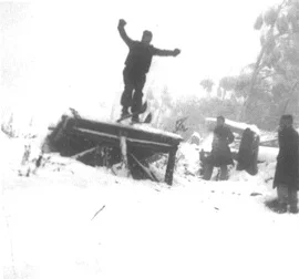
The ski jump
Ski jumping played a part in Victorian skiing from the 1930s to the 1960s. However this was the old nordic sport of distance jumping rather than the aerials at which Australians have excelled in recent decades. Jumps were constructed in many ski areas from the early 1930s culminating in 1966 with the enormous Ross Milne Memorial Jump near the top of the Gully Chairlift at Falls Creek. However despite good facilities and promotion, mostly by migrants from Europe, jumping never really ‘took off’ in a big way with Australian born skiers.
The wooden take off platform on the jump at Donna Buang. Photo USC website.
In 1932 a ski jump was built at Donna Buang by members of the University Ski Club. Clearing of the jump slope was funded with a generous £25 donation from Tom Mitchell. (Mitchell was Australian combined ski champion for four years and went on to assist and promote ski related causes as a member of state parliament from 1947 to 1976.)
The jump was designed by Norwegian born Martin Romuld who was the state ski jumping champion for much of the 1930s. Romuld worked as an engineer on the Kiewa hydro electric scheme and lived in a cottage on the Bogong High Plains all year round. As his home was in the snow for four or five months each winter, he had plenty of opportunity to practice.
Romuld designed the Donna Buang jump to minimise construction work. At the top, a three metre high wooden platform led to the natural slope of the hill. A small platform was built further down the jump slope at the take off point. The whole length of the jump slope was about 32 metres. In 1933, Romuld jumped 18.3 metres. The best an Australian could manage was 15 metres jumped by George Hulme in 1935.
However despite the attempts of Scandinavians such as Romuld and Eric Johnson Gravbrot, the owner of the Donna Buang ski hire, plus a few central European skiers, jumping never became terribly popular with local skiers and the jump may not have been used all that much. But some Australians did take up jumping; Tom Fisher and Derrick Stogdale actively promoted the activity on Donna Buang to members of the Ski Club of Victoria in the late 1930s.
It appears the jump survived the 1939 fires, although it may have become derelict during the six years of the Second World War when there would not have been the resources to maintain it. Reputedly it eventually fell down. In March 1951, when the mountain was in steep decline as a ski destination, former members of the defunct Warburton Ski Club assisted by members of the Ski Club of Victoria, renovated the jump area and trucked in 30 tons of stone which was used to rebuild the take off platform at the edge of the then road. The group also cleared rocks and scrub from the runs and extended the length of the nearby Main Run. The cost of all this work was £45/16/6, the State Development Committee contributed £25, the remainder being covered by the SCV.
Despite the obvious decline in Donna Buang’s popularity amongst skiers, some remained optimistic about its future and in the summer of 1951 - 1952 Mick Smith organised a group of locals to extend the jump run, including linking it to the Main Run by a route curving through the trees. Work parties were run on a number of Sundays with stumps being blasted and logs cut to provide a good clear extension to the run.
But by that time, keen skiers had already moved to higher mountains to the north and east, so there were not many left at Donna to benefit from the new work and the jump was hardly used after the 1952 ski season.
In the mid 1970s the stone ski jump was bulldozed by the Country Roads Board when, despite protests from locals, 400 metres of the road near the summit was realigned. Some of the rubble from the stone jump can be seen above the modern road, 100 metres south east of the summit area shelter hut.
1925 map of Warburton and district. From Tourist guide to Warburton and district.
The Knob engine house and the haulage leading up to The Pimple. Three seperate inclines lowered timber from Mt Victoria down to Warburton and hauled the bogies back up. Rose postcard.
4. Access and transport
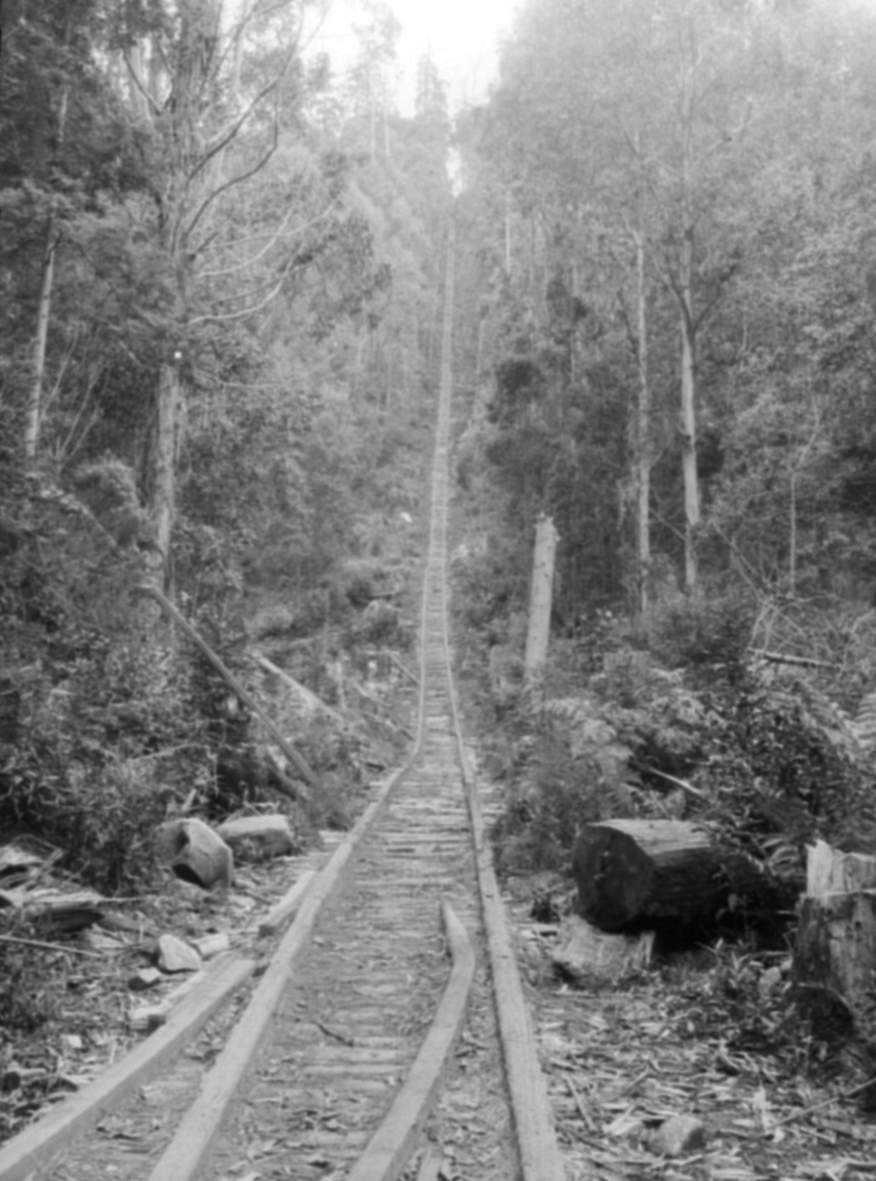
Jacob's Ladder incline on Currie's tramway from Millgrove, terminated at the Ben Cairn Road, 2 km west of the turnoff to Donna Buang Summit. It continued to be used for pedestrian access to the mountain long after the tramway closed in 1934.
Background. Most mountains and ski hills in Victoria were initially accessed and opened up by miners and mountain cattlemen, but unlike some other hills nearby, Donna Buang had no minerals and the grazing potential was very modest; lying below the treeline in an area of tall ash forests and temperate rainforest, there were no natural snowgrass plains and very little grass on the forest floor. As its slopes were too steep for farming, the mountain was largely untouched and, until the start of the 20th century, it received few visitors apart from the occasional surveyor or unsuccessful gold prospector.
Timber tramways
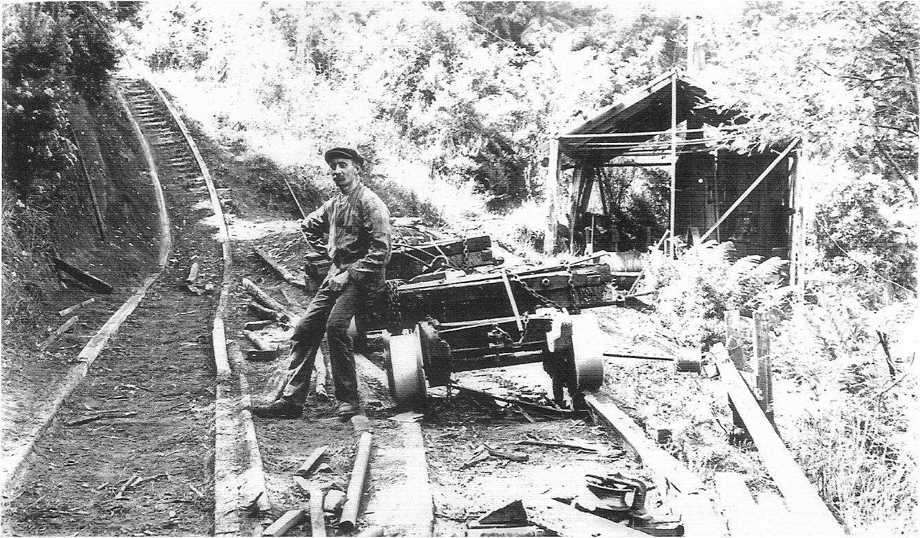
Plans to build a railway to Warburton were initially thwarted by the 1890s economic depression, but when the railway finally arrived in 1901, it massively reduced the cost of transport and large scale timber harvesting became viable. Before the railway arrived, farmers who cleared land often had no alternative but to burn the timber. However by the turn of the 20th century Melbourne was recovering from the depression of the 1890s and the forests of the Upper Yarra valley were soon being harvested to build new housing. Within a few years, eight cable haulages and funicular tramlines connected sawmills in the Yarra valley to the top of the Ben Cairn – Donna Buang ridge. At the top of these haulages, several timber tramways extended to within a few hundred metres of the summit.*
The timber tram on the ridge between Mt Victoria and Donna Buang ceased operating when useful timber was cut out in 1921 and the tramway accessing upper Cement Creek on the northern slopes closed in 1923 or 1924. To the west, timber harvesting lasted a little longer and the notoriously steep Jacobs Ladder incline on Currie's tramway from Millgrove was a popular access route for members of the Melbourne Walking Club.
While the timber harvesters had mainly moved on by the time skiers arrived on Donna Buang, the routes their tramways followed remained useful as access tracks for years afterwards. Material salvaged from buildings abandoned by the logging industry was later utilised by the Rover Scouts and University Ski Club in their own structures on the mountain.
* The story of timber harvesting on Mt Donna Buang is covered in comprehensive detail in chapters 3, 4 and 6 of Mike McCarthy’s excellent book. Mountains of ash: a history of sawmills and tramways of Warburton and district. Light Railway Research Society of Australia, 2001. It has detailed and accurate maps of the many former tramways on Donna Buang.
Map of early 20th century timber tram lines and haulages on the southern slopes of Donna Buang. Timber mills are indicated by a red triangle, the tram lines are shown as grey lines. The northern slopes were not logged as they were in the closed catchment of the Watts River which was used to supply water to Melbourne. Extract from a much larger map based on Mike McCarthy,s work on the Victoria’s Forestry Heritage website.
The Donna Buang Road at 8 mile in 1925. From Tourist guide to Warburton and district.
The Road
The unsealed, single lane, Donna Buang road. State Library of Victoria.
A steep foot track had been built from Warburton to the summit of Mt Donna Buang by sustenance workers in the 1890s depression (probably today’s Martyr Road to Mt Victoria walking track) and it was kept in good condition. In 1911 Carlo Catani, Chief Engineer of the Public Works Department, fresh from developing Mt Buffalo by improving the road, building the Chalet and the lake that was named after him, as well as proposing a similar development at Mt Erica on the Baw Baw Plateau, visited Donna Buang. Catani was sufficiently impressed with the mountain’s tourist potential, that a moderately graded access route to the mountain was quickly surveyed. Initially a 15 km bridle track was built at a cost of £400 and opened on 2 April 1912. It was upgraded to a 4½ metre wide road in the early 1920s and by 1925 it was being described as a ‘well made road’.

By the 1930s many skiers had access to a car and would drive up the mountain to the snowline before walking to the ski runs or, if they were staying overnight, to one of the club cabins on the mountain. In winter the road was never open beyond the 10 Mile Turntable. Depending on the depth of snow, cars could be parked as high as 10 Mile or as low as the 6 Mile Turntable at the Cement Creek road junction. Those without a car could take the train to Warburton and hire a service car to take them up the mountain, or hike up to the ski slopes if they were on a tight budget.
Beyond the 10 Mile 'Turntable' the road was even narrower. In winter it was closed and used as a ski touring route.
However the Warburton Highway was not sealed through to Warburton until 1941, and the road up the mountain was gravel until long after skiers abandoned Donna, so a car journey was not always comfortable.
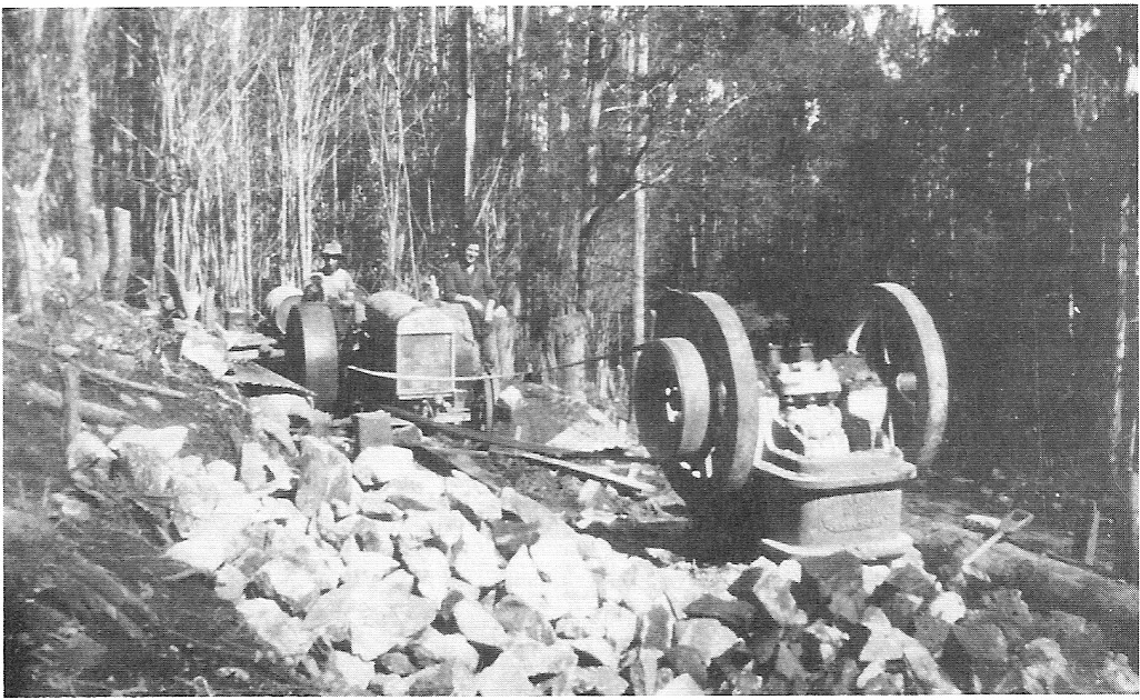
Rock crusher at 8 Mile on the Donna Buang Road circa 1933. The over-used road was rebuilt as an unemployment relief programme during the Great Depression. Later the worn out crusher jaws were salvaged by the University Ski Club and used as a backing for the fireplace of their new cabin.
A picture of the Donna Buang road in the early 1930s shows the unsurfaced road and a narrow bridge. While quite adequate for a minor road, it could not cope with the heavy traffic it received when the mountain became a popular tourist destination.
After the mountain became popular with skiers and other visitors, the narrow road received far more traffic than it was ever designed for and despite maintenance and improvements, wear and tear often made the road rough. As early as 1928, ski traffic reduced it to a muddy bog. The Herald reported that in 1930 ‘skiers… had to leave their cars… and wade through a sea of mud to reach the snow’. At times the heavy traffic was managed by only allowing uphill traffic in the morning and downhill traffic in the afternoon. In his memoirs veteran skier Mick Hull recalled that 'On Sundays [in 1932] we would quit the mountain before 3 pm to be ahead of the crush of returning sightseers'.
Over the 1932 - 1933 summer the dirt road from Warburton to the summit was widened and surfaced with gravel, culverts were built, the car park at the 10 Mile Turntable was improved and one of the heads of Ythan Creek was diverted into concrete pipes under the car park. Some of this work was paid for using unemployment relief funds during the Great Depression of the early 1930s and up to 250 men worked on the project, mostly at subsistence pay rates.
At the same time the Warburton Ski Club built a new foot track from the 10 Mile Turntable to the base of the Main Run to replace the longer original walking route to the summit over a boggy loggers' snig track. This short cut is now overgrown but its route can be followed without too much difficulty by looking for the benching into the hillside on the western side of the 10 Mile Turntable car park. Today most walkers from the 10 Mile Turntable to the summit follow the original route north up Parbury’s tramway to the ridge between Donna Buang and Mt Victoria before turning west to the summit.
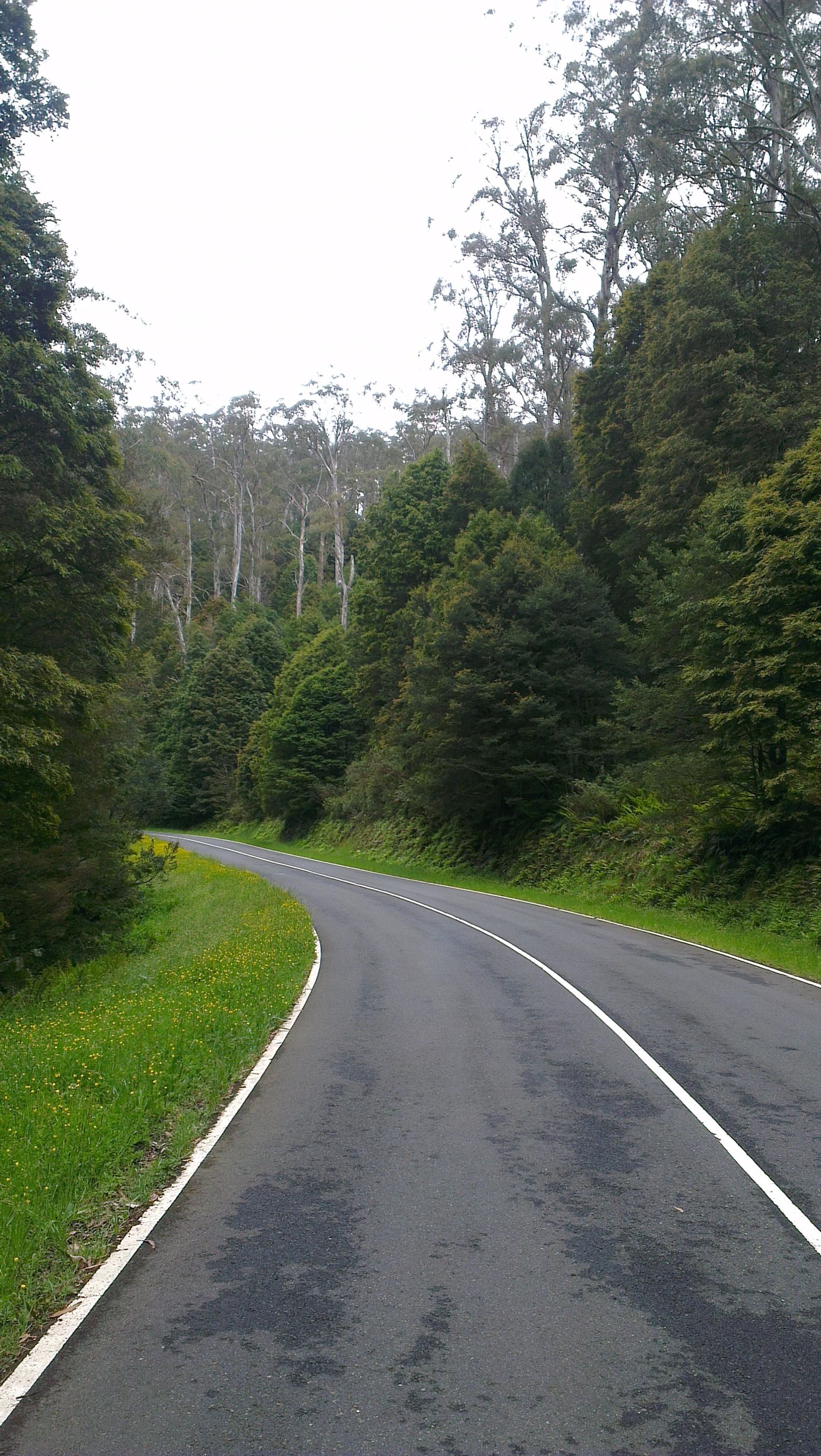
The Donna Buang Road near 10 Mile in December 2012, a vast improvement on the 1930s. The tall ash trees over a mid story of myrtle beech is typical of forests on the mountain. Photo © David Sisson.
There appears to have been no snow clearing of the road and heavy snowfalls often meant that cars could not get beyond the Six Mile Turntable at Cement Creek. When this happened, skiers had the option of walking 6 km up the road to 10 Mile or taking the shorter, but much steeper, walking track up the valley of Cement Creek. This track reached the summit from the north east, bypassing the main car park at 10 Mile.
Petrol rationing in the early years of the Second World War caused visitation to the mountain to drop off. But those who saved their petrol coupons for a ski trip were still subjected to media accusations of 'exorbitant' use of scarce fuel for trips to Donna Buang. After Japan entered the war at the end of 1941, petrol rationing was tightened even further and it became very difficult for most people to get to the mountain.
When the war finished, skiers returned to the mountain for a few years but their attention was gradually diverted to the new ski resorts that were developing further from Melbourne and skiers had almost entirely abandoned the mountain by the early 1950s. However Donna Buang remained as popular as ever with hikers and families visiting to play in the snow. So the road continued to carry plenty of traffic, especially in winter.
In the 1950s and 1960s the mountain remained very popular with sightseers, but the road did not receive as much maintenance as it probably should have and it deteriorated to a fairly poor standard. So in the mid 1970's the road was further widened and sealed along its full length. The final section to the summit beyond the junction with the Ben Cairn Road was rebuilt along an entirely new route. To help pay for this work a fee was charged for access during the snow season with a toll booth located just above the 6 Mile Turntable. In 1981 the fee was $1 for cars, $3 for minibuses and $10 for buses. Tolls continued to be charged until about 2008.
In 2009 Parks Victoria officially closed the Cement Creek track without giving a reason and ceased to maintain it. However the track is mostly still in good condition and easily followed except for the upper section of the track before Boobyalla Saddle which has become slightly overgrown with ferns and in places it is difficult to follow where it traverses knee height ferns through woollybutt woodland.

The railway line from Melbourne to Warburton. This 1939 map has been squeezed between the terminus of the electrified suburban system at Lilydale and Warburton in order to fit it on the suburban rail map. At 38 km from the city, Lilydale was exactly halfway to Warburton.
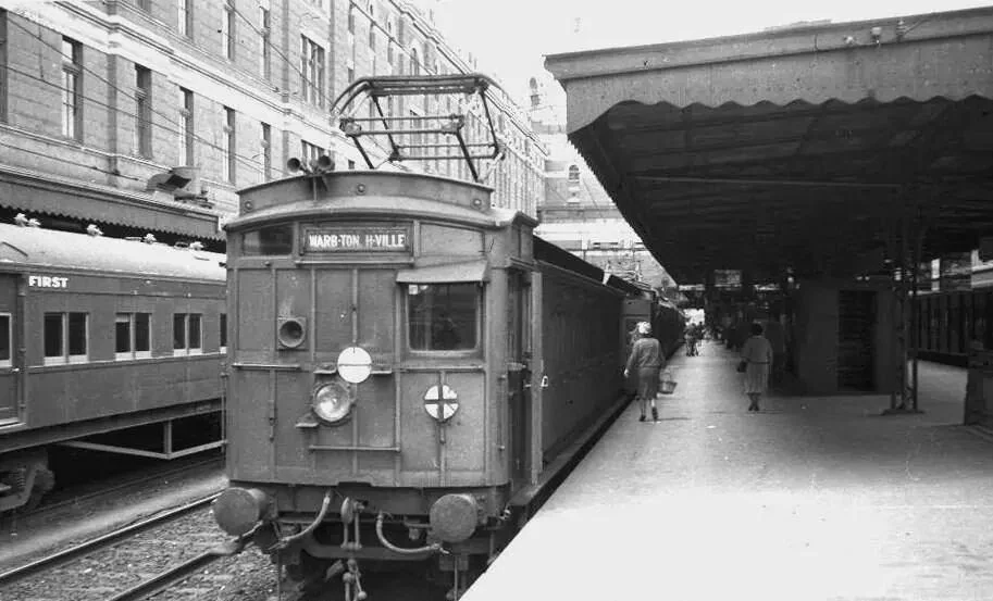
An E-Train at Flinders Street Station. The 'Swing Door' (also known as 'Dog Box' ) electric cars at the front towed the country carriages to the suburban terminus at Lilydale, where a steam engine took over for the second half of the journey. Photographer unknown.
The train
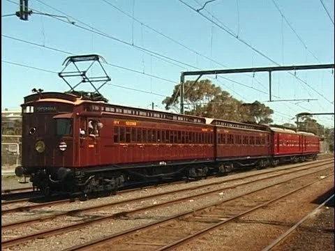
A 2002 recreation of an E-Train of the type that ran to Warburton in the 1930s. The 'Swing Door' (also known as 'Dog Box' ) electric cars at the front towed the country carriages at the back to the suburban terminus at Lilydale, where a steam engine took over for the second half of the journey. Photo © James Brook. Used with permission. Video of the recreated trip.
Another option for visitors to Mt Donna Buang was to catch a train to Warburton after work finished for most people at lunchtime on Saturday. The steeply graded railway with tight curves had been built through the hills as a slow freight line to transport farm produce and sawn timber from the ash forests of the Yarra and Little Yarra valleys, so even passenger trains were restricted to 65 kmh. However, this was still much faster than people could drive on the rough roads of the time.
The railway finally arrived at Warburton in 1900, well after most towns in Victoria. However it was immediately successful, partly as it opened the upper Yarra Valley to closer settlement, but mainly because it allowed the tall forests of woollybutt and mountain ash to be harvested economically. Hundreds of kilometres of light tram lines were built into every valley in the areas around Warburton and Powelltown to transport logs to dozens of sawmills and to then move the sawn timber to railway stations such as Yarra Junction and Warburton. In the 1920s it was asserted that Yarra Junction was the second busiest railway station in the world for loading sawn timber, (after a location in Washington state USA). While claims like that are impossible to verify, it is certain that vast amounts of sawn timber were transported along the railway in the first half of the 20th century and some of the timber tram lines on Donna Buang that fed the sawmills were used as access routes by early skiers.
Warburton station was only the passenger terminus. Being built into the side of a steep hill there was no room for a turntable and it was awkward to load sawn timber and other freight. So soon after the line opened it was extended by 1 km to La La Siding, a large flat area next to the Yarra River where freight wagons could be loaded more easily. Passenger trains never went to La La, although steam engines did continue on their own to the La La turntable so they could be turned before coupling to the other end of the train for the return trip to Lilydale.
Most passenger trains on the Warburton line were 'E-Trains'; a type of country train service for branch lines that didn't run too far beyond the electrified suburban network. The carriages bound for the upper Yarra Valley were hauled by electric 'swing door' suburban carriages as far as Lilydale where they were detached and a K or D3 class steam engine took over. Usually two carriages went to Healesville and two to Warburton. However special steam hauled trains often ran all the way from Melbourne to Warburton, especially during the peak summer tourist season. In 1939 a return train ticket from Melbourne to Warburton cost 8/7.
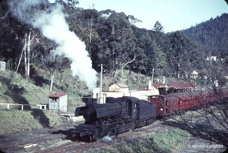
A J class steam engine at Warburton station in 1964, a year before the railway line closed. The scene was largely unchanged from 30 years earlier. Photo © Weston Langford.
On arrival at Warburton, most train travelers bound for the snow paid 3 shillings return for an eight seat ‘service car’ to take them as far up Donna Buang as possible. Depending on snow conditions, this could be lower on the mountain at the 6 Mile Turntable at Cement Creek or higher up the mountain at the 10 Mile Turntable. Then they walked to the ski slopes or to one of the club-owned cabins if they were planning to spend the night there. Most of the club cabins were a short walk from the 10 Mile Turntable.
However some energetic (or thrifty) skiers chose the steep walking track starting at Martyr Road that is still used today. A few especially intrepid characters also walked up the route of Parbury’s Mill cable-hauled tramway 300 metres to the west, which crossed the summit road at the 10 Mile Turntable. The top section of this haulage is still used today as the walking track heading north from 10 Mile, but it originally lowered timber all the way to a sawmill at Millgrove railway station on the Yarra River.
In summer buses transported tourists all the way to the summit observation tower.
After the Second World War, car ownership increased rapidly and with the road sealed as far as Warburton, fewer people took the train. An attempt to revive passenger traffic was made in early 1958 with the introduction of more comfortable 40 seat Walker railcars, but this did little to reduce the decline in passenger numbers, so with few people using the train, passenger services were withdrawn in 1964.
Haulage of sawn timber and agricultural produce had been the mainstay of the line but this freight traffic also began to decline with much of the timber being harvested in the preceding 50 years and even the earliest coupes to be logged had not had time to regrow. Increasingly widespread ownership of trucks after the war meant that a lot farm produce now travelled by road. However traffic on the Warburton railway was sustained by the construction of the Upper Yarra Dam from 1948 to 1957 and vast amounts of concrete and other construction materials were railed to La La goods siding 1 km beyond Warburton station. But with the dam complete and diminishing timber and agricultural traffic, there was no way to justify the expense of keeping the line open and it closed in 1965.
After the line was dismantled in the 1970s, the route of the Warburton railway lay unused until it was converted to a gravel path between 1996 and 1998. The more scenic sections of this path remain popular with walkers, cyclists and horse riders today.
A few fragments of the old railway survive. The Yarra Junction station has become a busy museum operated by the Upper Yarra Valley Historical Society while the rusting remains of the Warburton railway turntable are at the former La La railway goods yards, about a kilometre east of the site of Warburton station.

A 1920s style charabanc. Source Museums Victoria.
Buses and service cars
Most visitors drove to the mountain themselves or took the train to Warburton. Others took a railways bus which ran at times of high demand when no train was scheduled. The Victorian railways introduced bus services in 1925 in response to increasing competition from privately operated buses and as early as 1928 a bus operated by the Victorian Railways was scheduled to arrive at Warburton at 6.30 on Friday evenings.
A Pioneer Tours trip to Mt. Donna Buang. Photo supplied by Vivienne Worthington.
The government owned railways dealt with competition from privately run buses by running bus services of their own, but also through lobbying to restrict the operation of competitors. From 1924 the state parliament passed four acts specifically applying to bus operators. The most effective in thwarting competition with the railways was the Motor Omnibus (Urban and Country) Act of 1927. The four acts were consolidated and refined in the Motor Omnibus Act 1928. Section 38 (a) specified restrictions on bus services that might damage roads or compete with trains and trams. While a few bus operators elsewhere in Victoria (notably Reginald Ansett) managed to run services on the edge of the law by exploiting legal loopholes, these acts largely eliminated bus competition with the railways in the years before the Second World War.
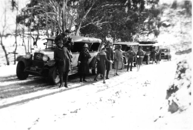
An early Pioneer snow tour. Photo supplied by Vivienne Worthington.
The legislation defined a 'motor omnibus' as a vehicle able to carry at least six passengers, so the railways did not have a complete monopoly on public transport to Warburton and a few service cars continued to run from Melbourne, however the fares were expensive. One company did manage to get a license to run a small 14 seat bus to Warburton from Melbourne in the late 1920s but the service only lasted a few years. So most people without their own cars continued to rely on the railways to get to Warburton.
Beyond Warburton, there were no government owned railways, so privately run transport was less hampered by the Motor Omnibus Acts. In the 1920s before modern style buses reached the Upper Yarra, charabancs were used. Essentially these were stretched versions of the cars of the time with four rows of seats and four doors along each side.

Ski Club of Victoria. Yearbook 1934. p. 158.
In the 1930s as many as four proprietors at a time operated service cars from Warburton. Their business was a mixture of private rentals, scenic tours for tourists staying at guesthouses, mail and passenger contracts for places further up the Yarra Valley such as McMahon's Creek, McVeighs Hotel and even all the way to Woods Point, which was still a sizeable town at the time. Of course in winter there was also the shuttle up to Mt Donna Buang. Most of the vehicles were large semi-luxury cars but one business had 14 and 24 seat REO buses in addition to their cars.
From 1925 until at least 1929, Pioneer Tours ran day trips to the snow at Donna Buang. Initially they used Nash vehicles but from the late 1920s they moved to Studebakers and Packards. The photos show a 'cavalcade' of up to seven cars that made the Donna Buang run for Pioneer.
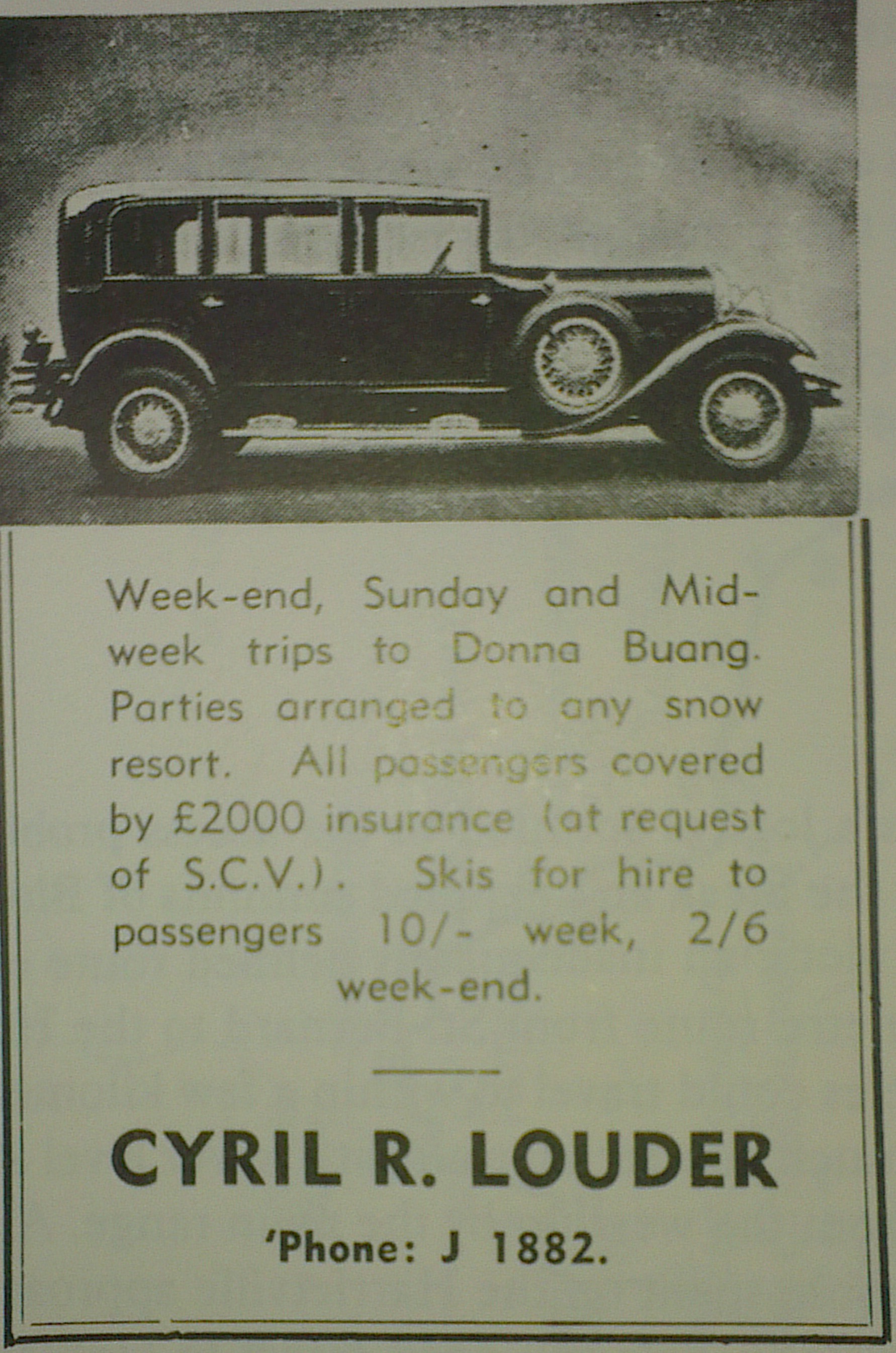
Later, dedicated transport for skiers was introduced. The Ski Club of Victoria organised car pooling for members of their club in the early 1930s, charging 11 shillings for a return trip from Melbourne. From 1936 all city based skiers could utilise a hire car service operated by Cyril Louder. Louder ran an eight-seat Buick fitted with ski racks and also charged 11/- for the trip to Donna Buang.
Alternately people could hire the Buick or a Hudson car from Louder and drive themselves for 8d per mile (1.6 km). Trips were run to any snowfield that clients wanted to get to and there are stories from the time of Louder's frequently overloaded cars getting bogged in some of the most remote locations in the mountains.
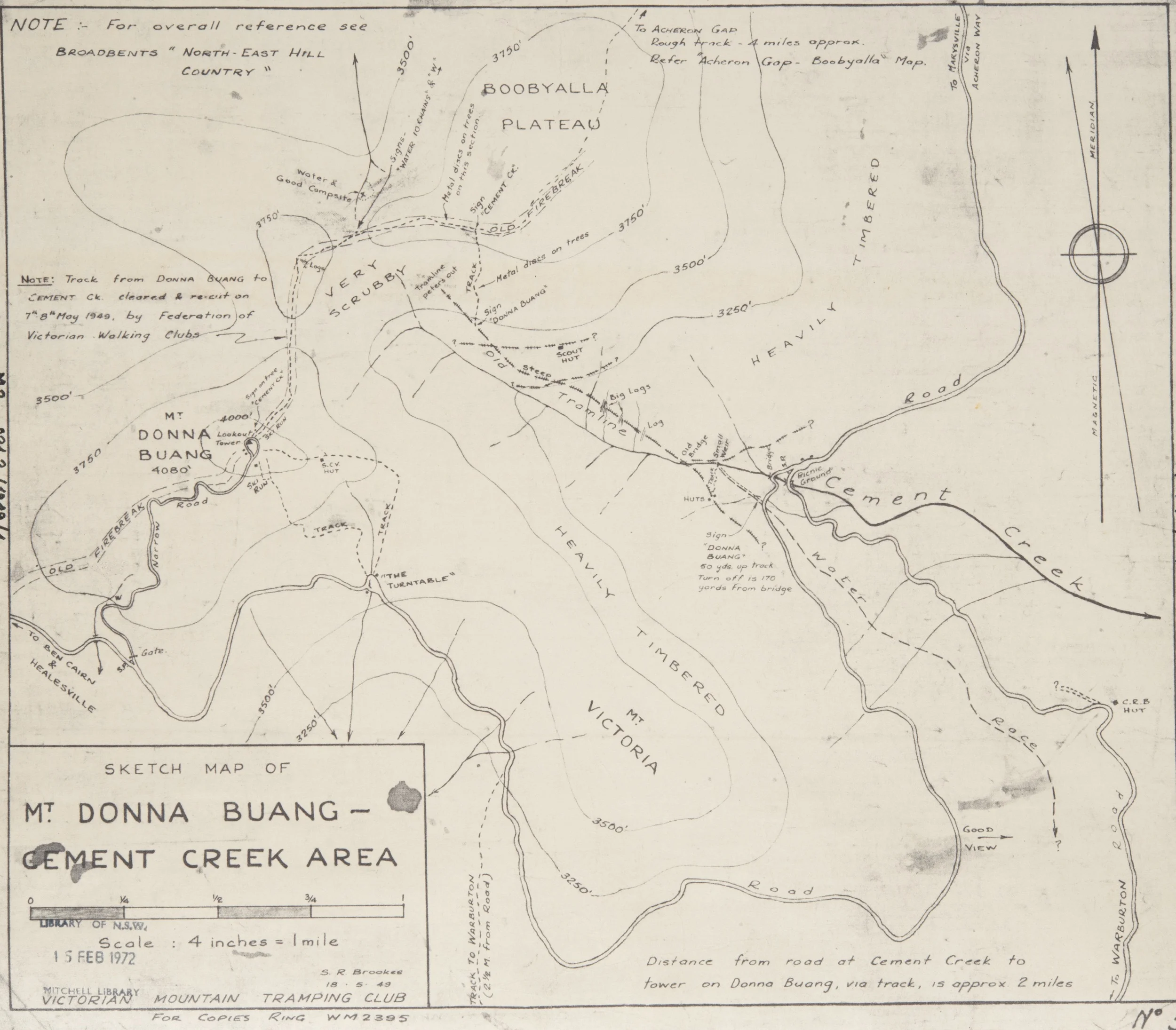
1949 map of Mt. Donna Buang. © Stuart Brookes, used with his permission.
5. Buildings and accommodation
Accommodation in Warburton
Warburton started developing as a tourist destination with the arrival of the railway in 1901 and from the 1920s there was an increasing amount of tourist accommodation in town catering to the summer market. Most accommodation was in guesthouses such as the huge, 250 bed, Warburton Chalet and Green Gables, which was especially popular with members of the Ski Club of Victoria. Other clubs and groups had their own favourite guesthouses. The Rover Scouts, who were usually on a fairly tight budget, stayed in a run down house for a nominal fee. Despite the sizable tee-total Adventist population in Warburton, there was also a hotel in town.

Green Gables was popular with SCV members before the club built a cabin on Donna
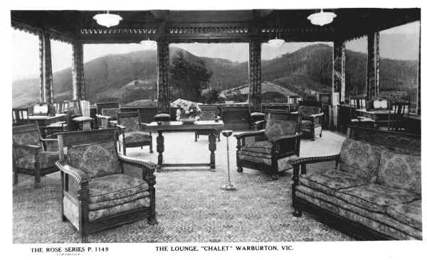
Guesthouses have largely disappeared today, but in the first half of the 20th century they were the most popular type of holiday accommodation. They ranged from small establishments with a few rooms run something like a modern B & B, right through to Phil Mayer's large and comfortable Warburton Chalet.
All featured communal lounges or 'parlours' where guests could relax and socialise. The rooms in most guesthouses had thin walls and were fairly small and basic by todays standards. Few places had ensuite bathrooms although some had a hand basin with a cold water tap in the bedrooms. Perhaps the nearest modern equivalents would be a bottom end ski lodge or a well run and cleaner than average backpackers hostel that includes meals in the tariff. That may sound rather bleak and basic for holiday accommodation, but living standards were lower in those days and people placed less importance on privacy, so guesthouses were quite popular.
With interest in skiing increasing by the late 1920s, proprietors of accommodation houses in Warburton took note and advertised to skiers in order to fill their rooms in the winter low season. The 1934 year book of one ski club features 22 advertisements from Warburton businesses. The Alpine Retreat Hotel at Warburton even offered a dedicated lounge room for the exclusive use of skiers.
But while there was plenty of accommodation available in town, Warburton based skiers faced a long and often difficult climb up the mountain each day, so attention turned to providing accommodation closer to the ski slopes.
Loggers huts on Donna Buang, winter 1924. Photo Weekly Times.
Club cabins
By the late 1920s Donna Buang was becoming increasingly popular as a weekend ski destination and in 1929 the mountain had 'continuous snow for almost four months'. At the time many skiers were content with occasional day visits from Melbourne or commuting up the mountain from accommodation in Warburton.

Events at Donna Buang received fairly good coverage in Melbourne daily newspapers. Extract from an article in The Argus.Saturday 14 July 1934. p. 10.
However travelling from Warburton each day could be slow and difficult. More importantly, it occupied time that could be better spent skiing. So attention turned to providing accommodation for skiers on Donna Buang. While groups from many clubs such as the Australian Women's Ski Club and even the distant Benalla Ski Club are recorded as having visited the mountain, from 1930, four clubs decided to build there. Because the club cabins were designed for relatively short stays and the mountain was not remote, they were not as large or as comfortable as commercial ski lodges of the time on more distant mountains, although they were a definite step up from the logging, miners and cattlemen’s huts that some skiers were used to.
The SCV Cabin on Mt Donna Buang from the walking track which still passes the ruin today
Many pioneering skiers had stayed in basic huts in the mountains of north eastern Victoria and places such as Cope Hut on the Bogong High Plains (1929) and Boggy Creek Hut on Mt Buller (1934) were built specifically for skiers. In addition six relatively comfortable commercial ski ‘chalets’ had been built: The Buffalo Chalet (1911), Rundell’s Alpine Lodge at Flour Bag Plain (an old mining hotel near Dinner Plain reopened in 1921), Hotham Heights (1925), the Feathertop Bungalow (1925), St Bernard Hospice (renovated and reopened 1925) and the Mt Buller Chalet (1929). All were successful and most were booked out months before the ski season started. So it made sense to build accommodation on Donna Buang too.
The small ski lodges on Donna Buang (or cabins as they were often called) were built by clubs on ‘permissive occupancy’ leases. In the past this was a fairly common form of tenure on Crown land in Victoria whereby an individual, club or company was granted permission to build in return for a modest rental, typically £1 per annum for the cabins on Donna. Many early ski lodges were built on PO's, right through to the 1960s. In theory PO lessees could be evicted at short notice without compensation, but this never happened to a ski lodge in Victoria until the 1980s when a controversy erupted at Mt Buller over the remaining permissive occupancies being replaced by more conventional leases.
The cabins appear small and fairly basic by today's standards and all were some distance from the road. Typically they slept over a dozen people in bunks on the edge of the main living area, with one cabin having space for more mattresses in an attic. Pit toilets were outside and washing facilities were limited. But skiers were a hardy lot in those days. In the 1930s there was only one ski lift in Victoria, so skiers were used to climbing hills and the cabins on Donna were a great improvement on the miners' and cattlemen’s huts they often stayed in at other ski destinations.
Four clubs built small lodges on the mountain. This made Donna the pioneer of the club lodge based resorts that developed from the late 1940s across Australia and New Zealand. Elsewhere, Australian ski fields in the 1930s featured isolated commercial lodges (such as the Buffalo Chalet) or individual club huts and lodges (the first was the Ski Club of Tasmania's 1927 hut that still stands at Twilight Tarn near Mt Mawson).
Donna Buang's pioneering example of a group of club lodges on a single mountain, with members cooperating to improve ski slopes and amenities was the template for the way most Australian ski resorts developed after the Second World War. CSIR, the first club lodge built at Mt Buller after the war was smaller and more basic than some cabins at Donna, but it was the first of hundreds of ski clubs to build on that mountain in the decades that followed. While most early ski resorts are now large commercial operations, the seven clubs with lodges at Mt Mawson near Hobart still hold volunteer work parties every summer and run their 'club field' in a way that would be familiar to skiers at Donna Buang in the 1930s.
However, unlike many other early ski destinations, Donna Buang never developed a proper ski village. Like most later ski areas, the first cabins were not all close to each other. At Donna, the University Ski Club and the Ski Club of Victoria were near the base of the ski runs to the east of the summit, but the Melbourne Walking Club and the Rover Scouts were some distance away in opposite directions. At other resorts, later development filled in the gaps between the original dispersed buildings, (at Mt Hotham the first four lodges were also 3 km apart), but there was no later development at Donna Buang.

A 1934 work party at the first Melbourne Walking Club hut. Used with permission of MWC.
Melbourne Walking Club. The Walter E. Briggs Hut
Founded in 1894, the Melbourne Walking Club is a hiking club for men. It thrived in the early twentieth century and Donna Buang became an increasingly popular destination for walks by the club in the 1920s. Many club members were also involved in the pioneering days of recreational skiing, so it is not surprising that in 1929 Bill Waters and Chris Bailey persuaded the club to build a hut on Donna Buang. While the hut was built with skiers in mind, it appears that it was also intended that it would be used in summer as well.

The rebuilt Melbourne Walking Club hut on the same site in 1950. Used with permission
A site 1 km from the summit was selected in April 1930 and a permissive occupancy lease was apparently obtained. Quotes were obtained from Gardner Constructions for materials to build a 4.8 metre wide by 6.5 metre long hut delivered to Warburton Railway Station for £52/10/- or a 7.6 metre long hut of the same width for £57.
It appears that the original hut was built by club members, but paid for by the Forests Commission with an agreement that the club would donate £25 towards costs if the shorter hut was built or £30 if the longer hut was chosen. A Forests Commission file on the hut states ‘The… Club are sharing in the cost [of the hut] and their members have undertaken to erect same’. But there is no indication of why the Forests Commission would have paid part of the cost of what appears to have been a private club project. It is possible that it might have been intended to use the hut as accommodation for fire watchers in the summer period, although neither surviving Forests Commission nor Melbourne Walking Club records confirm this and after the war, only the University Ski Club and Ski Club of Victoria cabins were rented as accommodation for fire watchers. By 1960 it appears that the FCV were thoroughly confused about the huts status ‘It is not known what the origins of the arrangements are, but it appears that the hut may have been erected by the commission for the club. There is no permissive occupancy license. In the past five years no departmental use has been made of the hut’. An addendum in pencil adds ‘no charge for rental ever made’.
So it looks like the reason why the Forests Commission paid half the cost of a club hut has been lost, but whatever that reason was, it appears that the club ran the building as if it was entirely their own. An opening ceremony was held in December 1930 and in 1933 it was named the Walter E. Briggs Hut after the incumbent club president.

The clubs optimism about the mountain’s ski potential was confirmed when a work party was almost snowed in on Anzac Day 1930. The eight bed hut proved popular and volunteer work parties improved it over the years, painting it, fixing the water supply and rebuilding the fireplace to help it draw better.
The cabin was initially saved from the Black Friday wild-fires on 13 January 1939, but was subsequently burnt by windblown embers a few days later, after the firefighters had left.
Happily the building was covered by the Government Insurance Office and a £200 payout financed the Forests Commission to construct a new wooden hut from December 1940 to January 1941. The internal fittings were at the club's expense.
With wartime petrol rationing, it usually wasn't possible to drive to the mountain in the early and mid 1940s, instead MWC members reported that it took them up to four hours to walk from nearby railway stations to the hut if they were carrying skis and heavy packs up the mountain for a weekend. After the war, outbuildings such as a new toilet and woodshed were built as the hut became more widely used. In the latter part of the 1940s, the club ran bus trips to the hut and hired it to groups of Rover Scouts.
Perhaps because the Melbourne Walking Club was not a dedicated ski club, their accommodation on the mountain continued to be popular with members into the 1950s, well after most skiers had abandoned Donna Buang. The Melbourne Walking Club had enjoyed their experience with skiing and as Donna declined as a ski destination, they built another ski lodge at Mt Buller which lasted from 1951 to 1990, before it was replaced. This newer lodge at Mt Buller still provides accommodation for members of the states equal oldest walking club today.
Plan for the 1940 rebuild.
Click to enlarge.
Above: The University Ski Club's cabin at Donna Buang with the 1935 porch.
Below: A view of the rear showing the chimney.
University Ski Club cabin
The University Ski Club was granted a permissive occupancy lease on the mountain for £1 per year in April 1934. Once the lease was granted, the club wasted no time and began to build immediately. A Warburton builder was employed to build a 4½ x 10½ metre iron clad hut with a stone fireplace. The snow arrived late that year, so building could continue into early winter and up to 11 carpenters at a time were working on the site. The lodge was quickly completed and was formally opened on 8 July 1934, making it the first lodge owned by a ski club in Victoria, narrowly beating the SCV's cabin at Donna Buang and their Boggy Creek Hut at Mt Buller.
The building was designed by Malcolm McColl who went on to design Cleve Cole Hut on Mt Bogong in 1937 and he became one of Victoria's leading snow country architect in the years after the Second World War.
The hut was paid for by 17 club members who each provided £12, about $1,200 at 2018 values. In return they were guaranteed a bed for the next 12 years, when the cabin would revert to the club. The rights to a bunk could be sold, and several transfers took place. For others the tariff was a shilling for a week night or 3/6 for a weekend.
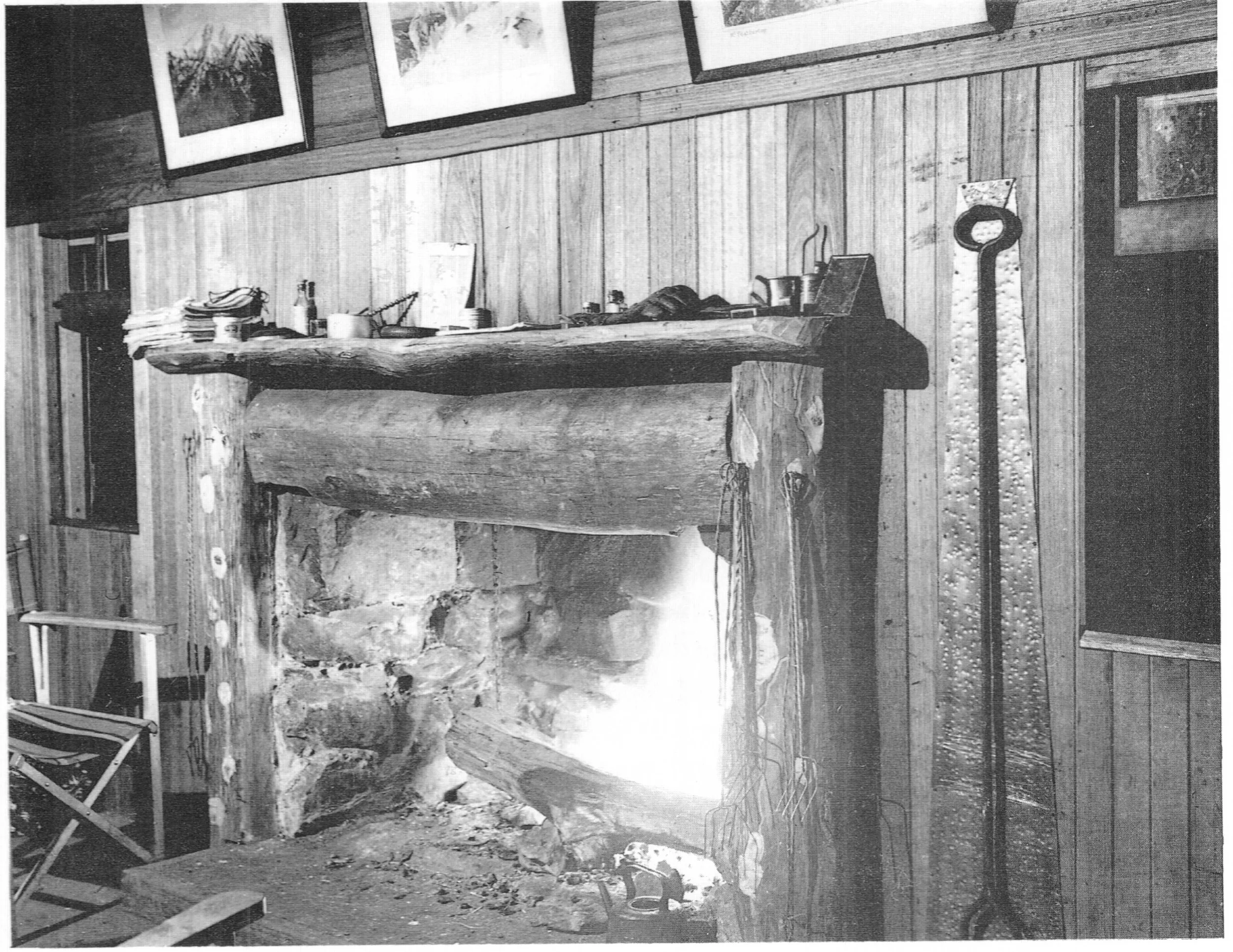
The University Ski Club cabin fireplace in action. Photo Warrand Begg.
The main room was lined with locally milled, varnished tongue and groove hardwood and decorated with framed photographs of other skiing locations such as Mt Buller. It had six bunk beds along the walls. Additionally there was a kitchen area and a small room with five beds. Men usually slept in the main room and women in the smaller bedroom. The nominal capacity of the hut was 17, but at times many more slept there. In 1935 a 3½ x 2½ metre entrance porch was constructed with material salvaged from derelict logging huts nearby.
The cabin was managed by a three person committee comprising the club president plus a male and a female elected by those who had 'subscribed' to a bunk. It was maintained by volunteer summer work parties and was popular with club members in the pre-war years, albeit with a slight decline in the late thirties.
The U.S.C. cabin survived the 1939 fires which burnt three huts on Donna Buang as well as three commercial ski lodges near Mt Hotham. While Hotham Heights was rebuilt before the outbreak of the Second World War, the loss of the large Buller Chalet to fire in 1942 compounded the shortage of ski accommodation. Even if skiers could get a booking at the Buffalo Chalet or the rebuilt Hotham Heights, petrol rationing and restrictions on civilian rail travel meant it was difficult for them to get there. This shortage of ski accommodation ensured that the USC cabin remained fairly popular throughout the war despite increasingly severe petrol rationing.
Scene after the cabin was moved to Buller. The tank has since rolled to below the chimney
Wartime shortages meant that worn out or decayed fittings could not be replaced; only 11 mattresses remained serviceable by 1944, but that didn't stop the cabin being full for much of that winter. After the war, the hut was renovated and fees were reduced to 2/6 for a weekend and 5 shillings for a week. Bookings were high in the bumper 1946 season, but declined from 1947. In 1948 and 1949, they were especially low. This reflected a couple of poorer than average ski seasons, but also the changing orientation of skiing in Victoria towards the higher mountains to the north east.

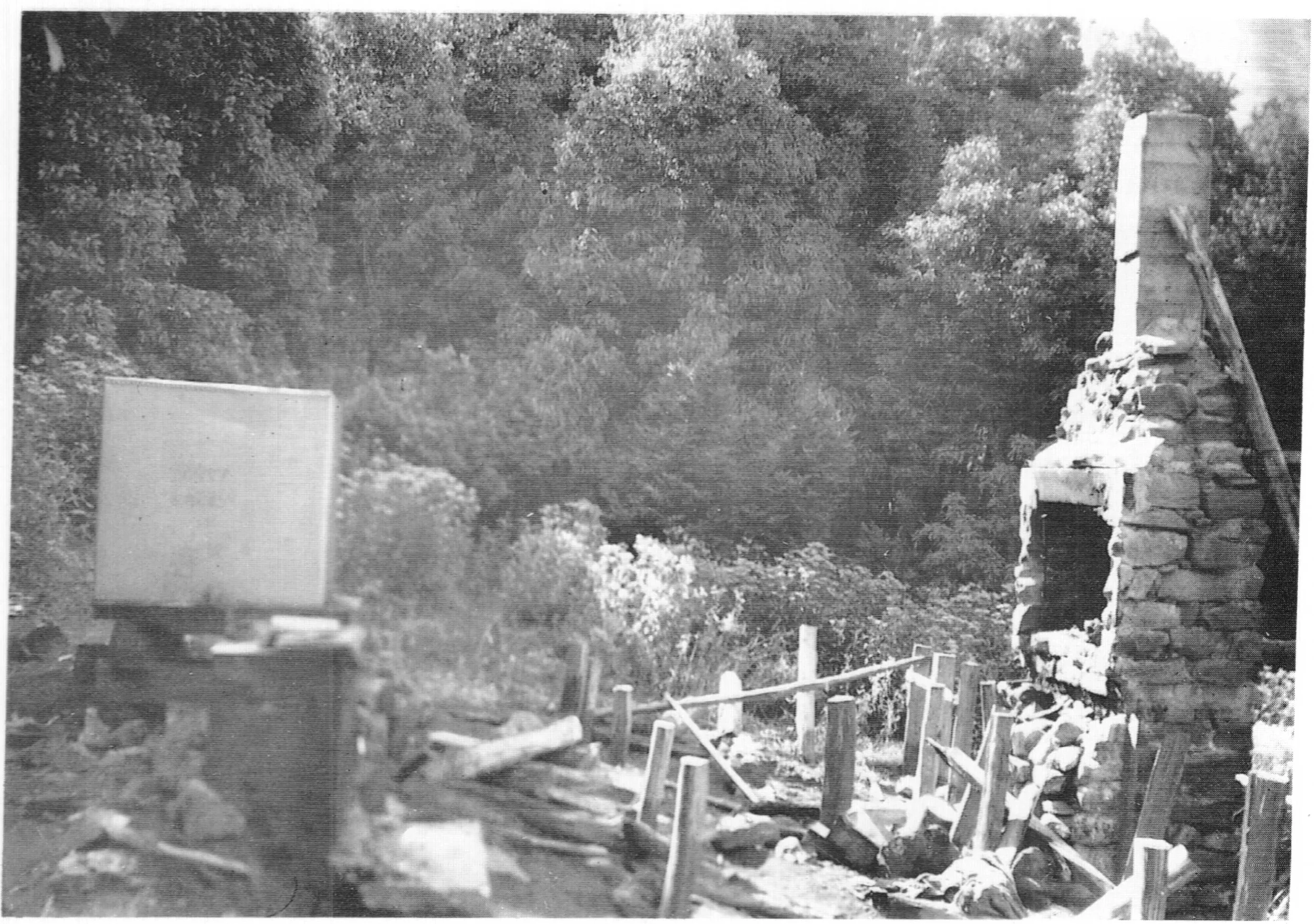
The author at University Ski Club chimney in March 2013 after a four hour search for it. The chimney is all that remains today after the cabin was shifted to Mt Buller in 1950. Photo © Blair Hamilton.
The U.S.C. built its own lodge at Mt Hotham which was open for the 1949 ski season. It cost a whopping £2,740. Meanwhile at Mt Buller, a small squatter village of illegal shanties and caravans hidden in the scrub had sprung up after the 80 bed Buller Chalet burnt down in 1942. The authorities at the Forests Commission realised some sort of administration was needed at Buller and from 1947 permitted a few clubs to build on sites of their choosing. They were overwhelmed with further applications and in the 1948 - 49 summer, the Forests Commission opened up a formal subdivision on the mountain. All of the 22 extra sites were immediately taken up and there was a strong demand for more from other clubs and groups that had missed out.
The University Ski Club was one of the successful applicants for a site on Mt Buller, but they were overstretched by the cost of their Hotham lodge and restricted by post war shortages of building materials. However they were required to build quickly or they risked losing their prime site. Faced with this dilemma, the U.S.C. turned to the Donna Buang cabin which was no longer meeting the accommodation needs of its members.
The December 1949 issue of Ski Horizon magazine reported that the U.S.C. was 'interested in selling their Donna Buang Cabin'. Apparently there was no interest from the ski community so they considered selling the cabin to the Forests Commission, as the cabin had been hired as accommodation for fire watchers in summer. However the 'suggested' price of £140, or one twentieth of the cost of their Hotham lodge, was far below what the USC thought the Donna Buang cabin was worth.
Instead, in early 1950, the Donna Buang cabin was disassembled, with sections being moved by horse sled down to the 10 Mile Turntable and then moved by ‘low loader’ to the new subdivision at Mt Buller, where the flat pack was reassembled to provide an instant lodge, enabling the U.S.C. to keep their desirable site in Mt Buller's first subdivision. Several extensions were built in the years that followed, but the relocated cabin from Donna survived until November 1982 when it was demolished to make way for an entirely new University Ski Club lodge at Buller.
The chimney of the original cabin on Donna Buang was left on site and in 1979 a cast iron plaque was attached to the old chimney to celebrate the club’s 50th anniversary. The ceremony was attended by 170 people.
The isolated chimney of the first lodge built by a Victorian ski club still stands among beech trees in the sub-alpine rainforest, looking as solid as ever. To visit it, locate the ruin of the S.C.V. cabin on the walking track between the 10 mile Turntable and the summit. Then head uphill on the track for few metres to where the scrub is a little less dense. Head north (your right facing uphill) for about 100 metres and you should see the chimney just below you.
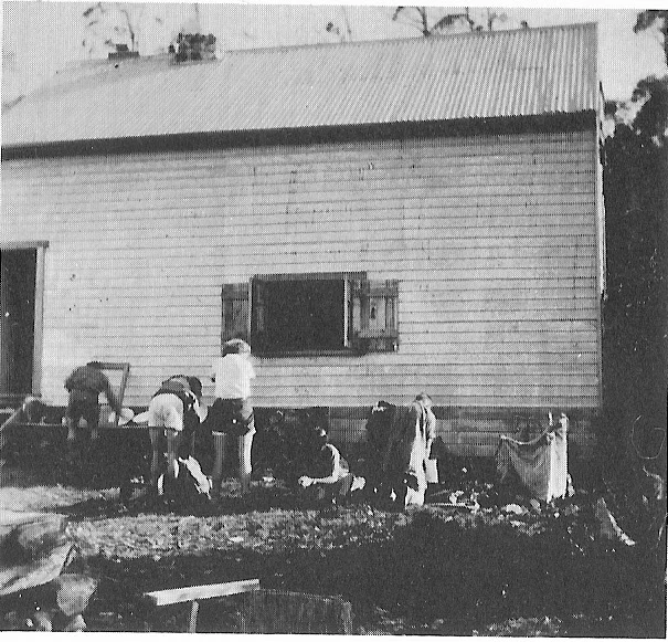
Ski Club of Victoria cabin
The third club to build on the mountain was the Ski Club of Victoria. After the bumper 1929 ski season Stan Flattely reported to the S.C.V. that: ‘... a mountain so near to Melbourne as Donna Buang, and capable of being snowcapped for nearly four months, is worthy of every effort our club can make to better conditions there’. The S.C.V. was never the most dynamic of clubs, so it took them a few years to mull over the idea of building on the mountain. Things had progressed a little by 1932 when the SCV president Gerry Rush told a young Mick Hull: 'The Committee is thinking of building a hut so in future members can stay Saturday nights when there is plenty of snow...'.
While it appears that they gained their lease before University Ski Club, the Ski Club of Victoria took longer to start construction. A newspaper report with information provided by the club states that there was 'difficulty in completing the hut' despite there being almost no snow in June 1934.
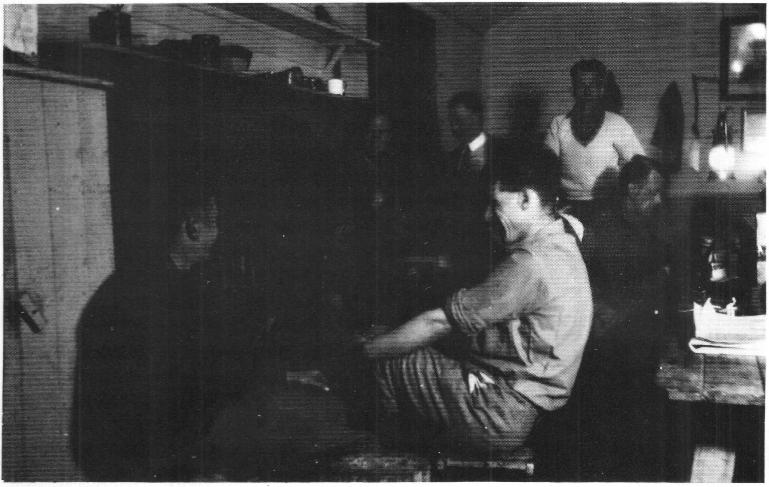
Interior of the Ski Club of Victoria Cabin.
The cabin was built by a club sub-committee led by Eddie Robinson. The building cost £144 and was partly paid for by 60 £1 contributions from members in return for first preference in bookings. Interior furnishings were mostly donated.
Like its near neighbour the U.S.C., the S.C.V.s cabin was built in 1934 to the north of the base of the Main Run. Written reports suggest it may have been iron-clad, but photos and an examination of the ruin make it fairly clear the hut was wooden. As it was built at the same time as the USC and only 150 metres away, it's likely that there was some interaction between the two clubs during construction.

The SCV cabin depicted in the Australian and New Zealand Ski Year Book 1936.
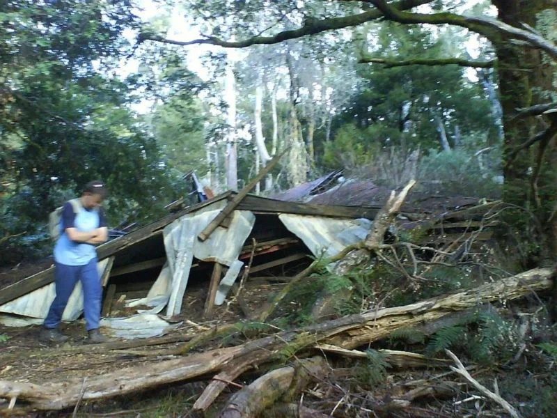
The ruin of the SCV cabin amongst myrtle beech trees on the main walking track between 10 Mile and the summit. Photo circa 2006. © David Sisson.
The SCV cabin had a similar floor area to its neighbour, but featured a usable attic space, so it had more beds. The building measured 4.8 x 8.4 metres and could accommodate up to 32 people at a squeeze. The front door opened onto a small room with a kitchen and a staircase while the main room had a fireplace and eight double bunks arranged along the walls with two moveable beds that doubled as seats. Upstairs, the attic had another 10 beds. In those days segregation was more common, so men tended to sleep downstairs while women had the attic area to themselves.
Regular work parties were held to maintain the hut, including during the Second World War when severe petrol rationing and the restricted availability of building materials made things especially difficult. The club magazine Schuss reported that in November 1944 a 15 person work party travelled by train to Warburton and were permitted to hire a bus up the mountain. Over a weekend they repaired the chimney, fixed a hole in the floor, painted most of the hut and cut wood ready for the following winter.
The cabin was kept locked to deter free-loaders. The fees charged varied over the years but for the 1945 winter they were 2/6 per person for a weekend or 5/- for the season. Like the M.W.C. and U.S.C. huts, the S.C.V. cabin was hired to other groups when club members were not using it and a staggering 49 Girl Guides crammed into it on one night in January 1947.
One usually reliable source states that the building was burnt in the 1939 fires, but the 1939 Australian and New Zealand Ski Yearbook says that fire came right to the door but that the hut remained intact, this statement is repeated in the club history published in 1984. So it is very unlikely that the S.C.V. cabin was burnt in the fires and rebuilt as the M.W.C. hut was. In any case, work parties on the S.C.V. cabin continued until at least 1951. The clubs annual report that year valued the cabin at £119/10/-.
The building was probably abandoned during the 1950s as a brochure produced by the Victorian Ski Association in 1958 stated there was 'No accommodation on the mountain of any kind' and a Forests Commission report from 1964 described it as ‘falling into disrepair’. However the cabin appears to have remained upright, although verbal reports say it was derelict by the late 1970s. The collapsed ruin is still visible next to a walking track east of the summit.

A plan of their new cabin on Mt. Donna Buang in the S.C.V.'s 1934 Year Book.
Scout Hut
The Rovers are an organisation for older scouts, in the 1930s and 40s membership was open to males aged 17 to 23. They took up skiing in 1931 when a group of Rovers visited Donna Buang and they first skied the Bogong High Plains near todays ski town of Falls Creek in 1932. A regular ski programme soon emerged, with weekend trips to Donna Buang, Lake Mountain and Mt Erica and week long trips to the Bogong High Plains staying at Cope Hut, which had been built by the state government in 1929 specifically to provide accommodation for skiers.
In 1938 the Rovers built a hut at Mushroom Rocks on Mt Erica at the southern end of the Baw Baw Plateau and in 1940 a 'chalet' was built close to Cope Hut on the Bogong High Plains. Over several decades this chalet was extended to become quite a large building, although it remains one of the most isolated ski lodges in Victoria. Both buildings are still used by Rovers, making the Mt Erica Rover Hut the oldest surviving Victorian ski lodge that is still in use, although the abandoned and derelict Mt Buffalo Chalet dating from 1911 is still standing... just.
On their first trip to Donna in 1931, 65 Rovers squeezed onto the floor of the garage at the Warburton pub. Later they hired cheap accommodation in town including taking a bargain lease for a few years on a run down four room house for a shilling a week.
In the mid 1930s the Rovers began a 'Hut Service Section'. Feiglin's Mill on the Dee River, 6 km west of Donna Buang, had produced fruit packing cases from small eucalypts and species normally overlooked by sawmillers such as wattles. After the surrounding timber had been harvested, the mill was abandoned in 1934. In 1936 the Malvern Rovers moved in and restored the mill hut that was in best condition using material from nearby derelict buildings. The hut was in reasonable proximity to Donna Buang and may have been used by Rovers skiing on the mountain. The idea of adopting abandoned logging huts was taken up by other Rover 'crews' and soon 20 abandoned huts in the upper Yarra area had been allocated to different crews to look after. Sadly many of the buildings were burnt in the 1939 wild fires, but some survived.
Apparently the badge of the Donna Buang Rover 'crew'.
One of the buildings the Rovers took over was a hut on the north eastern slopes of Donna Buang in the headwaters of Cement Creek, near Boobyalla Saddle. It appears to have been on a timber harvesting tramline that served Robinson's No. 2 Mill near Warburton until around 1924. A lot of machinery, cables and steel tram tracks were left behind when harvesting finished in that area, so it's likely that the Scout Hut originally housed timber workers and the Rover Scouts simply moved in a decade after the logging company moved out.
Located only 2½ km for the summit of Donna Buang, it appears to have provided useful on mountain accommodation for skiers. The hut survived the 1939 fires and was apparently still in good condition in 1949. However the hut was relatively small and could only be accessed from the road by a difficult hike up the steep Cement Creek walking track.
There is no record of when the Rovers abandoned this hut near Boobyalla Saddle, however the Scouts and Rovers continued to occupy two huts near the lower end of the Cement Creek walking track close to where the toll booth would later be built until at least 1964.
The run down house in Warburton rented by the Rovers was demolished in 1943 and when the war finished the Rovers had no cheap and easily accessed accommodation in an area that was popular with their members. So from 1947 to 1949 the Rovers built a much roomier War Memorial Chalet at the edge of Warburton on the highest freehold land on the Donna Buang Road. What happened to the hut on Donna Buang near Boobyalla Saddle is unknown and a search of the area around the site in May 2016 failed to find any evidence of it. But the chalet in Warburton at the base of the mountain remained in use by Rovers until about 2014 when it appears that it ceased to be used. However in 2020 the old War Memorial Chalet was reopened and rebranded as Warburton Trails Scout Adventure Centre.

Skiers on Donna in 1929 with the summit hut on the right. The Woollybutts in the background were killed in the 1926 bush fires. Photo Richard Courtney.
The summit hut
In addition to the observation tower (see chapter 8), there was an iron hut near the top of the mountain at an altitude of 1,240 metres. Little information about it has survived, but it was a known feature of the mountain by 1928. It had an earth floor, no bunks and measured 3 x 4.3 metres.
It may have been built by the Forests Commission of Victoria, possibly as basic accommodation for the observers who staffed the observation tower at peak fire danger periods in summer, or as a shelter for winter visitors. Another possibility is that the hut was built specifically for skiers or hikers. In the 1920s the Public Works Department, the State Tourist Committee and local ‘progress associations’ were building huts throughout the mountains and it is possible that the hut could have been erected to promote visits to Donna Buang.
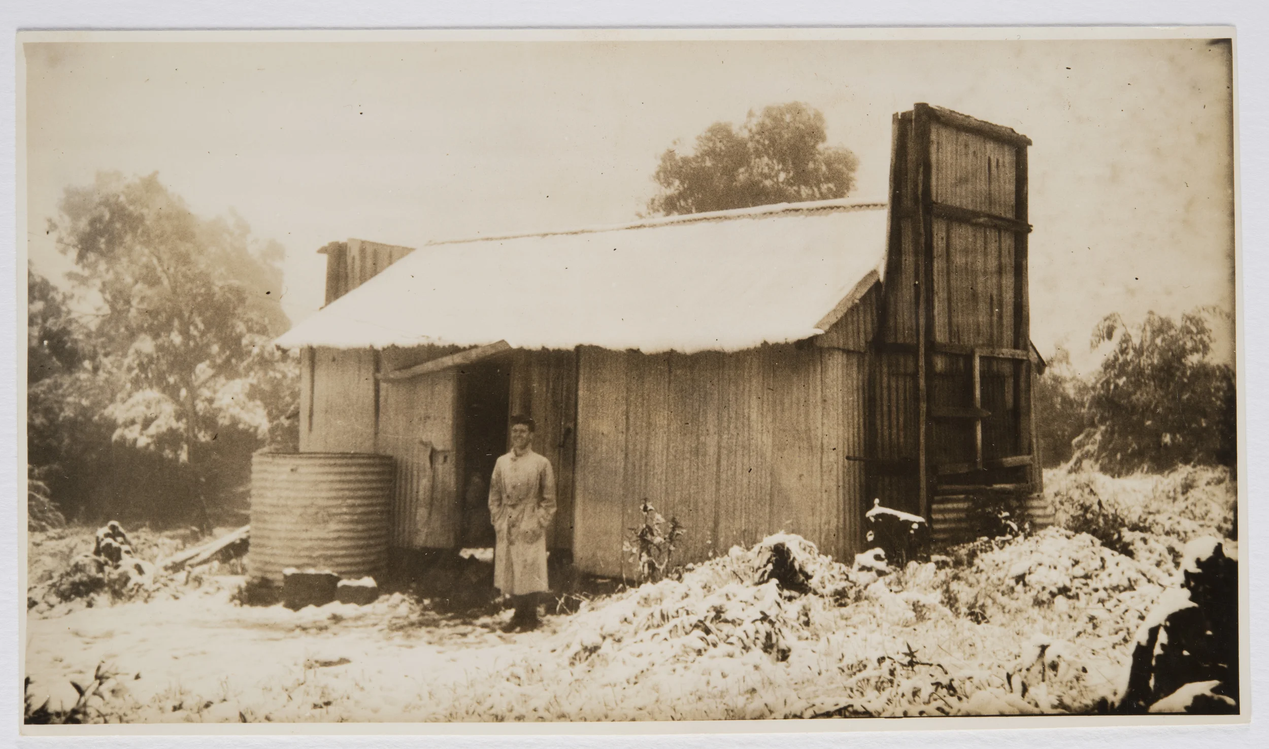
Old hut on summit of Donna Buang. Undated photo by Ella McFadyen. NSW State Library
Alternatively it could have been a hut that remained from timber harvesting operations. Edmund Robinson’s Enterprise Sawmill was located in the valley and connected to Mt Victoria by three steep cable-operated haulages. A substantial base was built at the top of a cable-hauled incline two kilometres south east of Mt Victoria and a steel-railed tramway ran for five kilometres north east to a terminus just north of the top of Donna Buang. Huts were built at at least four locations along the tramline on the ridge. Timber harvesting finished in the summit area in 1921, but it is possible that the hut may have been left behind when Robinson moved his operations to Cement Creek.
Whatever its provenance, the hut was utilised by early skiers. A May 1928 trip report by Eric Stewart stated... ‘as he [Bill Waters] felt fatigued, he persuaded me that my idea of ascending the mount and camping in the hut that night was not desirable... on the morning that followed... [after reaching the hut] we were not long getting a good fire going in the hut and thawing out...’.
In the 1930s when the mountain was a popular ski and snow play destination, the summit hut was widely used as a shelter hut for visitors. There is no record of what happened to the summit hut although Gordon Smith’s memoirs include a report of staying in it in July 1946, so it was not of the three huts on the mountain that were destroyed in the Black Friday wildfires of January 1939.
Other buildings of the 1930s
Skiers' shelter
In the 1932 - 1933 summer, a 'shelter shed' was built at the base of the Main Run by the Warburton Ski Club. No trace of this hut remains and no photos of it have yet been found. It is possible that mid 1970s bulldozing operations for tourism related ‘improvements’ in the area destroyed the site of the hut, although there are inferences that this was one of three huts on the mountain that were reported to have been burnt in the Black Friday fires of January 1939.
Ski hire hut
In May 1934 Eric Johnson Gravbrot applied to erect a building at the 10 Mile carpark and operate a ski hire from it. The application was refused as it was thought this might lead to people with no experience of skiing hiring skis and trying the sport without instruction. However it is almost certain that he was successful with a later application as sources from the late 1930s refer to Johnson running a ski hire on Donna, although no record of it has been found in preserved Forests Commission records and the location of the building is unclear. In the 1940s he went on to run a sled service for skiers up Bon Accord Spur to Mt. Hotham using horses shod in snowshoes. As his health declined, he transferred to Mt Buller in the late 1940s where he ran a similar service from Dump Inn up the relatively sheltered road to the early lodges at that resort.
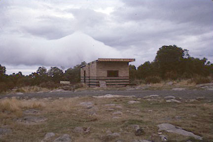
The abandoned Kiosk in the summit area of Donna Buang in 1963. Photo © William Prince collection.
Kiosks
There were a couple of places selling refreshments on the mountain in the 1930s. In 1934 the Kiosk at 10 Mile Turntable was run by F. Hardie, the other kiosk was in the summit area. The photo shows an abandoned kiosk just south of the summit that was standing in the early 1960s. In the 1970s, well after skiers ceased to visit Donna Buang, another kiosk operated down at the 10 Mile car park.
First aid posts
A 'new first aid post' was opened at the Ten Mile Turntable in 1968 and local St John Ambulance volunteers provided first aid at both the turntable and the summit in the snow season until at least 1993. It appears that this service was also provided during the the peak years of the mountain's popularity in the 1930s and that it probably operated from its own buildings.

Ski Club of Victoria. Yearbook 1934. p. 10.
Luscombe’s Hut
From 1934 to about 1954 a J. Luscombe rented a hut at 10 Mile and it appears he lived in it, at least during winter in the early years of his lease. The advertisement shows that in 1934 he was running a ski minding service and providing hot water to skiers, but there is no mention of him operating a cafe or other business, at least in the first year of his tenure and preserved Forests Commission records are frustratingly vague. So what Luscombe did with the hut is unknown at this stage.
More recent infrastructure
The decline of the mountain as a ski destination in the early 1950s did not substantially change the number of people who simply came to play in the snow. Even in its prime as a ski resort, sightseers probably always comprised the majority of visitors. However, facilities for snow play visitors were very basic and if the weather turned bad, their experiences could be rather bleak.

Toilet block below the road at 10 Mile. Date uncertain, possibly associated with the 1970s improvements or a cafe that operated in the 1960s. © D.S. 2019.
The rusting lookout tower was replaced in 1963 (see chapter 8), and the lack of facilities for visitors in the summit area was finally confronted in 1968 when it was announced that $200,000 would be spent in forthcoming years by the Tourist Development Authority to improve amenities on the mountain and create a destination with 'all-season appeal'. This would include the construction of a new sealed road to the summit, improved ski and toboggan runs, improved walking tracks, further enlarging the car park at the 10 Mile Turntable and providing parking spaces for 1,000 cars near the summit. New toilets costing $30,000 would be built at the Turntable and the summit plus $20,000 would be spent supplying water to the top of the mountain. (An unpublished map from this time shows a 'pipeline' heading in an almost straight line between 10 Mile and the new toilet block.) Finally, barbecue facilities and a ‘modern cafe’ would be built at the summit. To help pay for all this, the road above the Six Mile Turntable at Cement Creek would become a toll road in winter.

The modern doorless shelter near the summit. Photo © David Sisson.
From 1967 a kiosk in a four room brick building operated under the trading name of J. A. R. Fast Foods at 10 Mile Turntable until it was purchased by DCFL for $6000 in 1984. It was recommended to convert it into an information centre. However it appears the 'modern cafe' was never built at the summit, although on busy winter weekends in most years, there has been a caravan selling snacks.
Most of the rest of this ambitious programme was completed in the 1970s, new toilets and shelters were built at both 10 Mile and the summit. While the dark and doorless summit shelter is rather bleak and basic, it does have a barbecue under a verandah. To improve access from the summit area to the toboggan runs, stairs were built down the middle of the former Main Run.
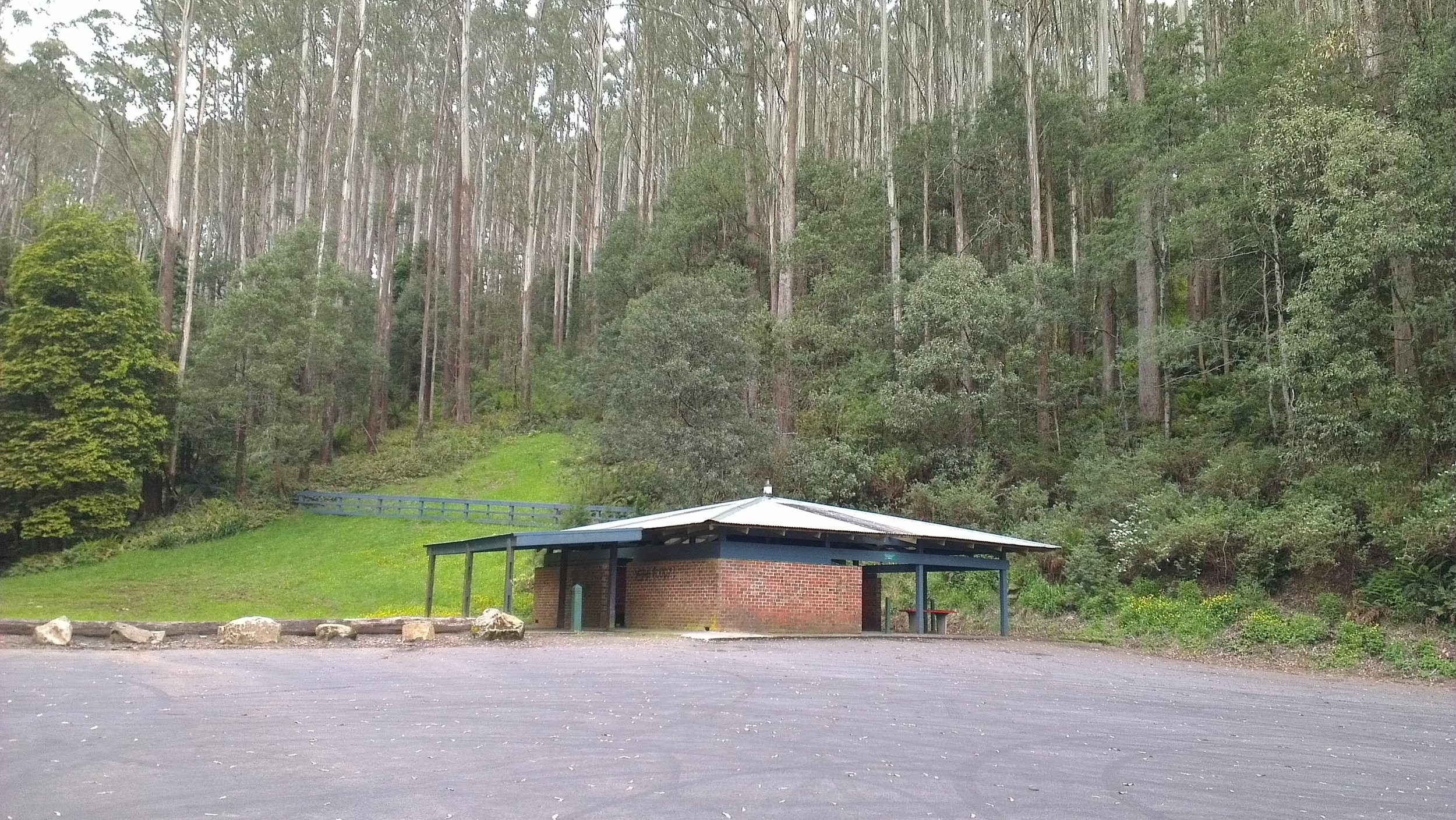
The former shelter at the 10 Mile Turntable on 2 December 2012. Photo © David Sisson.
The old road to the summit beyond the junction with the Ben Cairn road was narrow, unsealed and featured a number of sharp bends. This entire road was rerouted and rebuilt as a wide sealed road along an entirely new alignment in the mid 1970s, with the section near the summit going significantly higher than the old road had. While this made the summit area more accessible, the new road obliterated the big stone ski jump which was bulldozed out of the way. Three large car parks were also constructed on the new road, although in recent years the lower one has been fenced off.
While these new amenities improved the visitor experience in the 1970s, little has been been built on the mountain since, apart from a discreetly hidden automatic weather station. So an enjoyable winter visit is still reliant on fine weather.

The run down shelter hut at the 10 Mile Turntable in June 2015, 11 months before it was demolished. Photo Lilydale & Yarra Valley Leader.
Records of the mountain in the 1980s are full of references to systematic vandalism of this new infrastructure. It appears that local hoons were the main suspects although there were some suspicions that environmentalists wishing to remove the 'taint' of civilisation from the mountain may have also been responsible. As recently as 2016 many of the glass bricks on the upper walls of the summit shelter were smashed out and there were no plans to install new ones.
The shelter hut at the 10 Mile Turntable was demolished on 16 May 2016. A Parks Victoria ranger told the author that the reason for removing it was that the timber posts supporting the roof were rotten and leaning out from the base, rendering it unsafe. The hut had also received an awful lot of abuse from people who used the large car park for drifting and Parks Victoria did not have the budget to maintain or replace it.
The winter toll was abolished circa 2008 and access has been free since then, although the toll booth has not been removed and it is still beside the Donna Buang Road a few hundred metres from the junction with the Acheron Way at 6 Mile.
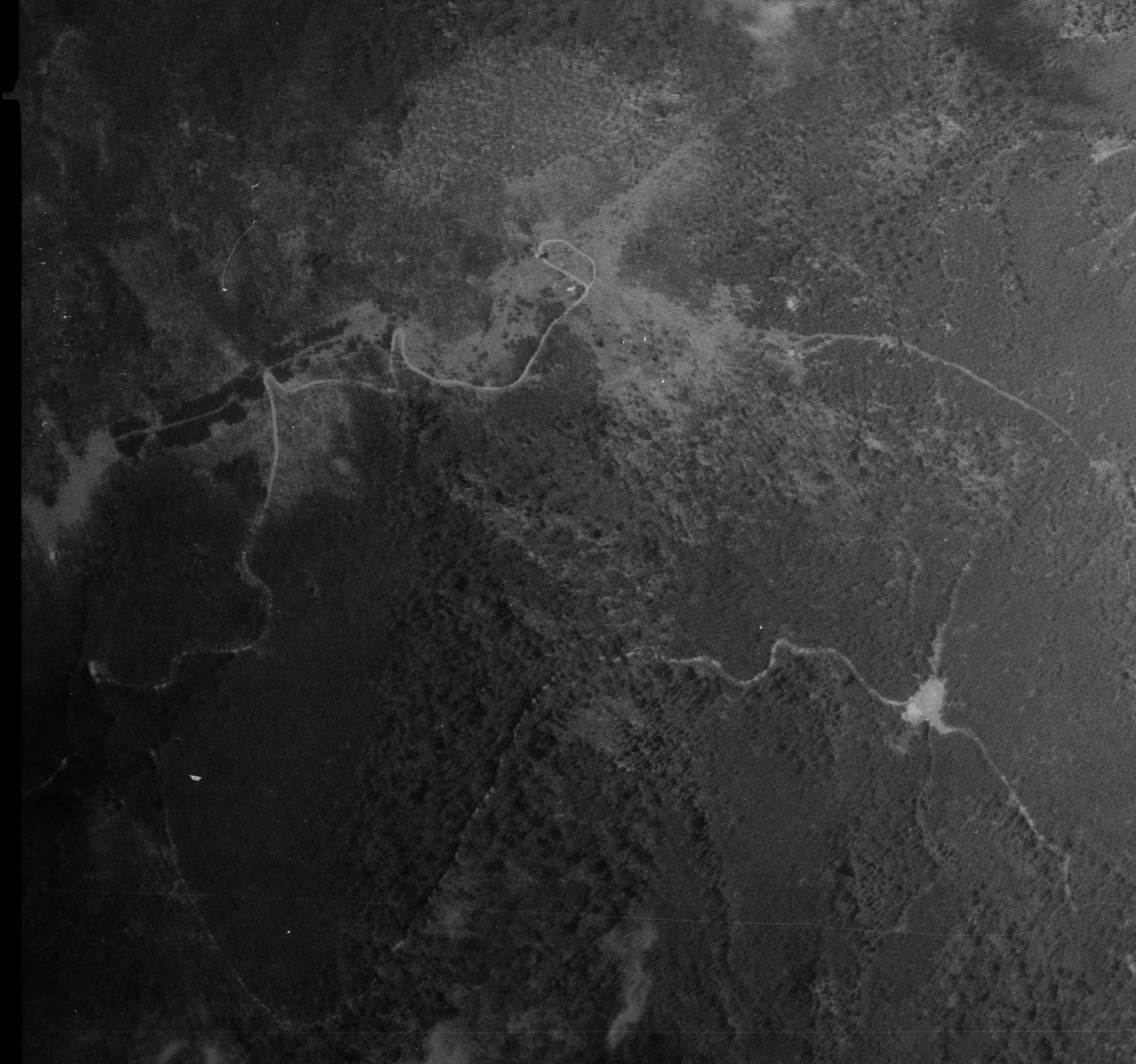
Aerial photo of Donna Buang in 1944. Five years of regrowth after the 1939 wildfires and a lack of maintenance during the war have obscured boundaries of the ski runs, but the summit area, the old summit road with it's sharp bends, the neighbouring USC and SCV cabins and the 10 Mile Turntable at the bottom right are all easily identified.
6. Fire, war and the decline of skiing on Donna Buang
By the 1938 ski season, a dozen years of hard work had developed the mountain into a first rate ski destination. It had a good road, walking tracks, two day shelters, four ski lodges providing accommodation, first aid posts, a lookout tower, a ski hire, a couple of kiosks, a ski jump and six ski runs of varying length and difficulty. The only drawbacks were the crowds, erratic snow and relatively short ski runs. But everything was changed by two events in 1939: the Black Friday fires in January and the outbreak of the Second World War seven months later.
There had always been the problem of altitude or rather, the lack of it. Donna often had over a metre of snow, but with a maximum elevation of just 1,250 metres, the snow cover wasn't reliable. Its location further south than the higher mountains helped a little, however its modest height also meant the mountain was more prone to rain that fell as snow at higher elevations, but washed away snow on the ground at 1,200 metres. Even in winter, periods of warm weather could raise the temperature well above melting point. So while snow cover could be deep (and in some years it lasted for four months), it was never reliable.
However, before the war, Melbourne skiers were willing to put up with crowds of non skiers, relatively short runs and erratic snow as there was really nowhere else they could easily go for a day or weekend ski trip.
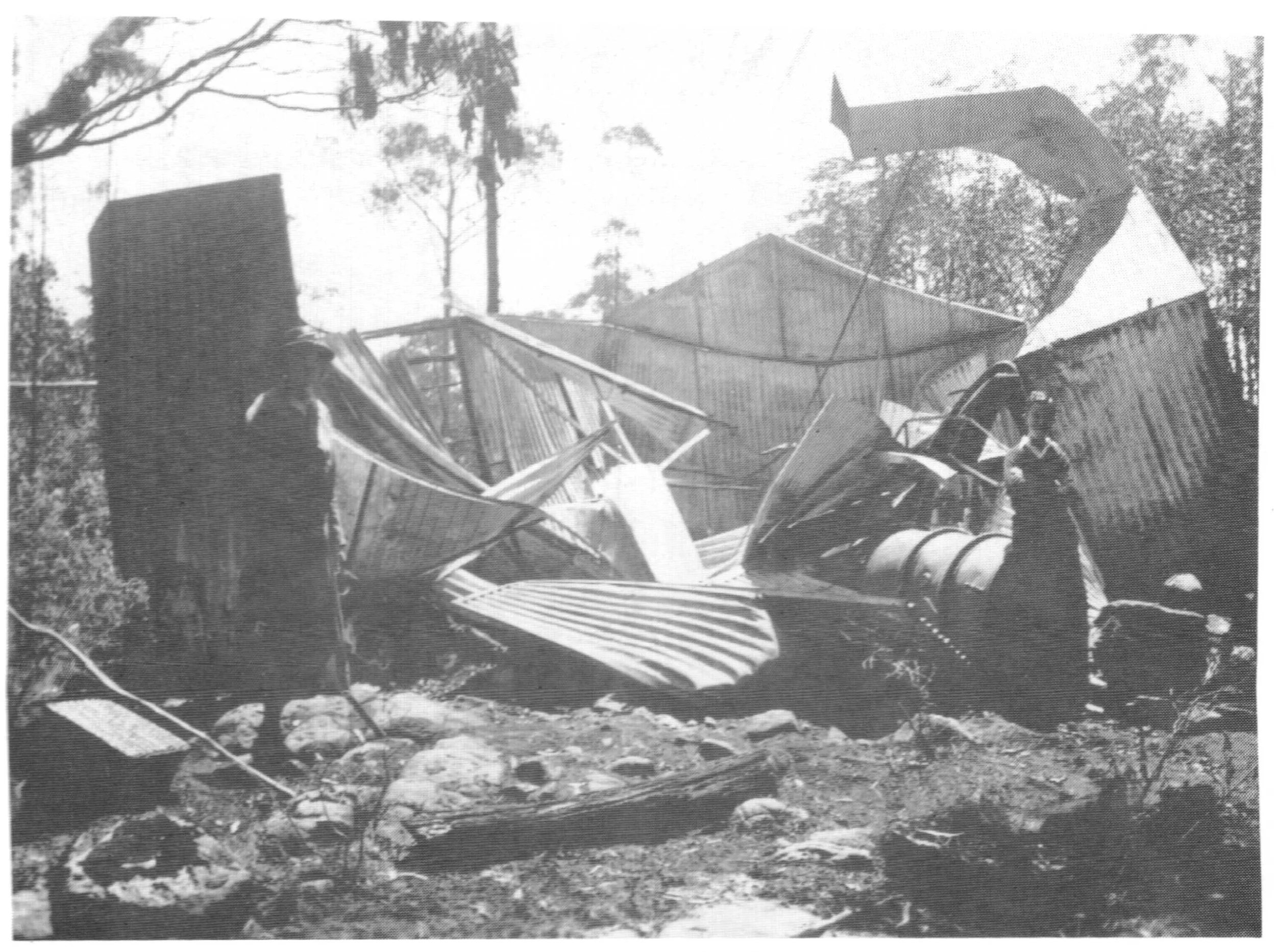
The Melbourne Walking Club hut after the 1939 fires. It was rebuilt in 1940 - 1941.
Fire and war
The 'Black Friday' wildfires of January 1939 were the worst ever experienced in Victoria. They burnt most of the High Country between the Dandenong Ranges on the edge of Melbourne and the NSW border as well as the Otway Ranges and large sections of the Western District and Gippsland. They destroyed most of the commercial ski lodges in Victoria and a number of buildings on Donna. While the club cabin that burned was rebuilt, the fires probably took other infrastructure on the mountain such as the shelter hut at the base of the Main Run, as well as the ski hire building. The wooden ski jump appears to have survived.
Over 20,000 square km of forest were burnt in the Black Friday fires of January 1939
The six ski seasons after the fires to the end of the Second World War from 1939 to 1945 were mostly fairly good years for snow, but visitor numbers were greatly reduced. Many skiers were away on active service with the armed forces, while petrol rationing and restrictions on train travel, including a ban on civilian country rail travel on Sundays after Japan entered the war in 1941, made it difficult for those who remained to get to the mountain.
While visitor numbers were much lower than they were in the 1930s, wartime transport restrictions did have an upside for skiers; “There was almost an entire absence of the crowd of sightseers which, in similar conditions in past years, has ruined the snow from the skiers' point of view.” In 1943 “Donna Buang had its longest season on record, ski-ing being possible for seventeen consecutive week-ends from June 1 until the end of September. The previous best year was 1929...” . While 1944, was a fairly poor season at the higher resorts to the north, Mt Donna Buang (and Mt Baw Baw to the east) had skiable snow for three months.
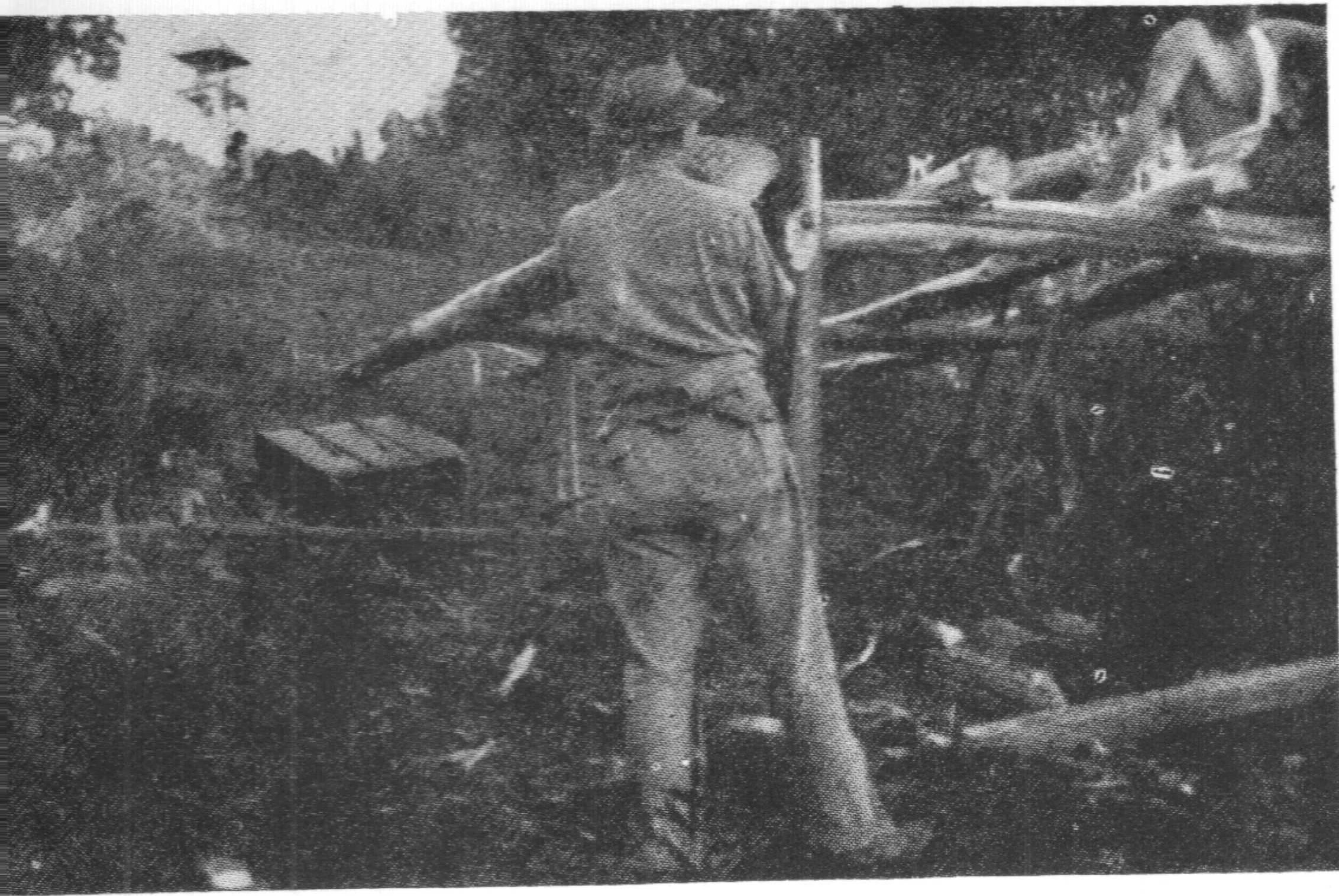
Building the take off platform for the new jump circa 1951. Lookout tower in the background
After the war
The Second World War ended in September 1945 and when the troops had returned home, the winter of 1946 saw the heaviest snowfalls ever, all across Australia, a record that still stands today. The snow arrived a little later on Donna Buang than in other ski areas, but when it did arrive the cover was excellent. 1947 was another late but heavy season on the mountain. In these years visitor numbers to Donna Buang surged and it looked like the mountain might regain its pre-war popularity with skiers.
However after the war, the whole country was fairly run down as buildings and infrastructure such as roads, railways, factories and electricity generation had been pushed to their limit during the six year long war with minimal maintenance. So the late 1940s was a time of repair and reconstruction across the country. Petrol shortages remained and despite surging demand, electricity continued to be rationed as power stations were taken off line for long overdue maintenance, while new power stations took years to build. It also took time and scarce resources to convert factories that had made bombers and guns to make consumer goods like cars and washing machines. This post war reconstruction led to shortages of materials and labour, pushing up prices and inflating wages despite booming immigration. The migration in turn caused further shortages of housing and building materials. So rationing, shortages and high inflation continued through to the 1950s with inflation peaking at 24% in late 1951.
But the prospect of prosperity was on the horizon. Working hours were also slowly declining. By 1948 most people worked a 40 hour week and, with Saturday mornings off, a Friday evening departure for more distant destinations became practical. Restrictions on petrol use were gradually eased after the war ended, but it was not until 1951 that petrol rationing was finally abolished. It is a neat coincidence that 1951 was also probably the last year when Donna Buang attracted just enough skiers to be called a ski resort.
Roads were improving and cars were becoming more comfortable and more reliable. Increasingly, people could travel longer distances faster and more comfortably. Thus a number of ski lodges were built in the area around Mt Hotham in the mid to late 1940s, often using second hand material and supplies that were obtained under the false pretense that they would be used for housing to get around rationing of building supplies. One lodge built at Hotham in the 1940s was denied permission to buy corrugated iron and cement, so it was roofed with re-rolled chemical drums and some of the cement appears to have been bought on the black market, while a lodge at Falls Creek was built with hand sawn timber and corrugated iron from an old tobacco kiln. Even before the 1949 subdivision at Mt Buller, a small village of caravans and unauthorised shanties was hidden in the scrub, some obscured behind war surplus camouflage nets. Elsewhere, the first lodges had been built at what would become Mt Baw Baw ski resort.
The cumulative effect of higher incomes, a shorter working week, reduced petrol rationing and improved transport was that most Donna Buang skiers could look elsewhere, often for the first time. The resorts further from Melbourne did not suffer from the sightseers and 'snowballers' who spilled onto the ski runs at Donna and more importantly, they had a longer and more reliable ski season. Essentially Donna's main disadvantages, unreliable snow, crowds and, to a lesser extent, short ski runs had begun to outweigh its main advantage, ease of access from Melbourne.
The USC's Donna Buang Cabin was moved to a scenic location on Mt Buller. Photo in 1953.
The experience of the University Ski Club sums up the changes to skiing after the war. Their cabin on Donna had high occupancy rates in 1946 and 1947 and then demand for accommodation went into steep decline, despite a reduction in charges. At the same time the club was building a lodge on Hotham which was ready for the 1949 season. When the authorities confronted the problem of the illegal squatter village at Mt Buller and opened up lots for development, it was not a difficult decision for the club to move their under used cabin on Donna Buang to the new subdivision at Buller.
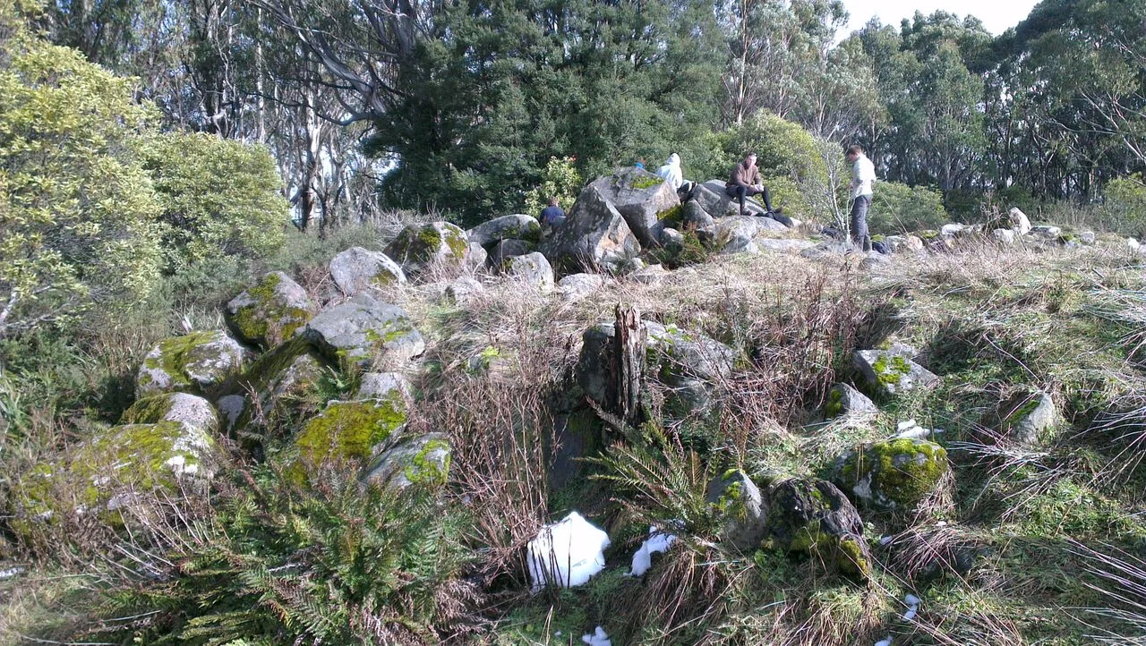
Large stone rubble south of the summit shelter hut. This is probably the remnants of the ski jump take off ramp that was rebuilt in 1951, but it's difficult to be sure. © David Sisson.
In the early 1950s skiing continued to decline at Donna Buang but the Ski Club of Victoria persisted longer than other clubs and even ran club races and jumping exhibitions as late as 1951. But as the appeal of other resorts increased, skiers gradually abandoned the mountain to sightseers. In 1950 the State Development Committee published the landmark Report on the future of the ski industry and potential ski resorts. Donna Buang was dismissed in three short paragraphs and is summarised in the sentences: 'On account of the comparatively low altitude of the Mount as compared with other snowfields, the depth of snow is not very great and the snowfalls are intermittent. This snowfield is mostly visited by novices and sightseers'.
It is difficult to define precisely when Donna ceased to be a ski destination, over a few years it rapidly lost its appeal until skiers stopped coming. But the mountain had played a vital part in the development of skiing in Victoria. It popularised the sport, it established the idea of a resort community of club lodges and many of the people responsible for the post war ski boom learned to ski there.
Although the stone ski jump was bulldozed during road ‘improvements’ in the mid 1970s, four cut ski runs are still discernible through the myrtle beech and woollybutt and the ruins of a few buildings lie deep in the forest. To the casual visitor today, there is little to show that Mt Donna Buang was once a popular ski resort with its own little community. Perhaps the ultimate snub to the mountain’s past is that skiing was banned until recently on the basis that it was a potential danger to tobogganists and children playing in the snow. However that didn't completely stop a few people recreating the experience of earlier generations by indulging in the occasional surreptitious ski trip. © David Sisson 2015, major revisions 2018, 2020.
Appendices
A mountain ash contemplating another kamikaze attack on a road sign at Ben Cairn. © D.S
7. Gazetteer
A directory of Donna Buang names and locations
Acheron Way. C 507. The 36 km road that heads north from Warburton and ends at Narbethong. The southern section is part of the road to Donna Buang was built in 1911 as part of the bridle track to the mountain. The northern section between the Six Mile Turntable at Cement Creek and Narbethong was opened in January 1929.
Ben Cairn. A 1,040 metre high rocky top at the western end of the ridge, five kilometres from Mt Donna Buang. This ridge overshadows the Yarra Valley to the south. A century ago funicular and winch powered tramways lowered timber down this steep ridge to railway sidings in the valley. The unsealed road from Healesville to Donna Buang (C 505) was built as a bridle track in 1922 and upgraded to a road in 1926. It passes close to the top of Ben Cairn and the short walk to the summit is quite worthwhile. During Donna’s time as a ski resort, the road was closed in winter (it still is). So when there was good snow cover it made a good ski touring route.
Cement Creek. The watercourse that rises at Boobyalla Saddle between Mt Donna Buang and Mt Boobyalla. It descends steeply to cross the Acheron Way at the Rainforest Gallery (opened in the summer of 2004 - 2005). One of the prettiest creeks in the area, it was named for the suitability of gravel in its bed for making cement. The Six Mile Turntable is located close to where Cement Creek crosses the Donna Buang Road.

The Donna Buang summit - Ben Cairn road junction in the 1926.
Downstream, part of the creek’s flow was diverted into an aqueduct which flowed into a small dam above a hydro electric power plant that supplied Adventist owned businesses in Warburton such as Signs publishing and Sanitarium foods. When there was a shortage of generation from hydro generators owned by the Upper Yarra Electric Supply Company, the Cement Creek plant was used to augment the town supply. The fall of over 300 metres caused enormous pressure in the penstock with occasional burst wood stave pipes providing spectacular displays.
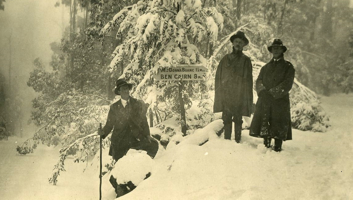
The same location in winter. Photo Melbourne Walking Club, used with their permission
One of the most scenic walking tracks in the area climbs up the valley of Cement Creek from the Donna Buang Road up to Boobyalla Saddle and Mt Donna Buang, it was used as an alternate access to the mountain when the road was closed by snow at the Six Mile Turntable. While the track was closed by Parks Victoria in 2009 for no apparent reason, it can still be followed. It is mostly in good condition although close attention should be paid to staying on the correct route on the very lowest and highest sections which have become slightly overgrown.
Donna Buang Road. C 505. First built as a bridle track in 1911, it was upgraded to a road in the early 1920s. Logging was not permitted within a 101 metre buffer zone near the road to preserve its scenic nature, although it was crossed by timber tramways and haulages in three places. It has been progressively upgraded over the years, most notably in the early 1930s to cope with the heavy usage it was subjected to. The final kilometre of the road to the summit was narrow and winding with sharp bends, so that section was completely rerouted in the mid 1970s, destroying the remains of earlier infrastructure on the mountain, notably the stone ski jump. The route of the old summit road crosses the new road several times and using the composite map between chapters 2 and 3 of this article, it can be followed without too much trouble. A full history of the road is in Chapter 4.
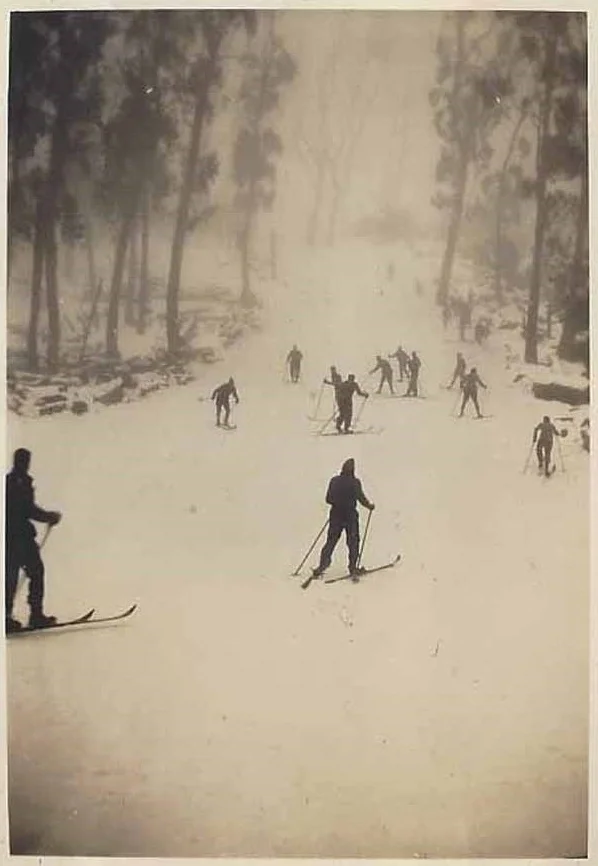
The Main Run circa 1931 or earlier. From the authors collection, photographer unknown.
Main Run. Originally known as the Ski Slide. It was the first of six ski runs on the mountain. Initially cut in the summer of 1924 - 1925, over the years it was widened and lengthened, with summer grooming removing rocks and tree stumps. Today it has a staircase built right down the middle of the upper section, which thwarts attempts to ski it. It can be seen behind the modern toilet block near the summit tending generally eastwards.
Mount Donna Buang. Despite occasional visits by aborigines, prospectors and early settlers, the mountain was rarely visited before the 20th century as it was steep, wet, cold and lacking in mineral or grazing potential. The arrival of the railway at Warburton in 1901 changed this as there was a strong demand for the ash timber that grew on Donna Buang's slopes and which could now be affordably transported to markets in Melbourne, which was growing strongly again after the 1890s depression. The first huts on the mountain were built for timber workers in the early twentieth century. By the mid 1920s most of the desirable timber had been harvested and activity on the mountain transitioned to skiing and tourism, with as many as 12,000 people visiting on the busiest days. By the early 1950s skiers had largely moved elsewhere, leaving the mountain to hikers and family snow visitors.
During the 1930s the Forests Commission created a management committee. More formally, the 380 hectare Mt Donna Buang Alpine Reserve was gazetted in the 1970s and it was incorporated into Yarra Ranges National Park which was created in 1995.
Mount Donna Buang name. The mountain was originally named Mt Acland in 1865 by Joseph Panton, a local goldfields warden and magistrate. Colonel Acland Anderson was Pantons cousin and nearby Mt Juliet had been named after Acland Anderson's sister in 1853, so Panton appears to have been continuing the family theme. However a few years later Panton announced that he preferred Mt Donna Buang and that name began to be used instead of Mt Acland. In the early 20th century there was a proposal to rename the mountain again to Mt Edgar after the Minister of Public Works at the time building a road was first proposed, although nothing came of this.
In 1911, when he was 80 years old, Joseph Panton appears to have revised his story and claimed that he later heard from the 'chief and head of the aboriginal tribe of the Yering valley that the mountain was known as Donna Buang' and that caused him to encourage the use of the name. This conflicted with stories from the 19th century and possibly with what Panton himself had said earlier. It was claimed by various sources that Donna Buang meant 'raven hill', 'body shaped mountain' or just 'mountain' in the local language. Also in 1911 the naturalist Reginald Kelly noted there was no 'D' sound in the local language and stated that Thuonna-be-wong (meaning 'the place of mist') was the most likely aboriginal name for the Ben Cairn - Donna Buang Ridge. A few letters appeared in newspapers and magazines debating the issue, including if Donna Buang really was it's Wurundjeri aboriginal name.
The renaming occurred in the late 19th century when there was a vogue for indigenous sounding names in Victoria with a surprising number of towns and features being renamed, especially in the 1880s. At around this time, the hamlet of Narbeth or Narberth, just to the north of Donna Buang, (named in 1861 after the Welsh home town of the first publican), had the suffix 'ong' added to its name to make it sound more aboriginal. The rather unlikely sounding explanation for the slightly altered new name of Narbethong was that it was an aboriginal word meaning 'cheerful place'.
While it is impossible to be sure, it is probable that Donna Buang is also a contrived name. In Malay and related languages, the word 'buang' means to remove, disregard or throw away, so a Malay or Javanese phrase may have been co-opted to provide an exotic sounding name that might pass as aboriginal. In the late 1800s Victoria was one of the richest places in the world and was regarded as a land of opportunity, so it attracted former civil servants and soldiers with colonial experience and a knowledge of the Malay language. It is possible that one of these people may have influenced the renaming. Alternately, in the distantly related Tagalog language of The Philippines, ‘donna buang’ means something like ‘mad woman’. But realistically, no one can ever be confident of where the name Donna Buang came from. All mention of Mt Acland had disappeared by the late 19th century and whatever its origin, the mountain has been known as Donna Buang for nearly one and a half centuries.
Broadcasting towers on Mt Victoria. © D.S. 2019.
Mount Donna Buang 'Spring'. This is an interesting myth, but there is no spring, it is just an old drain pipe. Visitors to the Ten Mile Turntable outside the snow season will often see people filling large containers from a pipe on the western side of the car park. Some online maps have the location marked as ‘Donna Buang Spring’ and web searches of the term reveal claims that it provides mineral water.
Sadly, none of this is true. There is no spring, the water has no taste, negligible mineral content and the pipe and ditch are simply one of the heads of Ythan Creek that was diverted underground when the car park was enlarged in the summer of 1932 - 1933. The location is actually only a few metres downhill from the septic tank of a demolished and long forgotten toilet block. So people looking for fresh, nearly pure water would be better off sourcing it lower down the mountain where Cement Creek crosses the Donna Buang Road near the Six Mile Turntable. Of course the legend of the Donna Buang Spring is well entrenched, so people will continue to visit the Ten Mile car park and fill bottles with “spring water“ to take back to the city in spite of the less romantic reality.
Mount Victoria is a 1,162 metre high bump on the ridge south east of Donna Buang that overlooks Warburton. While it is barely discernible from the summit of Donna, it appears to be a major prominence from Warburton and the upper Yarra Valley. Until 1922 Robinson’s tramway carried logs from as far as Mt Donna Buang along the ridge connecting the two mountains to a location on the south eastern slopes of Mt Victoria called The Pimple. From there they travelled down three steep haulages to Robinson’s No. 1 Mill east of Warburton.
In 1983 a tower was built on the slopes of Mt Victoria, it broadcasts television signals from all five free to air networks to the upper Yarra area. Another tower carries mobile phone antennas. However there may have been an earlier tower as a walking club history refers to a tower on Mt Victoria in 1958.

Rainforest Gallery walkway.
MWC Hut. Built in 1930, the Melbourne Walking Club hut was the first of four buildings built by ski and outdoor clubs on the mountain. It was formally named the Walter E. Briggs Hut after the club president at the time it was built. It was destroyed in the 1939 wildfires and rebuilt in 1940 - 1941. The MWC and their hut are discussed in more detail in Chapter 5.
Rainforest Gallery walk. Located at the old Six Mile Turntable, at the junction of the Acheron Way and the Donna Buang Road, the Skywalk is a 40 metre long elevated platform that allows close views of the forest canopy, while the Rainforest Gallery is accessed down a staircase. It is a 350 metre long metal walkway that traverses the cool temperate rainforest below the platform. This walkway was built in the summer of 2004 - 2005 to replace an earlier walking track and is a real highlight of any visit to the area.
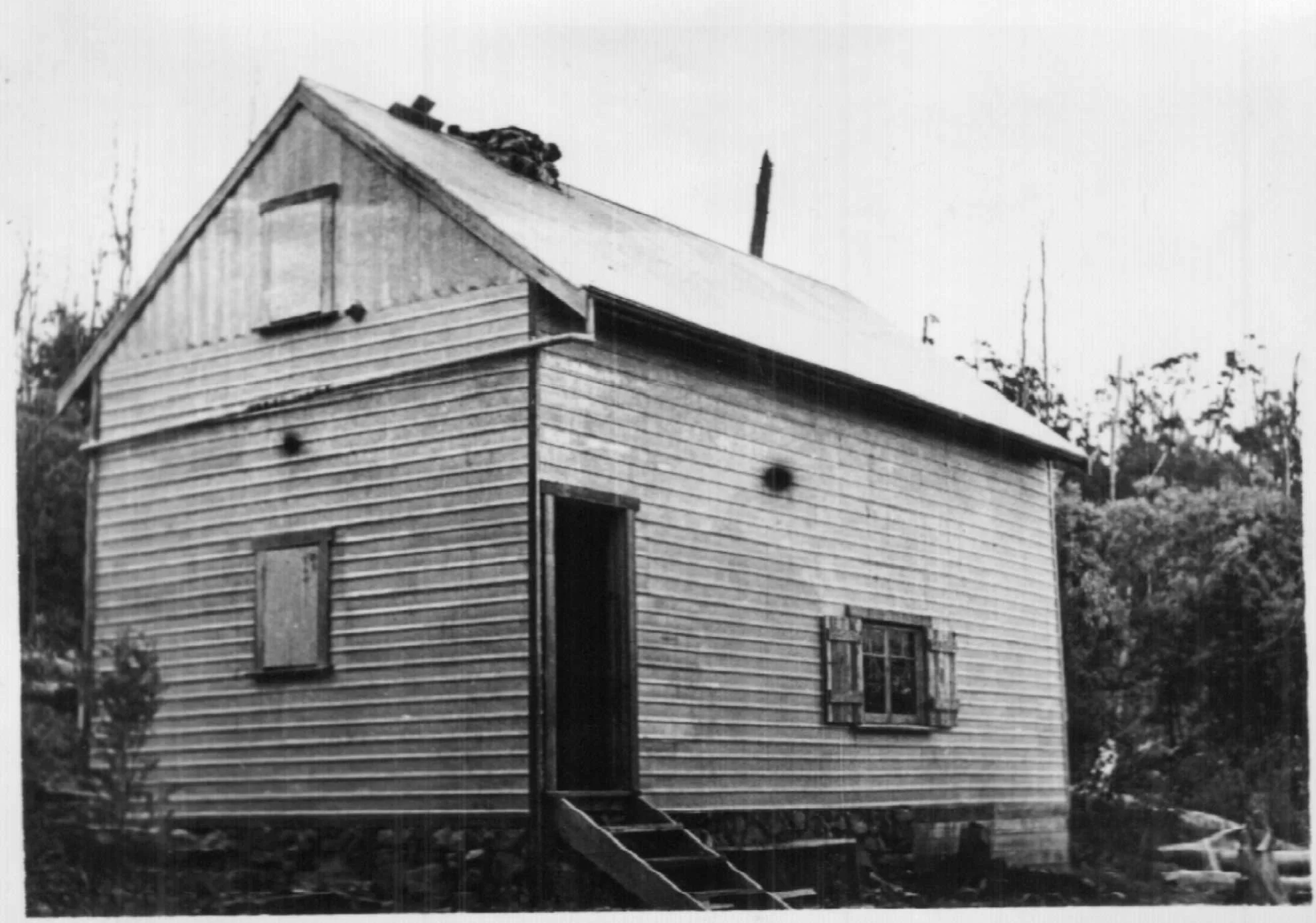
The SCV Cabin on Donna Buang. Photo by Kath Magill.
SCV Cabin. The Ski Club of Victoria's building was built in 1934 as the third club lodge on the mountain. In addition to the main living room it had a kitchen and an attic sleeping area. The hut was used until at least the early 1950s. Its ruin is visible north of the base of the Main Run on the modern walking track from the summit to the Ten Mile Turntable. The chimney of its neighbour, the USC Cabin, is in the scrub 150 metres to the north at the same altitude. The SCV and their hut are discussed in more detail in Chapter 5.
Scout Hut. A hut in the headwaters of Cement Creek near a walking track that ran along a former cable hauled tramline from the road junction at the Six Mile Turntable to Boobyalla Saddle. Very little information on it is available, but the hut was almost certainly an abandoned logging hut adopted by Rover Scouts who were active skiers on Donna Buang in the 1930s. The Rovers and their involvement on the mountain are discussed in more detail in Chapter 5.
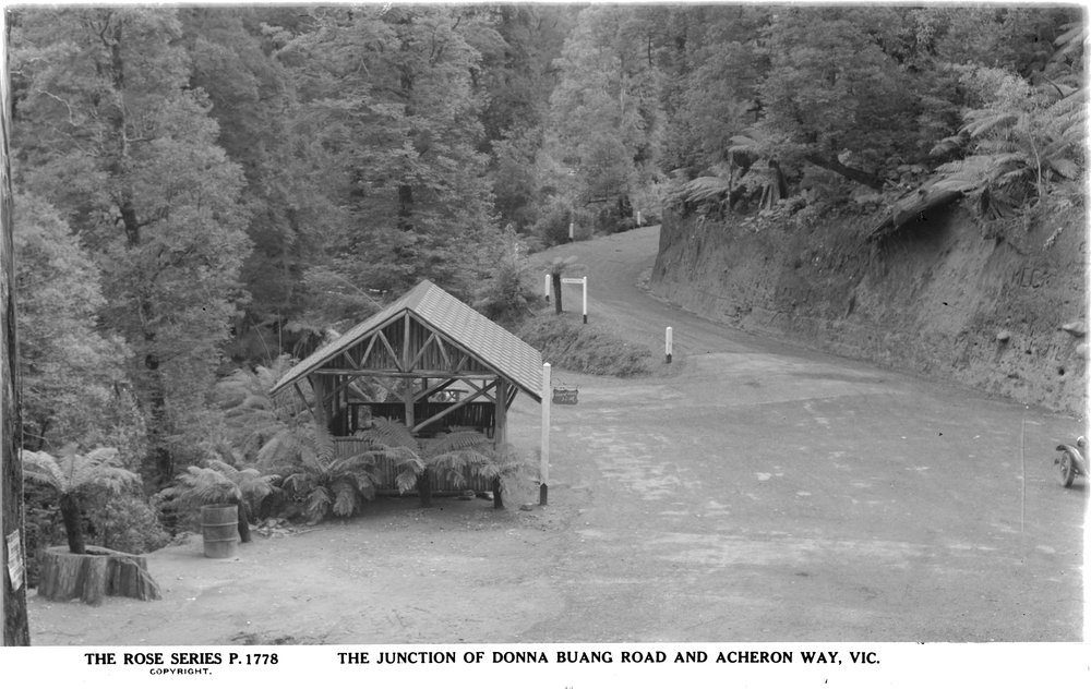
Six Mile Turntable. The old name for the road junction near where the road crosses Cement Creek at the junction of the Acheron Way and Donna Buang Road. Before snow clearing was intoduced, the road was often closed by snow beyond this location and people had to walk along the road to the main car park at the Ten Mile Turntable or hike up the steep track paralleling the upper part of Cement Creek.
A short walking track once traversed a section of forest here, but it was replaced by the Rainforest Gallery walkway in 2005 and the old track is now overgrown.
The Summit. Perhaps calling it a ‘summit’ is a bit of a misnomer, but it is the high point of a steep mountain, albeit one mostly below the treeline and only 1,250 metres above sea level. The summit is one area of the mountain where basic amenities have been maintained. In the 1970s an earlier shelter hut was replaced with a large but bleak structure without doors. The toilet block was built around the same time and the current summit lookout tower was built in 1963.
Summit observation tower. From 1918 three observation towers have been built on the summit of Mt Donna Buang, the current one dates from 1963. All three towers are covered in detail in Chapter 8.
Ten Mile Turntable. The main car park and picnic ground on the mountain. It is three kilometres from the summit by road or 1 km to the south east as the raven flies. Known as 'The Winch' in the mid 1920s before the area was developed, this was as far as cars could drive in winter before the summit road was rebuilt in the 1970s. It is located where Parbury’s cable hauled timber tramway crossed the road until 1928. In the 1960s and 1970s it featured a kiosk, since demolished and there was probably a kiosk there in the 1930s as well.. Today the Ten Mile Turntable is the start of a walking track to the summit, which can be found behind some posts, a few metres down the road from the car park.
USC Cabin. The second ski lodge on the mountain. Built in 1934 by the University Ski Club, it was removed to Mt Buller in 1950, although the chimney still stands with a memorial plaque unveiled in 1979 to commemorate the 50th anniversary of the club. It is in the scrub, 150 metres north of the ruin of SCV Cabin near the walking track from 10 Mile to the summit. The USC and their cabin are discussed in more detail in Chapter 5.
Ythan Creek. The creek (occasionally called a river) rises in the saddle between Mt Donna Buang and Mt Victoria and flows southwards to the Ten Mile Turntable on the Donna Buang Road. When the car park was enlarged in the summer of 1932 - 33, the main head of the creek was diverted into pipes under the car park. Further downstream the creek was diverted into a penstock and powered a hydro-electric power station owned by the Upper Yarra Electric Supply Company. The government owned State Electricity Commission bought the company in 1944 and closed the local hydro stations in 1948 when they connected Warburton to the state grid. Ythan Creek flows into the Yarra River just below the eastern side of the Warburton golf course.
Walking tracks. In over a century of tourism on Donna Buang a number of walking tracks have been constructed on the mountain. Here is a brief outline of them. Chapter 10 has notes for modern walking tracks.
Past and present walking tracks on Donna Buang. Click image to enlarge.
Cement Creek track. (Shown in red on map.) The track starts near the 6 Mile Turntable and climbs steeply to Boobyalla Saddle between Mt Boobyalla and Donna Buang on a ridge to the north east of the summit. The walking track mostly followed the route of a cable hauled timber tramway that was abandoned in the mid 1920s after logs suitable for sawmilling were cut out. While steep, it was the quickest route to the summit area if the road above 6 Mile was closed by snow. A former timber company hut used by Rover Scouts on ski trips was located near the top of this walking track. The track continued to be popular long after Donna Buang ceased to be a ski destination and the Federation of Victorian Walking Clubs began maintenance work parties in May 1953. Despite continued popularity, Parks Victoria closed the track in 2009 without giving a reason, although a shortage of funds to maintain it was the most likely cause for the decision. Most of the route remains in good condition, but the upper and lower sections have become slightly overgrown and those parts can now be difficult to follow.
The junction of Road Two and the northern route to the summit. (Light blue and purple tracks on the map.) © David Sisson.
The track north of the summit. (Purple.) Originally built as a firebreak, it was widened and groomed to become a ski run in 1936. At its base a short walking track through beech forest connects it with Road Two. This track is still in good condition.
Road Two (Light blue.) is the imaginatively named Melbourne Water road that skirts to the north west of the summit. It can be combined with the walking track heading north east from the summit (shown in purple) to make a short circuit walk. After snowfalls it is an excellent cross country ski route although, as it is on the sunnier north west side of the mountain, snow melts faster than it does elsewhere. Construction work on the road began far to the north at Mt Riddell in 1961 and the junction with the Donna Buang Road was probably reached in 1962 or 1963. Road Two was built to provide access to water catchments that are not open to the public and it is closed to public vehicles for its whole length and to pedestrians beyond the junction with the walking track to Mt Boobyalla.
Martyr Road track. (Grey.) This track starts in Warburton at the top of Martyr Road and heads straight up the mountain to intersect with the main Donna Buang road 1 km south of the large car park at the 10 Mile Turntable. It was probably built during the 1890s depression and it was restored and partially re-cut in early 1945. Today it attracts people training for more strenuous hikes as it is the second steepest track in the area after the formidable Mt Juliet track. During Donna's time as a ski resort, it was the most common access route for those who chose to walk from the railway station rather than hire a service car or drive up the mountain.
10 Mile Turntable to Summit. (Orange.) The original route from the 10 Mile Turntable to the summit and the main walking track on the mountain today. The bottom 400 metres from 10 Mile to the ridge top was originally a snig track for Parbury's Mill where logs were dragged by a steam driven winch to where they were loaded onto to tramway bogies and lowered down the mountain. At the top of the ridge the walking track turns west and follows a route that was originally a fire break to the summit.
10 Mile Turntable to Main Run. (Yellow.) Built in the early 1930s by the Warburton Ski Club as a short cut from the main car park to the ski runs. The track is now overgrown, but benching into the hillside makes the route identifiable and it can be followed up from the western side of the car park without too much difficulty, although scrub and fallen logs make it a slow walk. The area where the old track meets the Main Run has been heavily bulldozed (probably in the 1970s), making the track very difficult to find at the top, so if you wish to retrace it, heading uphill from 10 Mile is the better option.
Base of Main Run to SCV and USC cabins. (Brown.) Built in January 1945 by members of the Ski Club of Victoria to provide a short cut from their lodge to just above the base of the major ski runs. Today the route is slightly overgrown and difficult to find at either end, but once you are on it, the benching into the hillside enables it to be followed without too much trouble.
Mt Victoria. (Green.) The route from the sealed Donna Buang Road up to Mt Victoria initially follows a gravel road that provides access to a television broadcasting tower on the side of the mountain. The tower was built in 1983, although it appears the the road is older and a walking club history refers to a tower on Mt Victoria in 1958. From the tower the track follows what seems to have originally been a footpad created by walkers over the rather flat summit of Mt Victoria to join the route of a former timber tramway which it follows to a saddle on the ridge where it joins the track from 10 Mile to the summit.
The Old Summit Road (Black.) was built in 1911 and abandoned when the new road was built in the mid 1970s. It is not overgrown and can be followed using the composite map between chapters 2 and 3.
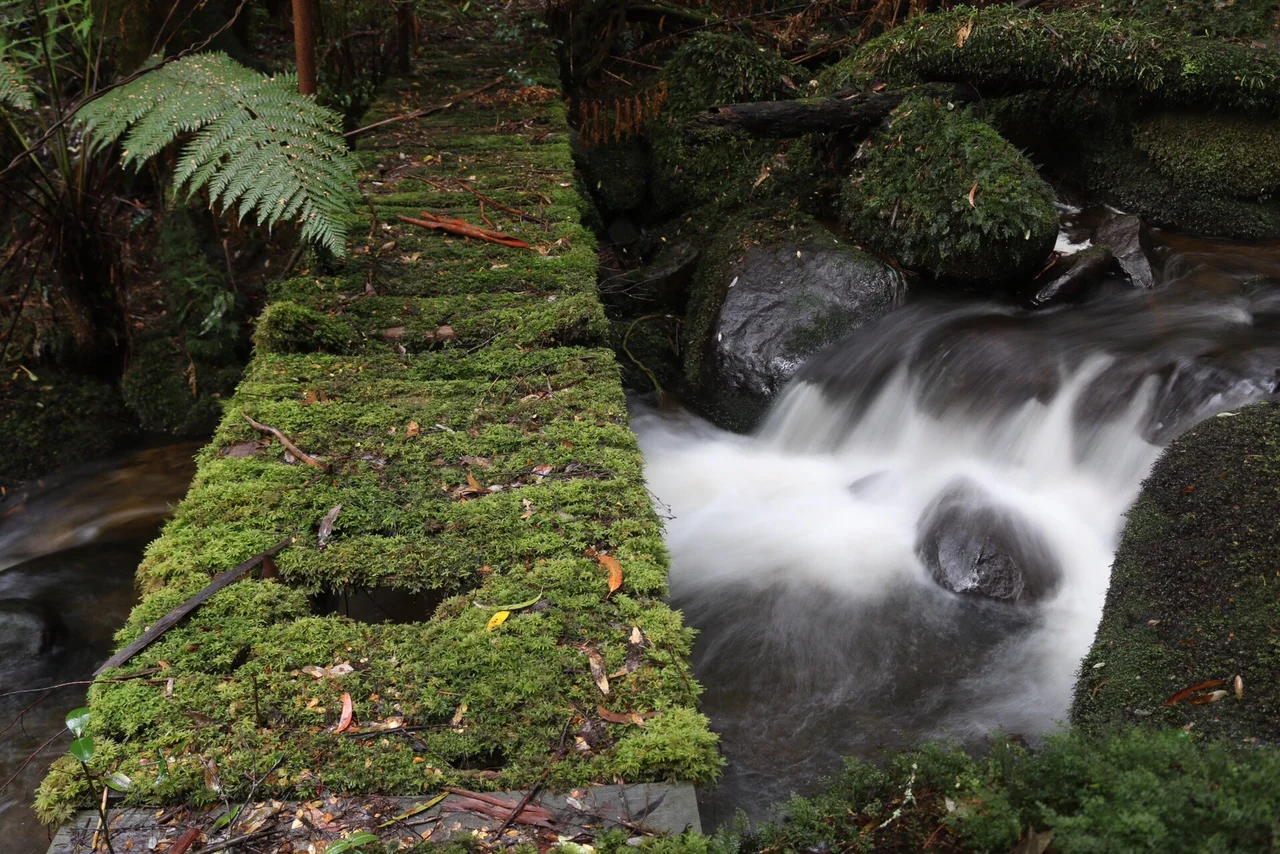
Bridge on the now overgrown lower Cement Creek track (dark blue on the map) near the present Rainforest Gallery walk. © Bradley James 2016.
Former lower Cement Creek track. (Dark blue.) The 300 metre track is shown on a government map published in 1989, although in May 1954 Ski Horizon noted that the Federation of Walking Clubs had cut a track from Warburton to the Cement Creek Turntable, so this may have been a remnant of that track preserved for visitors to view the Cement Creek rainforest. The track on the 1989 map is not near the route of any timber tramway. It was probably abandoned when the Rainforest Gallery walkway opened in 2005 and it is now heavily overgrown.
Rainforest Gallery walkway. (Pink.) A metal walkway at the Six Mile Turntable road junction. Opened in 2005 it allows visitors to view the rainforest and picturesque Cement Creek from a walkway a metre above the forest floor. It is accessed by a long staircase from the 6 Mile Turntable car park.
Finally, in 2018, an extensive network of tracks was proposed by Yarra Ranges Shire Council to make Warburton the ‘mountain biking capital of Australia’. One of these tracks was to traverse the slopes of Mt Donna Buang, most of the route is planned be on new tracks but the upper portion would incorporate a section of the old summit road that was abandoned in the 1970s, before travelling parallel to the road to Ben Cairn and then dropping down to the aqueduct and descending to Warburton via the golf course. A number of studies were conducted including a heritage impact assessment. The network of bike tracks attracted a fair amount of opposition from some residents of the Upper Yarra who felt that mountain biking was not compatible with their more quiet local culture and they set up their own website in response. At this stage the fate of the project is unknown.
The 2018 proposal to build new mountain bike tracks on Mt Donna Buang.
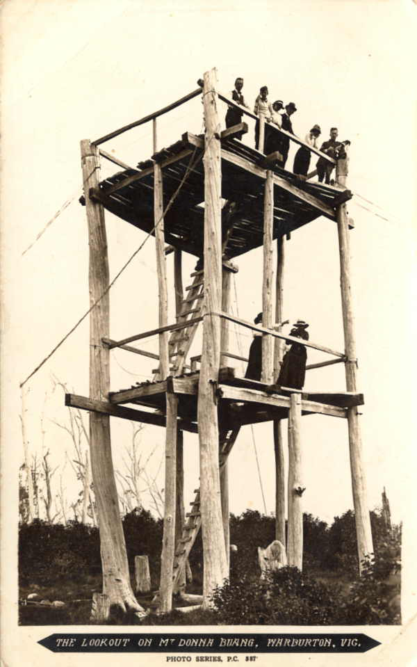
8. Observation towers
Today the summit of Mount Donna Buang is largely clear of trees, but until the early 20th century a forest of snowgum and woollybutt (also known as alpine ash) covered most of the area. Naturally people who climbed the steep mountain hoped to be rewarded with a view. There was also a need for an observation tower to give Forests Commission fire spotters a good view of the surrounding forests in summer.
The first summit lookout tower was probably built in 1918.* Four trees standing in a rough square were ringbarked and a couple of platforms were built between them. Access was by ladders built from logs, with split palings providing the treads. In 1926 a major bushfire burnt much of the mountain and while it is not known if the tower was damaged by the fire. The Argus reported in January 1927 that it was in poor condition. In any case woollybutt is not the most durable timber when exposed to the elements and it deteriorates fairly quickly. So for whatever reason, the life of the first tower finished about this time.
* Some sources imply it was built in 1912 to coincide with the opening of the bridle track to the top of the mountain, although the Handbook to Victoria published in 1914 mentions the new road but makes no mention of a tower.
In January 1928 the original lookout was replaced with a 21.3 metre high head frame (or poppet head as they were known at the time) from a gold mine. Mining of gold in deep reefs had been in decline for 20 years, so there were plenty of poppet heads available for not much more than their scrap value. A number were moved to become tourist and fire spotting towers on high points with extensive views including one at Mt Tarrengower in the town of Maldon and another on One Tree Hill near Bendigo. Others were moved to hilltops and utilised as broadcasting towers for the radio stations springing up in rural Victoria at the time.

The second lookout tower was a head frame for three gold mines in an earlier life. The photo was taken in 1942 and this was the tower that overlooked the mountain the whole time it was a ski resort.
The poppet head erected at Donna Buang originally saw service at the Long Tunnel Extended mine at Walhalla, before being moved to the Collman and Tacchi and then the Bard's Reef mines at Bendigo. The Argus stated that it 'had been obtained very cheaply'. The cost was 'under £1,000', mostly paid for by the Tourist Resorts Committee with contributions of £125 from the Forests Commission, £100 from the Melbourne and Metropolitan Board of Works (which managed the city's water supply at the time), £25 from Marysville Tourist Association and £25 from the Warburton Progress Association.
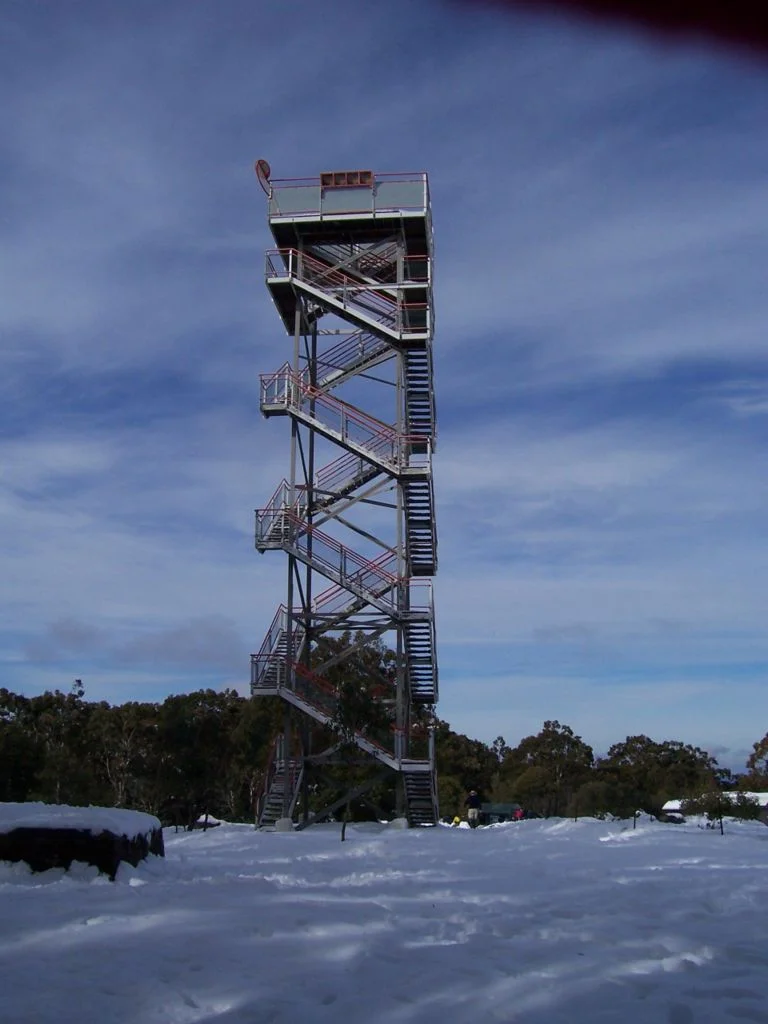
The third lookout tower dating from 1963. © David Sisson c. 2007
The new tower was a vast improvement on the original and the views it provided made it a drawcard in its own right. It was hugely popular with visitors and pictures taken from it feature in almost every album of photos taken of Donna in its heyday.
In summer fire watchers were rostered on the Donna Buang tower at times of peak fire danger and were connected with the wider world by a telephone line. In earlier years this line was closed down in winter, but from the 1934 season it was kept open to allow accurate snow reports to be sent to newspapers and ski club committees. How long the line remained in service is unknown, but it may have been consumed in the 1939 fires as after the Second World War 'fire-spotters' reported by radio.
In 1945 RAAF personnel were seconded to the Forests Commission for fire watching. As they didn't live locally, they stayed in the University Ski Club cabin which was only a few hundred metres away. In the summer of 1946 civilian fire watchers stayed at the SCV hut, but it appears that the Forests Commission hired the USC cabin more frequently in the mid and late 1940s.
The second tower on Donna Buang lasted until the early 1960s when rusting steel led to safety concerns and it was demolished by an army reserve engineering unit.
The latest tower appears to have been built to a height of 14 metres in 1963 (although it may have been later) by the state government’s Public Works Department. In 1995 or 1996 the tower was pulled down and re erected on it's side in a factory where it was extended by 7 metres. It was then rebuilt on the mountain in winter.
The current observation tower is distinguished by a lack of the midway platforms that characterised its predecessors and by curious double helix staircases that wind their way up the structure without ever meeting.
9. The warning sign
Just north of the lookout tower on the summit, the walking track to Boobyalla Saddle heads north down a partly overgrown ski run. Towards the bottom is an ancient warning sign.
In pre-war years, the huge number of visitors to the mountain meant that it was inevitable that some would get lost and newspapers of the time had occasional reports of people lost in the snow at Mt Donna Buang, although it appears all were eventually found without major injury. But as the mountain was ending its time as a ski resort, a major incident provoked the erection of this sign towards the bottom of a ski run north of the summit.
On 22 August 1953 Kirk McLeod and Jenny Laycock parked their ute at the 10 Mile Turntable and walked up to the summit. On the return trip they became disoriented and instead of walking south east to the car park, they headed north east down a ski run. A major search was begun and four days later Arthur Burch and Bill Horton located them in a rough shelter of logs and ferns three kilometres from the summit in the headwaters of the Watts River.

The warning sign north east of the summit. © David Sisson 2007.
It was dusk by the time other searchers got to the location and it was too late to move them. So they were made as comfortable as possible and stretchered out on the following day. As Road 2 and other Melbourne Water roads had not yet been built, a path needed to be cut through the dense rainforest by about 50 men. Both patients were suffering severe hypothermia and frostbite. McLeod eventually fully recovered but Laycock's frostbite was worse and she had both lower legs amputated. However she went on to lead a full and rewarding life, marrying and having two children. As detailed in her autobiography and her 2012 obituary, she became an advocate for causes affecting amputees.
In an attempt to prevent further tragedies, two of the searchers erected a warning sign before the 1954 snow season. The following year, the Public Works Department replaced it with the sign that still stands. By 1955 very few people were skiing on the mountain so it is unlikely the sign across the middle of a ski run caused much disruption.
A first hand account of the search with a detailed map can be found in Walk 1954. pp. 15 - 18.
10. Walks on Mt. Donna Buang
© David Sisson
Background. Mt Donna Buang (1250 metres) is the nearest snowfield to Melbourne. After the completion of the railway to Warburton in 1901 the tall ash forests on its slopes were harvested in the early 20th century and the timber was moved to sawmills by a network of tramlines and cable haulages. Logging had finished by the early 1920s and interest in skiing took off in the mid 1920s. Before the Second World War, Donna was a major ski resort with six cleared runs, a ski jump, cafes, shelter huts, a ski hire and four ski lodges. On one day in 1935 12,000 people watched ski races on the mountain. However the ski runs were fairly short and the snow was never terribly reliable and after the Second World War, skiers deserted it in favour of more reliable snow on higher mountains further away from Melbourne.
Today most of the mountain is parkland. It is a accessed by a sealed road and is a popular tourist destination. It attracts sightseers in both summer and winter, but almost no skiers. At the summit there is a 21 metre high lookout tower on the summit accessed by strange double helix staircases. From the top there are impressive views of mountains and forests, as well as the farmland and towns of the Yarra Valley. While you can drive to the top, there are a number of walking tracks up the mountain. One is a long day hike from Dom Dom Saddle, another begins at the aptly named Martyr Road in Warburton while a third track starts half way up, near the Cement Creek Rainforest Gallery. There is also an easier option of a scenic walk from the Ten Mile Turntable near the summit.
Walks on Mt. Donna Buang.
Ten Mile Turntable, summit circuit and Mt Victoria. . Easy - Medium. . 3½ hours. 8 km. . . . . . . . . . . . . . . . . . GREEN on the map.
Cement Creek, rainforest and Mt Victoria. . . . . . . . . . Medium - Hard. . . 4 hrs. 5 for full circuit. 8 or 13 km. . BLUE on the map.
Warburton to Summit. . . . . . . . . . . . . . . . . . . . . . . . . . . . Hard. . 4 hrs, 6½ return. 7 km, 13 km return. . . . . . . . . . PINK on the map.

The routes of the three walks described above.
Ten Mile Turntable, summit circuit and Mt Victoria
Shown in GREEN on the map.
Time and distance: 3½ hours, 8 km. Grade: Easy - Medium. Along with the Rainforest Gallery at the junction of the Acheron Way and the Donna Buang Road, this walk covers the best of Mt Donna Buang. The first half hour has some mildly steep sections, although they should not be too much bother if you take a few rests.
Access. Drive through Warburton until the highway, B 380, crosses the Yarra River. Shortly afterwards turn left onto The Acheron Way, C 507. The road climbs steadily for 7 km to the Cement Creek junction. Park here and spend 15 minutes inspecting the impressive Rainforest Gallery, a 350 metre walking circuit that starts high in the forest canopy before descending to the forest floor. Then drive up the Donna Buang Road, C 505, for 6 km to the 10 Mile picnic area and park. This pleasant location is much nicer and less crowded than the rather bleak car parks closer to the summit.
The walk. Leave your car at the large car park at the 10 Mile turntable and walk back down the road for 20 metres. There you will see a track heading up hill behind a couple of posts to prevent vehicle access. Walk up this track which climbs through mountain ash and tree ferns for 400 metres to a signposted junction. Turn left and continue uphill, through mixed beech and ash forest, past a ruined ski lodge, for another 600 metres to the treeless summit area. In addition to the 21 metre high observation tower, there are picnic tables, a toilet block and a large but basic shelter hut without doors. The view from the tower is breathtaking. On a clear day there are endless forested mountains in most directions, while to the west, Melbourne's office towers are often visible.
After a break, walk to the north of tower and locate a track that descends to the north-east. It follows an old ski run from the days when Donna was a ski resort. At the bottom of the ski run, the track continues through a forest of myrtle beech before intersecting with a well maintained gravel road. Turn hard left and walk south along the road for 1 km until you reach a gate. Walk around the gate and soon you will meet the sealed road that provides access to the summit area. Turn left and head up the road for a short distance before taking an earth road that branches off to the right. This road crosses three more former ski runs (one is still used as a toboggan slope), before it becomes a walking track that heads through bush for a few hundred metres before joining the track you originally climbed to the summit.
Head down the track for about 400 metres to the junction where you have a choice. You can end the walk by turning right and walking 400 metres to the 10 Mile car park. If you wish to extend the walk by an hour to Mt Victoria, stay on the track along the ridge top, The route undulates through attractive mixed species forest to Mt Victoria, (which is barely a knoll), before descending to a television transmission tower. Then walk down a gravel road for 500 metres to the main sealed road, turn right and walk 800 metres up the road to the 10 Mile picnic area.
Last walked in August 2014. All tracks were in good condition. © David Sisson 2009 - 2015.

The middle section of the track is still easy to follow and in fairly good condition. © David Sisson 25 May 2016.
Donna Buang via Cement Creek, rainforest and Mt Victoria
Shown in BLUE on the map.
Time and distance: 4+ hours, 8 km. Grade: Medium to Hard grade, suitable for a reasonably fit group. Add an hour if you will be walking the last 4½ km down the road rather than driving back to the start.
This is the most attractive walk in the Warburton area and is mostly through cool temperate rainforest. So while it involves a 750 metre climb, it is well worth the effort. Most of the walk is moderately graded except for an overgrown section near Boobyalla Saddle and two short but fairly steep sections later in the walk. If it has rained in the past day or there is snow on the ground, there will be water on the track for the first kilometre and it may be difficult to keep your feet dry, so carry a spare pair of dry socks.
2016 update: In 2009 Parks Victoria officially closed the section of this walk that parallels Cement Creek without explanation. So while it remains one of the best hikes in the state, it has not been maintained and navigation of the lower 1 km near where the track crosses Cement Creek can be difficult for groups heading downhill, although sticking to the track is not difficult heading uphill. There are a few 20 cm logs at waist height across the track at the start of the walk, but only a few beyond the creek crossing. There is evidence of people maintaining the route as the scrub has been cut back and flagging tapes of various colours help route finding on the lower section.
The steeper middle section of the track along a former cable hauled tramway remains in relatively good condition, the track is fairly easy to follow and there are only a few logs across the track.
The top part of the track through open Woolybutt woodland used to be the easiest part of the walk but it has become overgrown with knee high mother shield ferns which obscure the track and this section now requires careful attention to stay on the track. However it could be easily restored with a couple of hours work with a whipper-snipper. If you are heading downhill, Parks Victoria have conveniently placed a prominent 'Track closed' sign where the Cement Creek track diverges from the Mt Boobyalla track, making the junction easy to identify.
Access. From Melbourne drive to Lilydale and follow the Warburton Highway B 380 through Warburton to where the road crosses the Yarra River. Shortly afterwards turn left on to The Acheron Way, C 507. The road immediately begins a steady climb which continues for 7 km to the Cement Creek junction. Park here and spend 15 minutes inspecting the impressive Rainforest Gallery, a 350 metre walking circuit that starts high in the forest canopy before descending to the forest floor.
The Cement Creek walking track starts 250 metres along the Donna Buang road. You can either walk from the Rainforest Gallery or drive up and park in the large clearing at the start of the track on the left of the road.
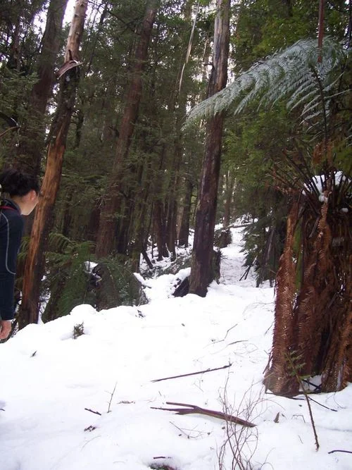
The Cement Creek track under snow. © David Sisson 2007.
The ascent via Cement Creek and Boobyalla Saddle
The track immediately plunges into tall eucalypt forest where it has become slightly overgrown since Parks Victoria ceased maintenance in 2009. The route is not always obvious, but it crosses Cement Creek and some tributaries by a combination of bridges and stepping stones. If it has rained recently or there is snow on the ground, the first 1½ km can be quite wet and muddy with water running down the track. Eventually the route emerges from the creek valley and the track becomes more obvious as it begins to climb the hillside on the north side of the creek. This is actually an old cable haulage tramline where logs were winched down the mountain. There are a few diversions where trees have fallen over the track, but it essentially continues in a fairly straight line parallel to the creek. This is the steepest part of the walk, so take a few breaks and look around at the forest. Below the towering mountain ash canopy, you will see a rainforest understory of tree ferns, sassafras, mountain hickory wattle and myrtle beech.
Soon the old cable haulage finishes and you emerge onto a flat section where the tramway was horse drawn before the climb resumes for a short distance. Soon after the end of this second climb, the scenery changes from rainforest with a mountain ash overstory to more open woollybutt (or alpine ash) woodland. Follow the track through the tall trees and just as they are changing to snowgums, you will arrive at a track junction at Boobyalla Saddle.
Take a breather before the final section to the summit. Turn left and head south along an undulating track. There is an especially attractive spot where the track passes through a pure stand of myrtle beech. Before long, it joins a Melbourne Water road. Turn left and continue south for 250 metres until you reach a dip in the road which often features a large puddle. Just as the road starts to gently climb, take a discreetly signposted track to the left heading into the forest. There is a short climb up a former ski run through beech and eucalypts and soon you will emerge at the the summit.
The summit boasts an impressive 21 metre high lookout tower and the view from the top is spectacular. Nearby is a rather squalid shelter hut with partially open sides and a toilet block. At busy times in winter, there may be a caravan selling snacks.
The unimpressive ‘summit’ of Mt Victoria. © 2019.
The descent via Mt Victoria. From the observation tower, walk 100 metres east towards the toilet block. Contour north from the toilets across the top of a fenced off former ski run. Soon you will pick up a good track that heads downhill, roughly parallel to the fence line. In snow the route is fairly clear and it is marked with occasional red metal arrows. Just past the bottom of the ski run is the ruin of an old ski lodge.
Soon you will reach a junction with a track to the right heading south to Ten Mile picnic area. Take the left hand track which stays on the top of the ridge and remains fairly level for two kilometres to Mt Victoria. The 'summit' is barely perceptible as it is really a knoll on a spur that looks like a mountain from near Warburton. The track then descends to a televison broadcasting tower. From here there is a short section of gravel road before the main sealed Donna Buang Road. If you have left a car here, drive down to the start of the walking track, otherwise it is an easy one hour walk along the road to your car.
Winter. The Cement Creek walk is especially attractive for experienced groups in winter, although heavy snow in July and August may make things a little harder. However walking through a silent beech forest in deep snow is a truly wonderful experience and rare outside Tasmania. Everyone in the group should have a good quality raincoat that won't tear on scrub as well as overpants, gloves, a warm hat, telephone, food and a spare pair of warm, dry socks. The snow can be quite soft and deep, so if it has snowed before your walk, it might be useful if a few people in the group have snowshoes to help pack down the track.
At most there should be only light snow over the scrubby and navigationally tricky section at the bottom of the walk. While you should use a GPS on this section, staying on the track in snow isn't too much of a problem on most of the route except for the top section of the track paralleling Cement Creek before Boobyalla Saddle. Having a GPS with the track shown on the screen will help in this regard. Keep an eye out for the markers nailed to trees on this section. They are more easily seen looking downhill, so make sure you turn around frequently so as to stay on the track.
Warbuton to Donna Buang via Mt Victoria
Shown in PINK on the map.
Time and distance: 6+ hours, 14 km. Grade: Hard.
If you're up to it, it's very satisfying to climb the mountain right from the bottom. This walk is a bit of a 'hero hike' for people training for long trips. The 1,100 metre ascent is long and steep, (the only steeper walk nearby is the track up Mt Juliet). While it is all on reasonable tracks, the walk is rated hard. Fit people should be able to do the 7 km climb in under 4 hours, while the downhill return by almost the same route will take about 2½ hours.
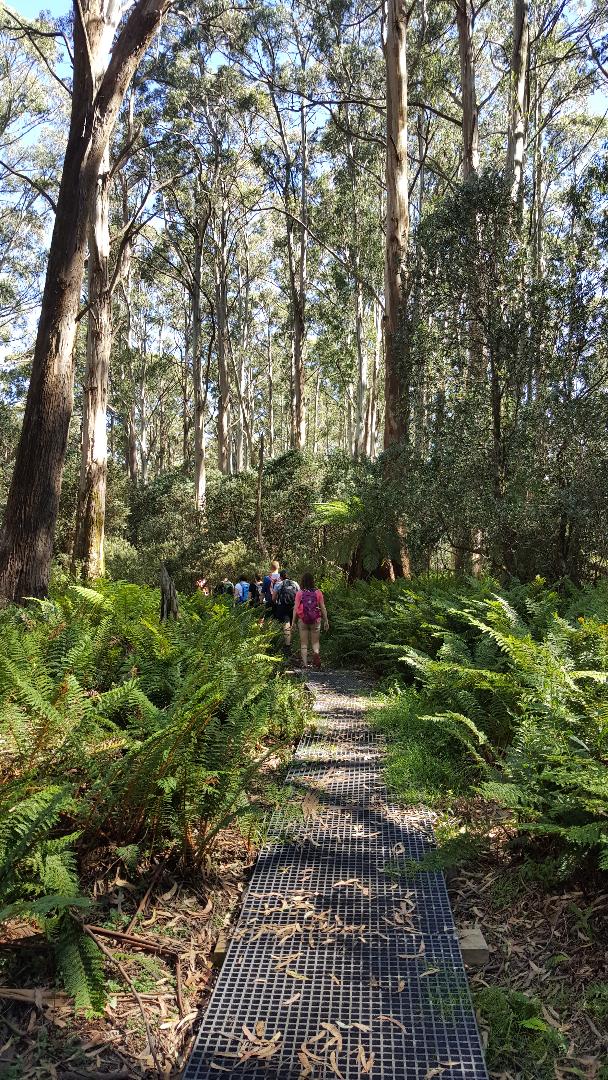
Ridge between Mt Victoria and Mt Donna Buang. © 2019
Access. From Melbourne drive along the Warburton Highway, B 380, to Warburton. As you enter the town, turn left on to a bridge which crosses the Yarra River. (Melways 289 K4) Immediately turn right along Dammans Road and take the first turn to the left onto Martyr Road. Drive to the top of this very steep road next to the golf course and park at the corner where the road turns right and becomes Wellington Road.
The walk. From the car park at the the top of Martyr Road, the track initially drops down through forest to a creek before heading north, climbing along a fence line next to a paddock. At the top of the paddock, the track turns east for a short distance before heading north into forest for a minute to meet a disused aqueduct. Cross the aqueduct and keep climbing. The track unrelentingly heads straight up the mountain, mostly through mountain ash forest.
Four kilometres from the start of the walk, cross the sealed Donna Buang Road and continue up a gravel road to a TV broadcasting tower. At the end of road, continue along a well defined walking track. After 500 metres you will get to the rather flat top of Mt Victoria and the climbing ends! The next 2 km are gently undulating. At a junction, ignore the track heading south to 10 Mile car park and head north west for the final 600 metre climb to the summit. If you still have the energy, it is worthwhile to climb the 21 metre observation tower.
If you haven't arranged a lift down, have a rest and go back the way you came. For variety divert via 10 Mile Turntable and a short walk on the sealed road.
If you want to have an especially long and epic day, from the summit take the old Cement Creek track down to the road junction at the Six Mile turntable and then walk down the Acheron Way towards Warburton for just over 3 km to where it crosses the aqueduct. Leave the road and head west along the aqueduct walking track until you come to the well signposted track back to the top of Martyr Road. Retrace the first 500 metres of the day's walk downhill to where you left your car.
© David Sisson.
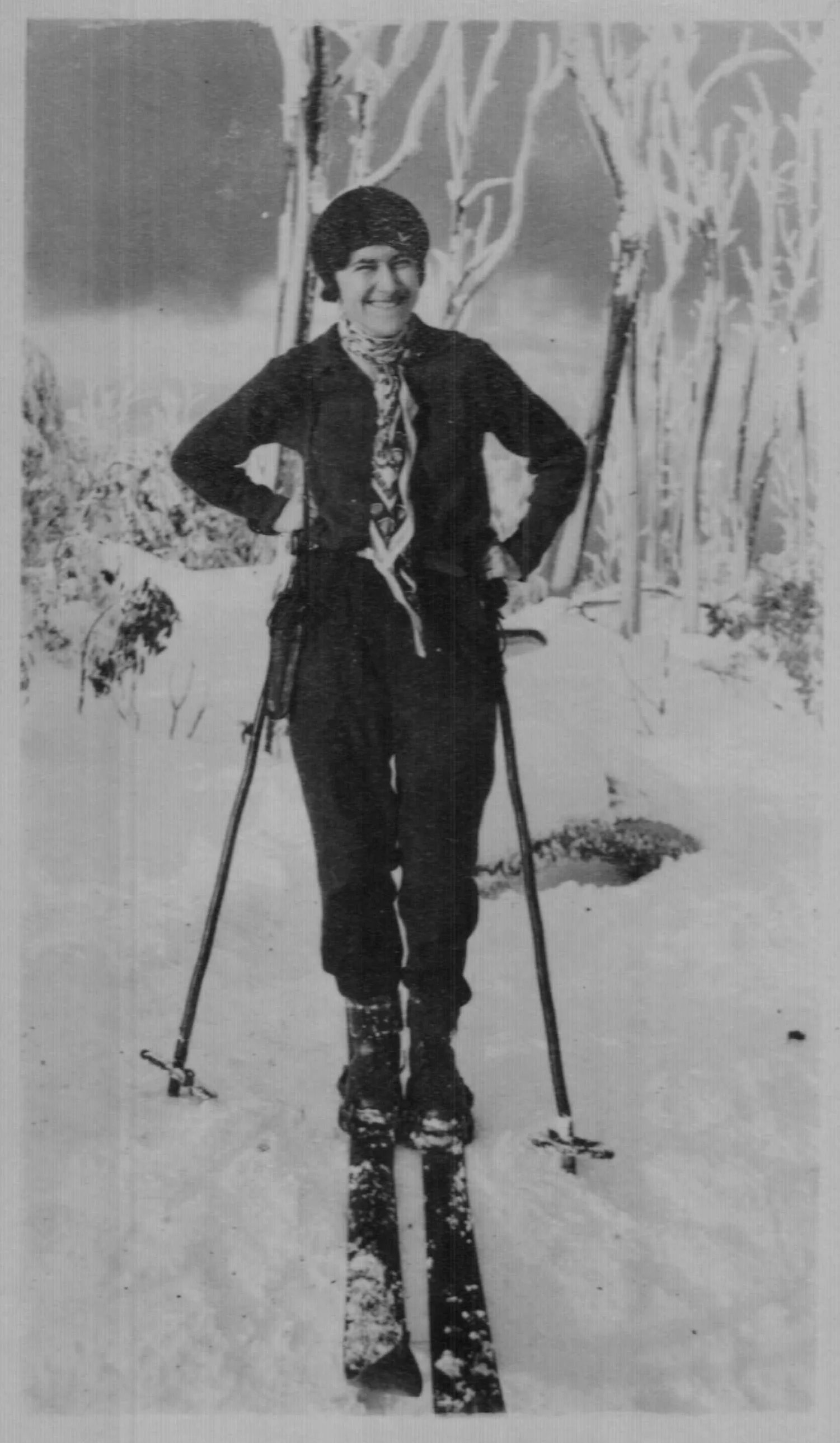
'Good snow, Donna Buang July 1929'. Photo Kath Magill.
11. Historic articles on Donna Buang skiing
Review of the 1929 ski season. Stan Flattely
Mt. Donna Buang: Melbourne's nearest snow resort
The most pleasing feature of snow season 1929 was, I would say, the convincing manner in which Donna Buang justified its claim as a winter sports ground. Not only was its potentiality in this respect brought home to Club members, but to hundreds of day-trippers from the city, many of whom had never seen snow before.
The first fall of the season was reported on Friday, April 28th. This snow lasted over the week-end, and about fourteen members took advantage to have their first run of the season. A week or two later further snowfalls occurred, but did not hold.
The heavy snow started on June 15th, and was followed by a week of severe frosts. Further falls were frequent from then on, and the depth of snow grew steadily till a depth of about three feet lay on the newly constructed ski run. The result was that Donna Buang was snow-capped without a break from June 15th to September 30th -- that is, for fifteen consecutive weeks, or just a week less than four months.
Sunday, June 21st, was a day to remember. About fifty Club members and a number of sightseers from Melbourne, lured by the prospects of snow and the glorious frosty weather, journeyed to the mount. All were amazed at the quantity and quality of the snow. Many who had been several times to Buffalo declared that they had never seen such conditions so good there, or such a beautiful snow scene as the snow-laden trees on the Donna Buang Road.
Those sightseers who had never seen snow before, let alone ski-ing, were delighted at the sight of over thirty skiers gliding about over the ski run. Crashes, of course, were frequent, as the track, well covered as it was, was still somewhat bumpy, and the heavy frosts made the snow very fast. Most of the skiers took advantage of the fast snow to ski from the summit, along the road to the winch, a distance of two miles.
The next week-end an even greater number visited the mount, and so on for the next three months. On one Sunday over two hundred cars travelled up the mountain road.
Many think the quantity of snow was phenomenal, but personally I do not believe it was. I certainly have seen deeper snow on Donna Buang--in fact, on one occasion, so much as six feet. However, this is the first time we have had members visiting the mount throughout the Winter, and we do not really know how long the snow has lasted in other good Winters. So it may have been phenomenal, or it may not--it does not matter which. The main fact, however, is this, and I am very emphatic about it, too: a mountain as near to Melbourne as Donna Buang, and capable of being snowcapped for nearly four months, is worthy of every effort our club can make to better conditions there.
Of course Donna Buang is not the only near mountain that holds snow. There are many peaks and ranges in the same vicinity, all about or over 4000 ft. high, perhaps the most notable being Lake Mountain, near Marysville. Lake Mountain is 4800 ft.--that is, 720 ft. higher than Donna Buang, and over 400 ft. higher than the Mt. Buffalo Chalet. Its claim, then, as a future snow resort is worth considering. The nearer ranges offer an opportunity for exploration to the more adventurous Club members. These mountains, however, are at present more or less inaccessible, so we should first of all confine our efforts to the nearer and easily accessible Donna Buang.
Last season, reaching the snow on Donna Buang was not an easy matter altogether, the transport facilities being hopelessly inadequate to cope with the number visiting the mount. The road certainly had been improved; but, as the good road ended at the seventh milepost, one still had over two miles of mud to walk through before reaching the snow.
The tourist committee is now at work on the road, so that in the coming Winter cars may drive right up to the snow. An improved road to the winch, with an area to park a number of cars, should make a big difference. The Club is helping, too, by looking after the ski run. During the Summer a number of working bees have been held, and enthusiastic members have made big improvements to the track.
Given another season like the last, plus a good road and better ski-ing conditions, Donna Buang may easily be the means of adding several hundred new members to the Club. Therefore, I have no hesitation in saying that the development of Donna Buang is of the utmost importance, and essential to the future welfare of the Club.
It is no credit to the City of Melbourne that this glorious tourist resort, with its wealth of scenic beauty, plus the attraction of Winter sports, should be so neglected. When we consider that this mount is less than sixty miles from the city, it is hard to realise that about 70% of the population of Melbourne have never seen snow. Yet here it is almost at their own back door. On any clear day in Winter, Donna Buang and other snow-capped summits may be easily seen from any of the high suburbs, or even from some of the high buildings in the city itself.
As our Club is, or should be, directly interested in the development of our snow resorts, it is our duty to see that Donna Buang, our nearest snow ground, is given the publicity it deserves. The Donna Buang - Ben Cairn Road, with its grand forest and gully scenery, its wonderful panoramas, and, in Winter, its magnificent snow scenes, is one of the most beautiful trips in the state, and is undoubtedly the show trip of Melbourne. Yet thousands of Melbourne tourists who travel to far-away beauty spots are unaware of this fact.
We of the Ski Club of Victoria, who know of the possibilities of this resort, should continue to agitate for its development. By so doing, we can hope to make the people of Melbourne realise the desirability of making the old road into a perfect highway. The cost of such would be more than paid for by the number of tourists who would be attracted to our city.
The Ski Club of Victoria. Year book 1930. Volume 5. Pages 34 - 36.
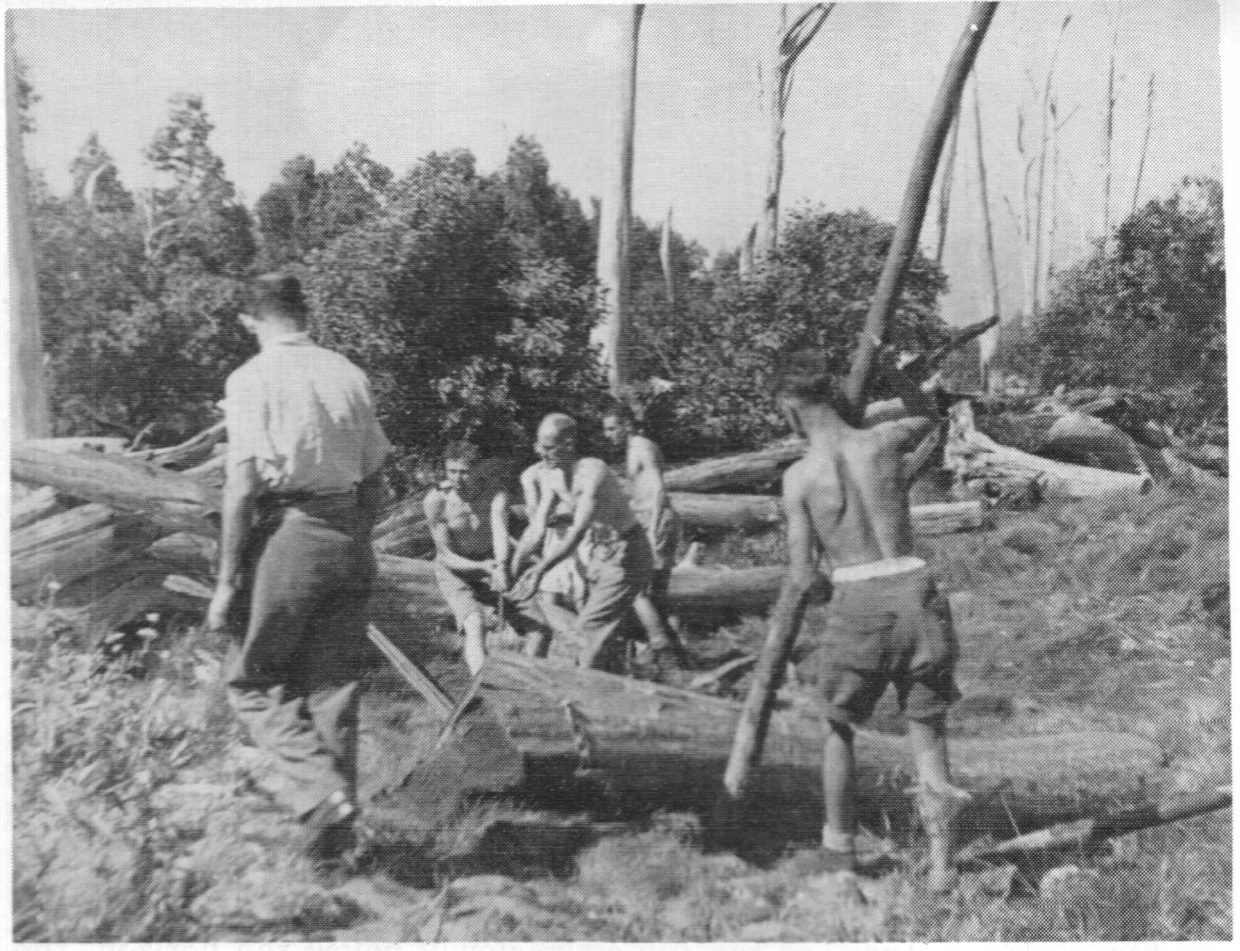
Mick Hull's photo of the 1934 slope clearing work party.
1930s Donna Buang work party. Mick Hull
The Monday-holiday weekend in early March has long been one for mountain workparties. In 1934 members of the SCV and USC went to Donna Buang to clear and widen the two ski runs and the jumping slope, at the top of the mountain by the lookout tower. This clearing work had been in progress for a number of years. There was always more to do, digging out stumps, removing protruding rocks, winching old logs to one side for burning later. There was also pick and shovel work preparing the ski slope for the sowing of grass, so skiing was possible with a minimum of cover.
Donna Buang was only 60 miles (96 km) by road from Melbourne, via Warburton and a winding road to the summit.
Most of us lacked cars and we would leave by train from the city after noon on a Saturday for the two hour trip to Warburton. From there the journey was on foot to the top of Donna, a climb of 3000 ft (915 m).
We would walk across the main road, over a bridge across the Yarra River and through the houses on the other side along a lane to the paddocks below the aqueduct at the foot of the forest.
This climb was treated by the regulars as a training walk. It helped get one’s legs in shape for the longer climbs involved in access to Hotham, Buller, Bogong or Feathertop, as the Donna track was just as steep through the forest. It was also a very useful test for unknown new hands who had rashly offered to join some ski tour that they had never been over in summer, and consequently had no idea whether it was within their capabilities. So you took them up Donna from the river, and if they liked it they were okay, or if they blew up then it was obvious that the tour was not for them.
We eased our way through the houses and over the rabbit-proof fence protecting their gardens. From there it was open walking along the dividing fence between two of the paddocks. It was covered in blackberries. They were still in flower, some ripe with fruit which we picked and ate as we walked. One of the girls plucked a blossom for her hair. The afternoon was hot, our rucsacs heavy with gear for the workparty and the blokes soon discarded shirts for the comfort of walking in shorts only. One of the girls made a face in unspoken envy: the bikini top was not yet in fashion.
The paddocks ended at the banks of the O’Shannassy aqueduct . We squeezed through barbed wire avoiding the blackberries, crossed the bridge and jumped into a different world of tall trees. There was an indistinct track along the leafy floor of the cool forest. With a shorter stride we ‘dropped into second gear’ for the steeper going. The more experienced switched to a breathing rhythm matching their stride. It was a climbing rate they could maintain easily for an hour or more.
The forest floor was park-like, grassy with occasional patches of undergrowth that we had to push through, well wetted by Friday’s rain. Higher up the path zig-zagged through some steep pinches, then traversing to the right across a creek, and in a few steps we came up to the road from Cement Creek.
Here we sat for five minutes while one or two had a cigarette. “Ooh, I’ve got a leech on my leg” called one of the girls. “How do I get the wretched thing off?” “Half a mo” said one one of the smokers as he leaned over and touched the wriggling black worm with the tip of his cigarette - it fell to the ground. “Thanks, that’s a trick I've learned” responded the victim. “Came off the undergrowth, you’ll bleed for a while, they inject something with their bite.” said the smoker.
Along the level roadway it was easy to stride out after our shorter steps on the climb. After passing two or there corners we heard distant voices and came up to the Turntable where cars were parked and day-trippers were sipping tea and munching sandwiches.
We crossed the broad expanse of asphalt to a track disappearing into the bush. It led up a gully toward a ridge above, and then along the firebreak.
We were near the end and our leaders quickened stride up this last steep stretch through the forest. At the top we came out into a wide grassy lane between the trees, the firebreak leading up past the huts of SCV and USC to the crest of the mountain. There we found a band of members from both clubs already on the job hauling logs to one side of the ski run. We dropped packs and helped them for a couple of hours.
Then it was time to go back to the hut for a beer and a quiet yarn before preparing dinner. Soup we heated in billies over a portable kero stove, and potatoes we baked in the ashes by the logs glowing in the fireplace. Above the fire was a solid iron frame for pots and pans, with various concoctions, stews, spaghetti, vegetables and white onions. People were cooking in small groups, those who had bought their food as a party. All steak, chops and sausages were grilled together, clamped in a large wire-frame over the open fire.
When the grilling was done everybody presented plates, the cooks served the vegies and in no time we were sitting either side of the long bench to eat and yarn about the day’s events and the program for tomorrow.
On the Monday morning we started early and worked until after midday, then back to the hut to tidy up and have lunch before the descent to Warburton. The climb had taken two hours but we trotted down in three-quarters of an hour. A quick swim in the cold river, we were still in plenty of time for the train to Melbourne.
Being a holiday there were hardly any passengers aboard until Box Hill, but from there the train filled steadily. The earlier sense of ‘free spirit’ in our party waned as it was gradually overrun and became lost in the impersonal crowd.”
— Mick Hull. Mountain memories: sixty years of skiing. M. H. Books, 1990. Pages 45 - 47.
Hull dated this trip as March 1934 in his memoirs, however the ski club huts were not built until a few months later, so it is either incorrectly dated or a hybrid report of several trips.
A 1951 semi-obituary for Donna. Ski Horizon
A very poor snow season in 1949 and a below average one in 1950 accelerated the transfer of skiers loyalties to higher mountains further from Melbourne. This short uncredited article in the monthly Victorian magazine Ski Horizon summarises the experience of skiers at Donna Buang and accurately implies that the mountain did have not much of a future as far as skiers were concerned.
Mt. Donna Buang
Donna! We all know it affectionately by that name. There were few Melbourne skiers in the pre-Buller village days who didn't start their ski life at Buffalo or Donna. And during the difficult war years, when petrol was very scarce, Donna was the mecca of week-end ski-ing--many even spent a week or more there. Sundays saw thousands on the mountain--most of them throwing snow at one another--and well over two hundred ski-ing. Who will ever forget those Friday night slogs up the short cut from Warburton and the Sunday night slithers down that same mud chute to catch the 8 p.m. bus to Lilydale?
Those days are well behind most of us now but let's pay tribute to Donna for keeping ski-ing alive and introducing many to the snow during the days when accommodation, petrol, war and other difficulties made the better mountains inaccessible. Going back further into Victorian ski history, the very early thirties saw tremendous interest in Donna. The S.C.V. and Public Works Department built a jump and toboggan run as well as clearing the ski run and doing other developmental work. The now defunct Warburton Ski Club was then in its hey day. Martin Romuld jumped 62 feet on the old jump and on one August Sunday in 1934 five thousand people went up Donna. Old records tell us that Derrick Stogdale donated a cup for "The Novice Turning Championship of Mt. Donna Buang;" Tom Mitchell donated £25 towards the cost of the jump and the S.C.V's. Donna Buang Committee raised money by holding a picture night for which the programme was arranged by Arthur Shands.
Let us delve no longer into the past. These few notes are intended to mention something about Donna's future. The report of the State Development Committee entitled "The Alpine Regions of Victoria; Ski-ing and Tourist Resorts," gives Donna only relatively brief mention on account of the diminished value of the mountain as a ski resort. The Committee recommends:-- "That investigations be made as to the possibility of extending the road over the mountain with a view to affording access from both sides, with the provision of parking bays at suitable intervals along the road."
Mt. Donna Buang (4,080 feet) is not used very much now by skiers although the S.C.V. is re-building the old jump which will provide good for the jumping aspirants and will no doubt be appreciated by the thousands of "snow bunnies" who flock to the mountain every weekend there's snow. The only accommodation is the S.C.V. cabin and the Melbourne Walking Club hut. The University Ski Club cabin was removed last year from Donna and re-erected at Mt. Buller.
Ski Horizon. May 1951. Vol. 2, No. 9. Page 6.
12. Sources and thanks
Views since 20/06/2015.
© David Sisson. Please send any comments, corrections, suggestions or pictures to: australianmountains (at) gmail.com
I'm especially interested in reminiscences from people who visited Donna in its heyday and in photos and information on minor buildings that are not well documented. Other things I’m looking for include a contemporary ski map of the mountain and a post 1951 photo of the ski jump rebuilt in stone.
This article was begun in late 2010 and first published on line in June 2015. Since then it has been expanded as new information has become available
The original drafts of this article were fully footnoted with each fact and assertion sourced back to primary sources and original documents. When it became apparent that producing it in book form would be too expensive and that instead, it would be published on a website, I realised that footnoting would be inappropriate. However I can cite most sources for any researchers who may be interested. Please email me.
Sources
Periodicals
Monthly Victorian ski magazines: Schuss 1935 - 1955. Ski Horizon 1949 - 1955.
Ski Club of Victoria. Year Book. 1930 - 1934.
Australian (and New Zealand) Ski Yearbook, 1935 - 1952.
The Melbourne Walker 1929 - 1955. Annual publication of the Melbourne Walking Club.
Walk 1949 - 1955. Annual journal of the Melbourne Bushwalkers. All issues from 1949 to 1987 are now available online.
The four daily Melbourne newspapers of the time: The Age, The Argus, The Herald and the Sun News Pictorial.
Local newspapers: Lilydale & Yarra Valley Leader, Healesville and Yarra Glen Guardian, Warburton Mail.
Table Talk. Weekly pictorial social magazine begun in 1885 and closed shortly after WW II broke out. In the 30s it had several ski features each winter
Books
Anchen, Nick. Yarra Valley railways. Sierra Publishing, 2012. A largely pictorial book with enough text to explain the railways in context.
Brennan, Niall. Tales from the Australian mountains. Rigby, 1979. Anecdotes (mostly accurate) on the author's adventures, including Donna in the 1970s
Budge, Allan. No end to walking: 100 years of walking by the Melbourne Walking Club. Trevor Budge, 1992. An unofficial club history.
Carroll, Brian. The Upper Yarra: an illustrated history. Shire of Upper Yarra, 1988. A well illustrated and better than average shire history.
Cross, Wendy. Australian skiing: the first 100 years. Walla Walla Press, 2012. The definitive ski history book for pre 1962. Has short section on Donna.
Elford, Jennifer Laycock. The snow girl story: a story about survival and revival. The author, 2011. Autobiography of the woman mentioned in chapter 9
Hermann, I.D. Author, 2021. A labour of love: public works of Carlo Catani 1876-1918. More time line than a bio or discussion of his work, but still useful
Holth, Tor and Jane. Challenge of the high country. Rigby, 1985. Has research that didn't make it into Holth's Cattlemen book, inc much on early skiing
Hull, Mick. Mountain memories: sixty years of skiing. M.H. Books, 1990. The autobiography of one of Victoria's most enthusiastic early skiers.
Hutchison, John. Skiing: a manual for teachers. Education Dept of Vic, 1984. Not much on Donna, but shows schools were still skiing there occasionally
Kelly, Reginald. From Healesville to Mt Donna-Buang. Field Naturalists' Club of Vic, 1911. Exploratory winter trip report. Final page has info on naming
Lloyd, Janis M. Skiing into history: 1924 - 1984. Ski Club of Victoria, 1984. A useful text, but partisan. Treats the SCV in isolation from other skiers & clubs
McCarthy, Mike. Mountains of ash: a history of sawmills and tramways of Warburton and district. Light Railway Research Society of Australia, 2001.
Melbourne Walking Club. Footsteps from the past: a centenary publication 1894 - 1994. MWC Inc., 1994. Pages. 6 - 9.
Parkinson, Earle. Warburton ways. 2nd ed. The author, 1993. A well written local history.
Sheridan, Lynette. University Ski Club 1929 - 1979. U.S.C., 1988. A very readable club history, has a chapter on their involvement on Donna Buang.
Smith, Gordon J. R. Mountains of my youth: hiking, biking and skiing in the Victorian Alps… The author, 2020. Includes Donna trip reports in the 1940s.
Stephenson, Harry. Skiing the high plains. Graphic Books, 1982. An interesting compilation of articles and photos related to early skiing in Victoria.
Stephenson, Harry. W. F. "Bill" Waters: a biography. Rover Section, The Scout Association, 1982. Has information on pre-war skiing by Rovers.
Many other books that only mention the mountain in passing were checked, but the ones above have at least a few relevant paragraphs.
Videos
In addition to the home movie of skiing on Donna in the 1920s that can be viewed in chapter 3, there are a few other on-line films that are relevant:
A professionally produced 1938 film promoting skiing on Mt Buffalo. The style of skiing gives an idea of what would have been seen on Donna
A 1951 colour film of Swinburne students at Donna Buang. It shows the second observation tower and the sort of snow play that irritated skiers
A 12 minute colour film of passenger trains on the Warburton line in the 1960s. It starts with the country carriages being hauled by electric stock to Lilydale before continuing to Warburton hauled by K and J class steam locomotives. Includes scenes at Warburton station and La La turntable
Web sites
The following web pages and on line resources may be of interest:
Fire lookouts down under: Donna Buang page
Ski jump directory. Australian entries are not entirely accurate.
Warburton Railway Facebook page. Photos and comments on the line that opened up the district and made visits to Donna Buang practical.
Donna Buang Facebook page.
Bob Padula's pictorial Donna Buang webpage
The State Development Committee. The alpine regions of Victoria; ski-ing and tourist resorts. 1950. The recommendations in this important report laid the foundations for modern skiing in Victoria. The brief dismissal of Donna Buang is on pages 48 - 49.
Other primary sources
Many other documents were discovered at two locations essential to anyone writing local histories:
The Public Record Office of Victoria. The state government archive located in North Melbourne has records going back to 1835.
The National Library's website Trove. The site has scanned records of hundreds of newspapers and thousands of historic photos.
Thanks
Thanks to Blair Hamilton for company on scrub bashes searching for ruins on Donna Buang, especially for persisting with the search for the USC chimney when, after four hours of looking, I was almost ready to give up. For rediscovering the lost walking track between the Main Run and the SCV Cabin, for obtaining a useful historic photo that I would not otherwise have seen, and later for scanning some photos and pushing me to get this article finished.
Wendy Cross offered to edit an early rough draft of this article. Her knowledge of ski history has been invaluable and her suggestions and corrections made me realize that I'm not as sharp on punctuation as I thought I was.
I'm also grateful to Robin Bailey for information on the Melbourne Walking Club's activities on the mountain, to Ben Laumen for sending me information and feedback after a draft version was first published online and to Simon Walliss for lending me copies of ski magazines and annuals that I do not own and which are missing from the state library. Thanks also to the late Fred Derham for giving me a copy of the University Ski Club history and to the late Don McDonald for allowing me to photocopy his ski magazines and annuals from the 1940s and 50s. Sadly I began writing ski history too late for me to interview either of these veteran skiers.
Finally, I should thank my history teachers, tutors and lecturers from when I was at school and university. They stimulated my interest in history and taught me the necessary skills, technique and discipline to write this original history decades later. Almost all of them were great, but I should give special thanks to Dr Joe Rich.
My interest in the subject was first aroused by Fred Elliot who gave me his copy of the 1934 SCV Yearbook when Simon Walliss and I interviewed him about his pioneering first landing on Rodondo Island in 1947, his first ascent of Tasmania's Federation Peak in 1949 and his time in Antarctica in the 1950s. The information on Donna Buang in the 1934 yearbook was so interesting that when I realised that no history of Donna existed, I began to research the history of the mountain.
David Sisson. © June 2015 - 2026.